 January 11 2018
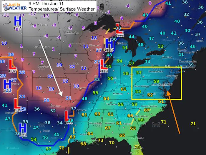
Baltimore hit a hit temperature of 61ºF today and 59ºF the day prior. If you think this is crazy compared to two weeks in a row below freezing, its is more common than you might imagine. The Wind Advisory issued for Friday morning from 5 AM to noon for the Delmarva is part of a strong storm that could bring wind gusts to 45 mph. If you can recall the blizzard of 1996 that brought three days of record snow between January 7 and 9, it was followed a week later by flooding rain. This time, we are actually short on snow and in a moderate drought.
Rain will arrive Friday morning and be heavy at times with strong winds. We will have much of the afternoon dry before the next round of rain in the evening and at night. We all will have the return to winter on the other side of this storm, and some north/west of Baltimore and parts of the metro area may wake up with a wintry mix Saturday morning.
Stats For January 10
Normal High: 41ºF
Record High: 73ºF in 1975
Normal Low: 24ºF
*Former Record Low: 1ºF in 1982
Snow Record: 3.8″ in 1954
Seasonal Snow To Date (at BWI): 5.2″
Sunrise: 7:26 AM
Sunset 5:04 PM
*Daylight = 1:14 longer than yesterday
*Bay Water Temperature = 33ºF at Thomas Pt. Light House.
Keep In Touch All Winter
Click here to sign up for email alerts…. Just in case you don’t get the post on your social media feed
Wind Advisory
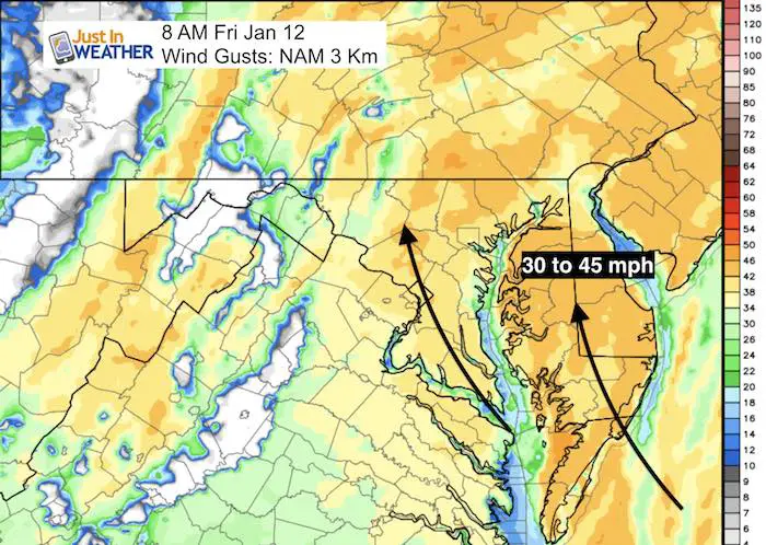
The Wind Advisory is for Delmarva but I expect winds may reach those levels west of the Bay as well as the wind forecast maps show. The storm that is moving in will bring us moderate to heavy rain and pump in warmer air that we got today. But, the return side could crash fast and possibly bring in a wintry mix at the end. The abrupt change over a few hours may shock you. The rest of the weekend will remind you that this is still January.
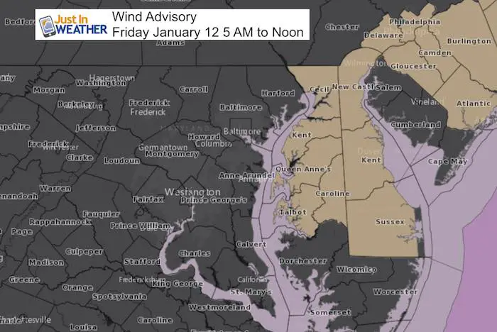
Friday Winds:
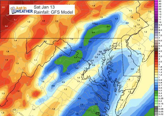
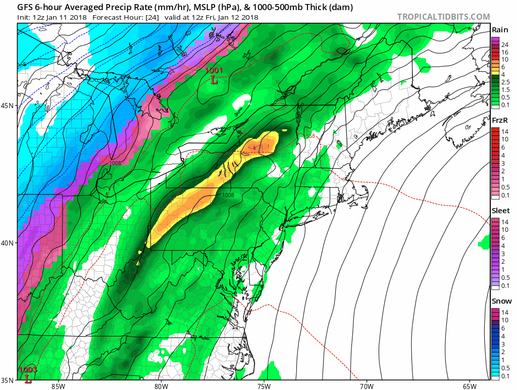
Rainfall
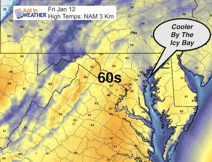
High Temperatures
Saturday Morning: Abrupt Change
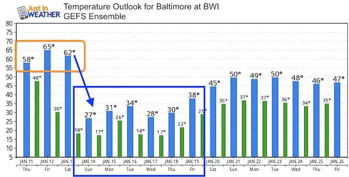
You may notice below that the high temperature on Saturday will be in the 60s. That could be just after midnight and then the colder air may bring a wintry mix in by daybreak if the track remains shifting east.
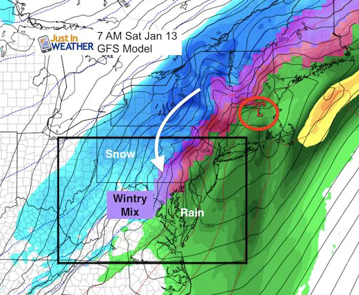
Storm Timeline
There will be moderate rain in the morning, but much of the afternoon should be rain free, before the next round arrives late evening and overnight. The wintry mix potential will be Saturday morning.
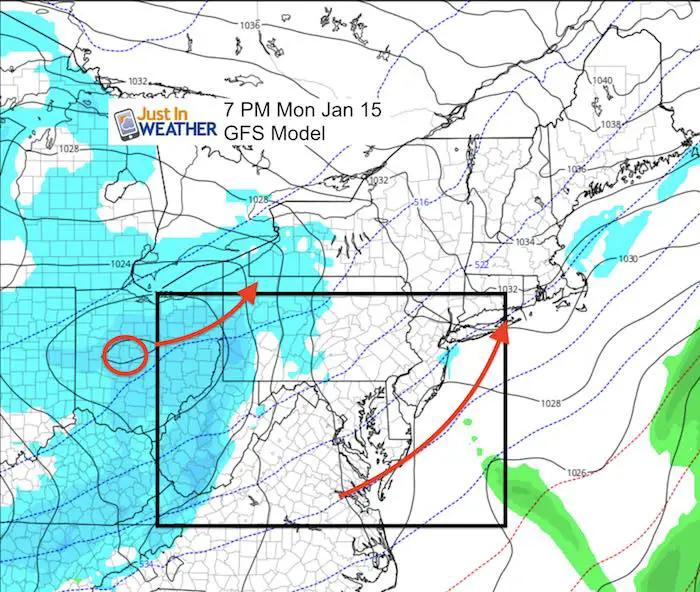
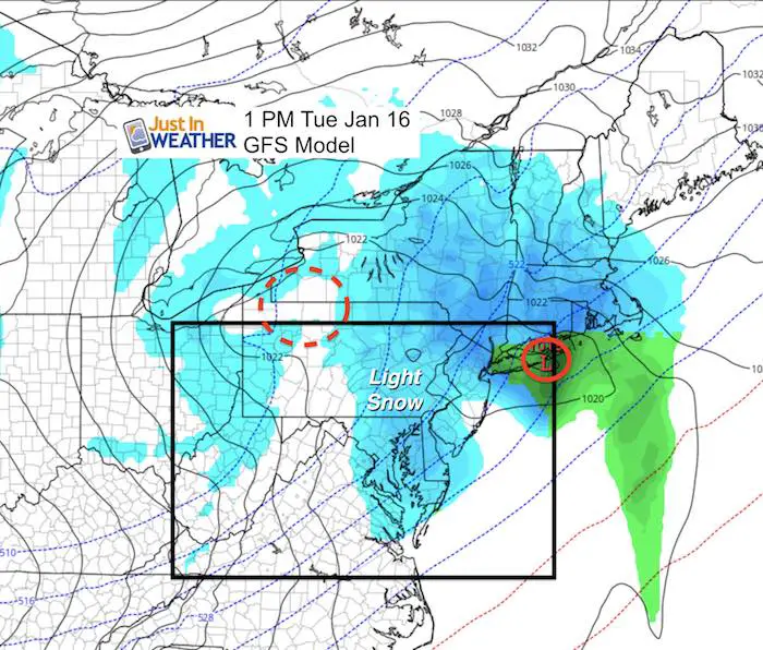
Next Week Snow?
The chatter of snow next week comes from a clipper. In actuality it is a western storm that will fade to our west but redevelop off of the coast. The location is not optimal for us, but light snow is possible
Temperature Outlook
Please share your thoughts, best weather pics/video, or just keep in touch via social media
-
Facebook: Justin Berk, Meteorologist
-
Twitter: @JustinWeather
-
Instagram: justinweather
Shirts
I do these for fun, but also:
A Portion of the proceeds will go to Integrated Wellness programs for Pediatric Oncology Patients
May The Flakes Be With You- Limited Edition Shirt

FITF Gear

Snowstix- We Need You To Measure Snow Too
We are giving 10% of each sale to programs that benefit pediatric oncology patients.

 Get the award winning Kid Weather App I made with my oldest son and support our love for science, weather, and technology. Our 3 year anniversary of the release and our contribution to STEM education is this November. It has been downloaded in 60 countries, and works in both temperature scales. With your support we can expand on the fun introduction to science and real weather.
Keep In Touch All Winter
Click here to sign up for email alerts…. Just in case you don’t get the post on your social media feed
Also See:
My Winter Outlook 2017-2018 for more snow
La Nina Formed: What it could mean to our winter
NOAA Winter Outlook: Not The Best But Not The Worst For Snow
Two Farmers Almanacs Winter 2018 Outlooks
Winter Weather Folkore: Suggestions from Animals and Crops
First Frost and Freeze Dates For Maryland (southern PA and northern VA)
My Preliminary Winter Outlook Notes
Low Snow Winters In Baltimore: To Repeat Or Not Repeat
NOAA Ranks Blizzard 2016 4th Worst Snowstorm On Record
Blizzard 2016 Record Top Snowstorm: Area Totals
Extreme Weather of 2015 balanced out on both ends