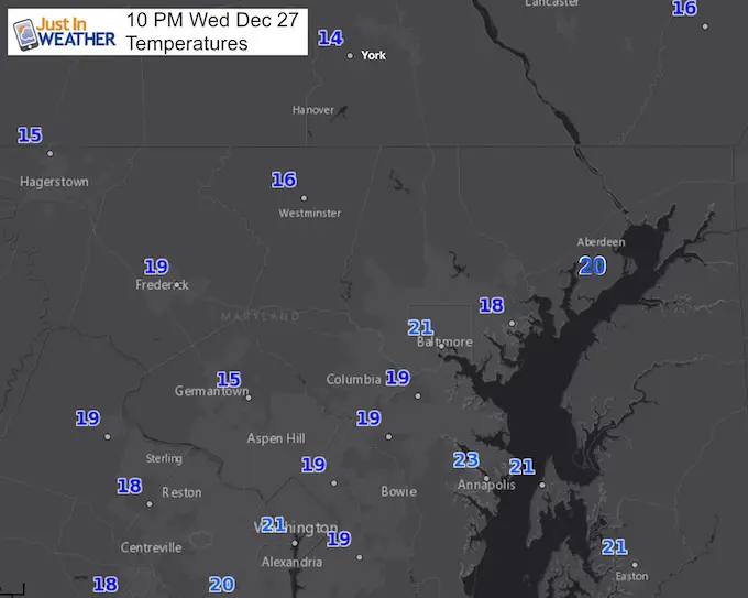
 Wednesday December 27
The cold air in place this evening is really going to bottom out on Thursday morning. Much of the area is already down into the teens, and there is room to go lower. The record low temperature in Baltimore for December 28 was 10ºF set back in 1950. That may be challenged this year which is even more impressive with our lack of snow cover. If we had snow on the ground, it would be easier to get that cold. At least we got it to fall today, just not the dusting we had hoped for…
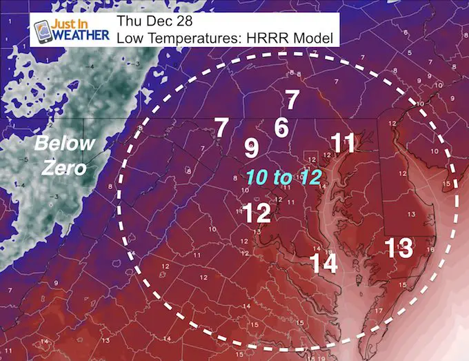
Below is the forecast map showing many areas just inland from the city that should be in the single digits. I believe York PA, which tends to run much colder than the rest of our region, could reach zero in the morning.
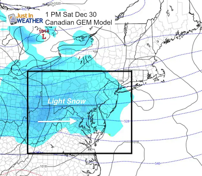
While you may think this is a waste of cold air and not trust any computer model, I hear ya! But there is support for at least light snow on Saturday. Then we we wait for reinforcing cold air in early January.
Forecast Low Temperatures
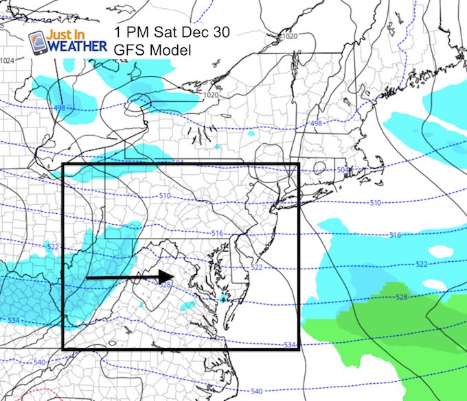
Weekend Snow?
Again, I know the computer models are have been less than stellar. But I have seen the error and think I can spot it again. In fact, now that we have this arctic pattern, my trusty Canadian Model is back up to the plate as the lead forecast guidance. This shows a clipper on Saturday that will bring in some light snow. There is support from the European Model in similar fashion. The only wrinkle is the trend to shift this a little father north.
Snow Saturday: Canadian Model Animation
The clipper style system relies on the developing Low passing through Central Virginia. You won’t see the surface Low present itself on here until it is off the coast late Saturday. 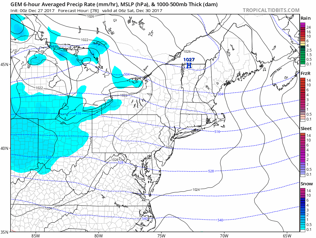
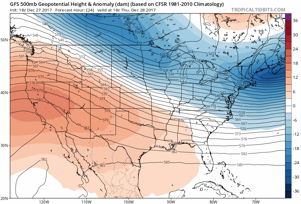
Compare To the Dry GFS
This is the American Model that had a storm at the end of this week that is not going to happen. This is also the model that had projected many other events that have not come through for us, with the exception of our Friday snow event that closed schools early. That was seen a week ahead of time.
Snow To Date (at BWI): 3.8″
Keep In Touch All Winter
Click here to sign up for email alerts…. Just in case you don’t get the post on your social media feed

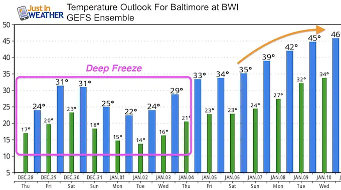
Deep Freeze For Another Week
Temperature Outlook
Notice New Year’s Day will be colder than our current set up. We are poised to have arctic air in place for a week, then lead into a January Thaw by the second week of the new year.
Please share your thoughts, best weather pics/video, or just keep in touch via social media
-
Facebook: Justin Berk, Meteorologist
-
Twitter: @JustinWeather
-
Instagram: justinweather
FITF Gear

Snowstix- We Need You To Measure Snow Too
We are giving 10% of each sale to programs that benefit pediatric oncology patients.

 Get the award winning Kid Weather App I made with my oldest son and support our love for science, weather, and technology. Our 3 year anniversary of the release and our contribution to STEM education is this November. It has been downloaded in 60 countries, and works in both temperature scales. With your support we can expand on the fun introduction to science and real weather.
Keep In Touch All Winter
Click here to sign up for email alerts…. Just in case you don’t get the post on your social media feed
Also See:
My Winter Outlook 2017-2018 for more snow
La Nina Formed: What it could mean to our winter
NOAA Winter Outlook: Not The Best But Not The Worst For Snow
Two Farmers Almanacs Winter 2018 Outlooks
Winter Weather Folkore: Suggestions from Animals and Crops
First Frost and Freeze Dates For Maryland (southern PA and northern VA)
My Preliminary Winter Outlook Notes
Low Snow Winters In Baltimore: To Repeat Or Not Repeat
NOAA Ranks Blizzard 2016 4th Worst Snowstorm On Record
Blizzard 2016 Record Top Snowstorm: Area Totals
Extreme Weather of 2015 balanced out on both ends