Wednesday December 27 2017
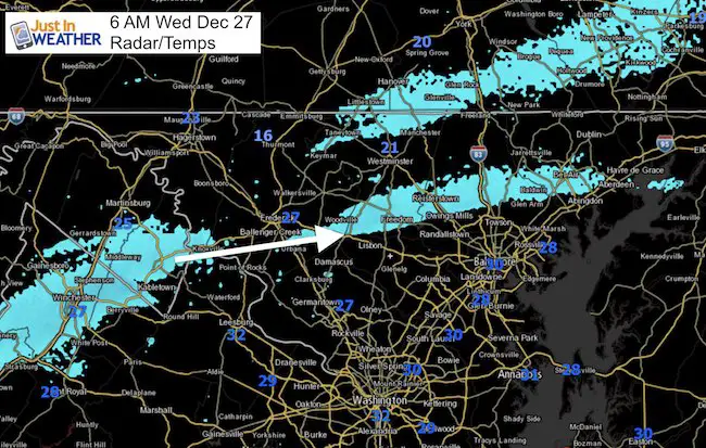
There was no way to win this morning with this forecast. I know the win is not having a travel problem, but the snow did show up on radar and fall as suggested last night. It was just a very narrow band. VERY NARROW! The latest look was between Sykesville and Eldersburg to Cockeysville and near Bel Air. There will be more this morning as the band on the north side near the PA line is trying to again momentum and drift southward towards the beltway. Still aiming for a dusting in most areas in the path. Up to 1 inch at best.
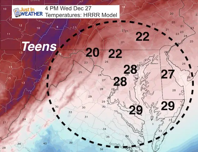
The temperatures fell into the lower 20s north of Baltimore as expected. But that will not be the measure of what you will be looking for this morning.
This is the type of morning that gives weather people a bad name, and I get it. The upper level disturbance is still here and producing ‘some snow’ throughout the morning. Here is the radar loop over the past few hours, showing the light snow. But most in our area will not wake up to anything to show for it.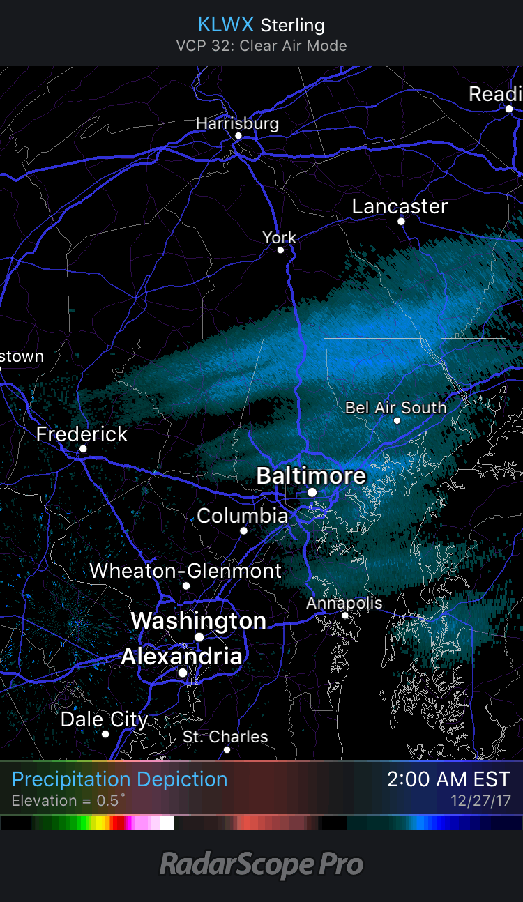
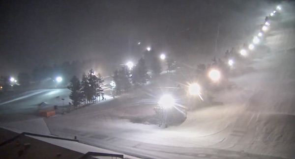
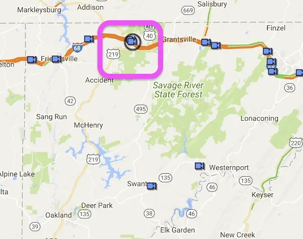
Snow At The Ski Resort
At least there is snow where they need it, and it has been a good December for them at Wisp Ski resort.
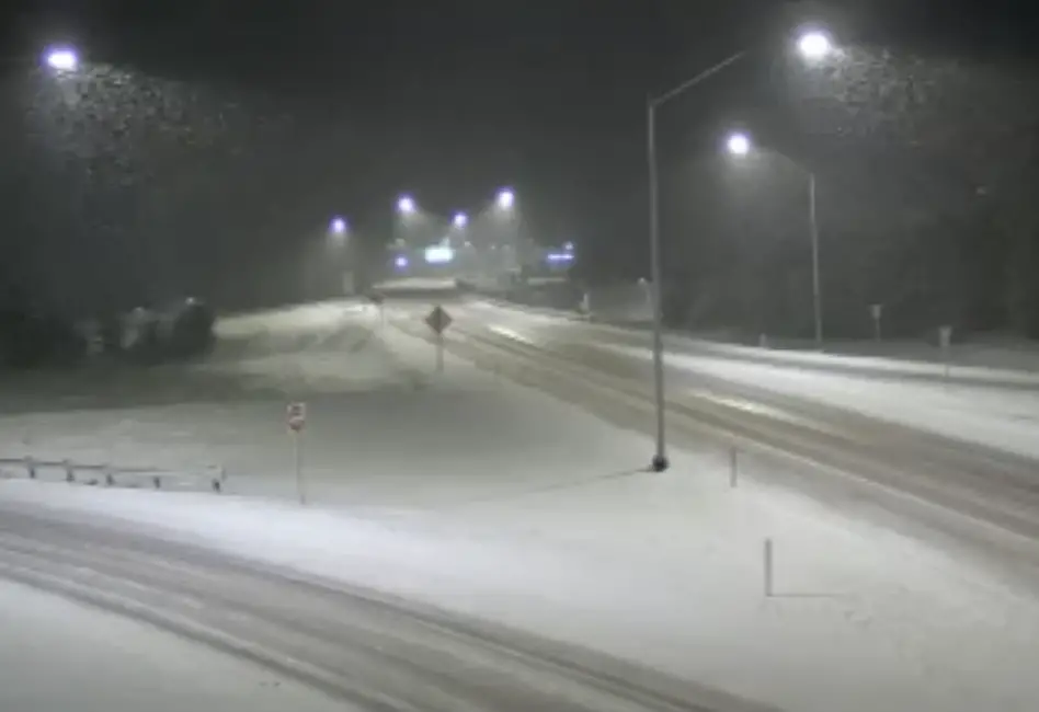
The roads in Garrett County are covered with snow along I-68 and Rt 219
Stats For December 27
Normal High: 43ºF
Record High: 69ºF in 2015
Normal Low: 26ºF
Record Low: 5ºF in 1914
Snow Record: 5.0″ in 1939
Sunrise: 7:25 AM
Sunset 4:51 PM
*Daylight = 7 seconds longer than yesterday
*Bay Water Temperature = 43ºF at Thomas Pt. Light House
Snow To Date (at BWI): 3.8″
Keep In Touch All Winter
Click here to sign up for email alerts…. Just in case you don’t get the post on your social media feed

Afternoon Temperatures Today
Snow On The Way?
If you missed my updates, there is not big storm expected on Friday. I did not put much weight in that and it did fall apart. My primary reason is that computer models have been notorious for seeing systems that do NOT materialize. Instead I believed this winter would bring us snow with events we don’t catch until late. There is one model showing snow on Saturday. I want to see the morning package before showing this and putting any credit to it. But there is hope.
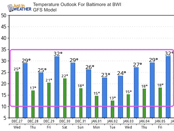
Temperature Outlook
This cold air is here to stay. That is a high confidence part of the forecast.
Please share your thoughts, best weather pics/video, or just keep in touch via social media
-
Facebook: Justin Berk, Meteorologist
-
Twitter: @JustinWeather
-
Instagram: justinweather
FITF Gear

Snowstix- We Need You To Measure Snow Too
We are giving 10% of each sale to programs that benefit pediatric oncology patients.

 Get the award winning Kid Weather App I made with my oldest son and support our love for science, weather, and technology. Our 3 year anniversary of the release and our contribution to STEM education is this November. It has been downloaded in 60 countries, and works in both temperature scales. With your support we can expand on the fun introduction to science and real weather.
Keep In Touch All Winter
Click here to sign up for email alerts…. Just in case you don’t get the post on your social media feed
Also See:
My Winter Outlook 2017-2018 for more snow
La Nina Formed: What it could mean to our winter
NOAA Winter Outlook: Not The Best But Not The Worst For Snow
Two Farmers Almanacs Winter 2018 Outlooks
Winter Weather Folkore: Suggestions from Animals and Crops
First Frost and Freeze Dates For Maryland (southern PA and northern VA)
My Preliminary Winter Outlook Notes
Low Snow Winters In Baltimore: To Repeat Or Not Repeat
NOAA Ranks Blizzard 2016 4th Worst Snowstorm On Record
Blizzard 2016 Record Top Snowstorm: Area Totals
Extreme Weather of 2015 balanced out on both ends