 Tuesday December 26 2017
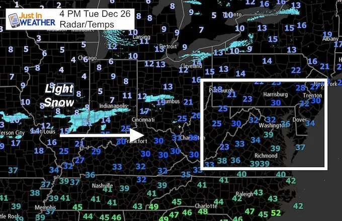
This may come as a surprise, but there will be some light snow in our area tonight. I was in holiday mode and didn’t see anything major, but there is a piece of energy in the jet stream that is going to peak out overhead overnight. This is a light snow event, but in the arctic air, the flakes will stick and may lead to slick roads in the morning.
The main area will include Frederick, metro Washington, Annapolis, Baltimore, and up to York and Lancaster in PA. This will be a light, fluffy snow that can blow around easily. The chance is mainly a dusting to 1 inch with some variation across the area. This is just under the criteria for an official Advisory, but even the National Weather Serve put out a special statement agreeing on this as a travel hazard.
Here’s the quick look:
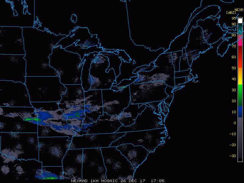
Doppler Radar Loop
This is not very impressive, but that band of snow in central Missouri, southern Illinois, Indiana, and Ohio is what is heading our way.
Keep In Touch All Winter
Click here to sign up for email alerts…. Just in case you don’t get the post on your social media feed

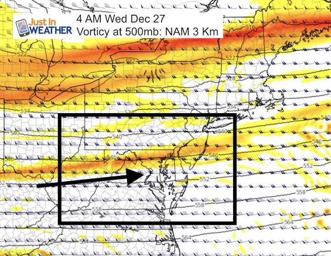
Jet Streak
This fast moving wind funnel in the jet stream is what will be moving over us overnight and Wednesday morning. This jet streak will help enhance the light band of snow after midnight and into Wednesday morning.
—> slider: Snow Radar Simulation
[metaslider id=56207]
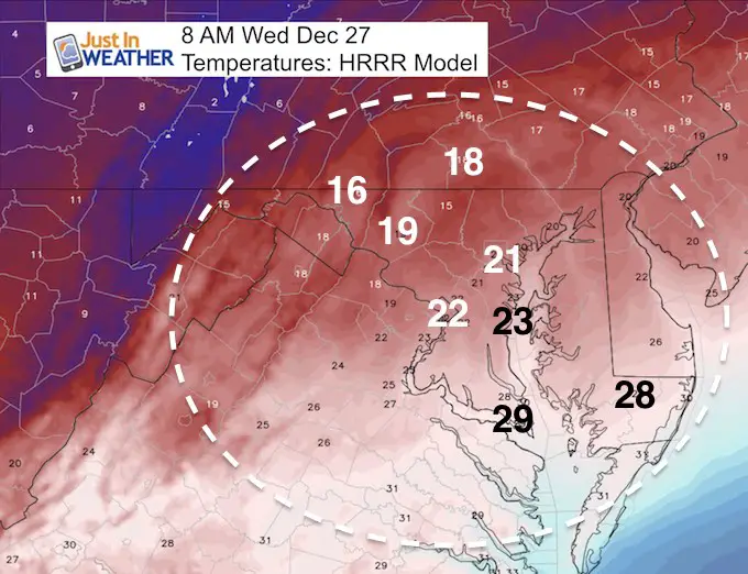
Cold Air: Temperatures at 8 AM
This will translate to light fluffy snow with maximum ratios and stickage.
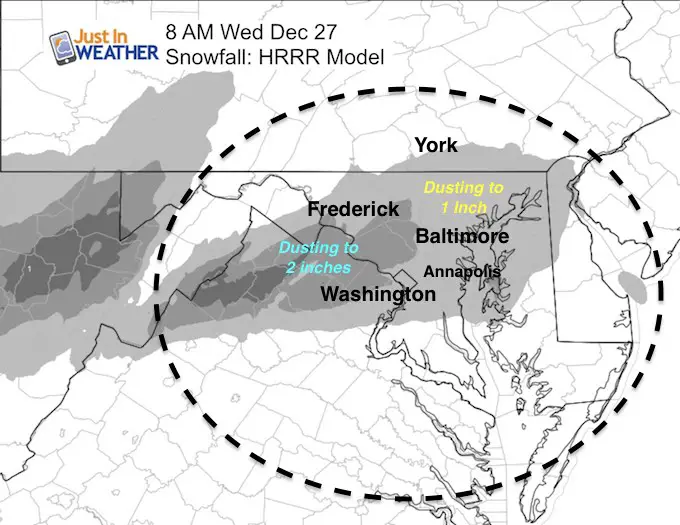
Snow Potential By 8 AM
Most areas get a dusting of light and fluffy snow. Up to 1 inch in spots. The better chance for 1 to 2 inches will be west of Washington in Montgomery Co and northern Virginia.
Please share your thoughts, best weather pics/video, or just keep in touch via social media
-
Facebook: Justin Berk, Meteorologist
-
Twitter: @JustinWeather
-
Instagram: justinweather
FITF Gear

Snowstix- We Need You To Measure Snow Too
We are giving 10% of each sale to programs that benefit pediatric oncology patients.

 Get the award winning Kid Weather App I made with my oldest son and support our love for science, weather, and technology. Our 3 year anniversary of the release and our contribution to STEM education is this November. It has been downloaded in 60 countries, and works in both temperature scales. With your support we can expand on the fun introduction to science and real weather.
Keep In Touch All Winter
Click here to sign up for email alerts…. Just in case you don’t get the post on your social media feed
Also See:
My Winter Outlook 2017-2018 for more snow
La Nina Formed: What it could mean to our winter
NOAA Winter Outlook: Not The Best But Not The Worst For Snow
Two Farmers Almanacs Winter 2018 Outlooks
Winter Weather Folkore: Suggestions from Animals and Crops
First Frost and Freeze Dates For Maryland (southern PA and northern VA)
My Preliminary Winter Outlook Notes
Low Snow Winters In Baltimore: To Repeat Or Not Repeat
NOAA Ranks Blizzard 2016 4th Worst Snowstorm On Record
Blizzard 2016 Record Top Snowstorm: Area Totals
Extreme Weather of 2015 balanced out on both ends