Saturday December 23
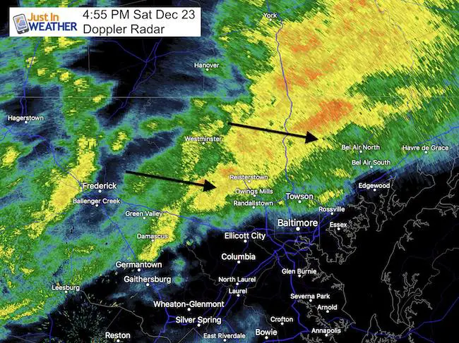
This is a quick update for the purpose of sharing the radar simulation timeline this evening. Moderate rain is moving through as I write this just before 5 PM. Whether you are heading to The Ravens game or a holiday party, I want to help you plan ahead. The rain will be briefly intense and then end, but the temps will drop. The next round of rain will arrive Sunday evening that may impact anyone going to church or last minute traveling. We still have a chance for snow to close out this event. Here’s a look below.
This evening:
—> slider: Radar Simulation
This model is not perfect, so compare the 4:55 PM Doppler at the top of this post to the first image here for any adjustment in speed and location.
[metaslider id=56139]
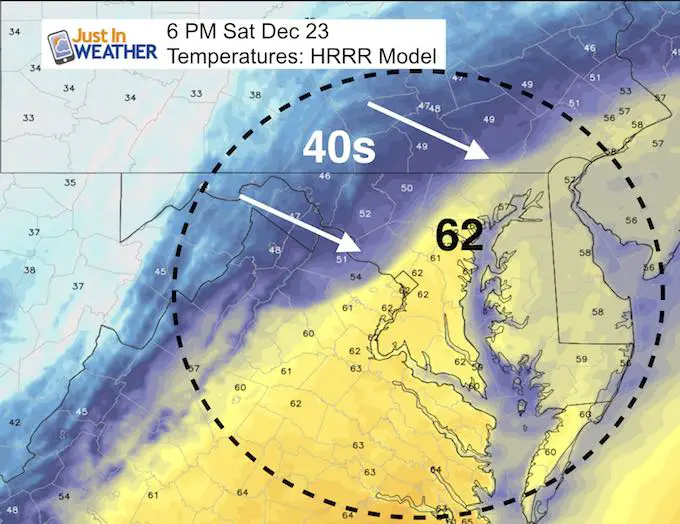
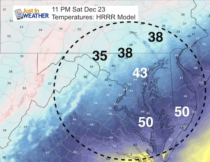
Temperatures
Mild evening will end chilly as the temps will tank behind the rain. This might have the biggest impact on the Ravens game.
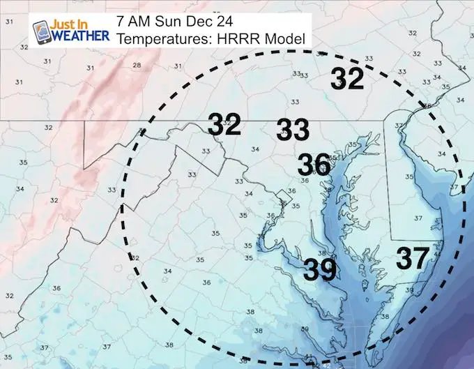
Christmas Eve
Morning Temps will drop close to freezing inland. There could be some icy spots early
Christmas Eve
Rain returns in the evening. There could be some new or sleet mixed well north and west, but the temps should be warm enough for it to melt.
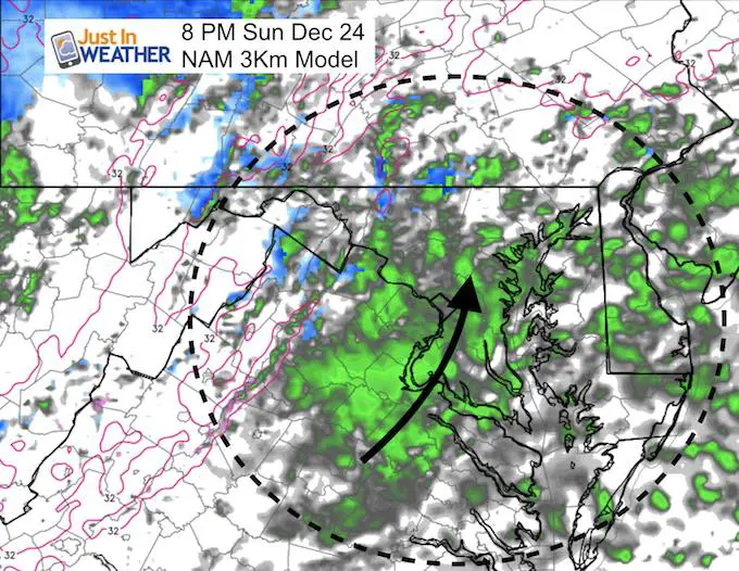
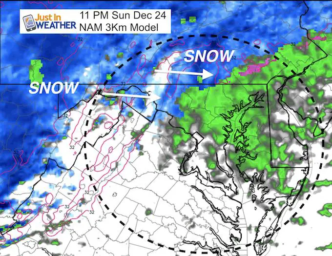
Will It Snow?
This is where I think the computer models are still struggling for our region. I see the decent chance for this to end with flakes for a few hours, especially north and west of Baltimore. Look out the window after midnight and you may see the snow flying by. Stickage, that might be limited as I see it now. But s coating on the ground in northern, western Maryland and southern Pennsylvania is possible.
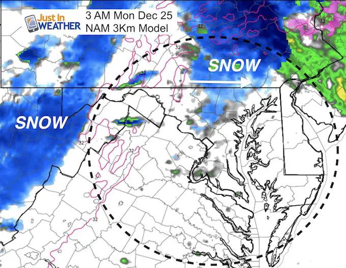
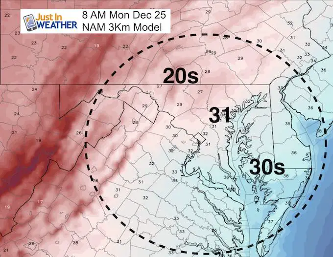
Christmas Morning
The ‘stuff’ from the end of the storm will have moved away by sunrise. The temperatures will be down below freezing west of the Chesapeake Bay. Then we progress to an much colder pattern all week long.
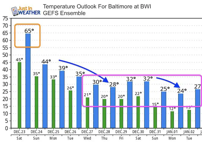
Temperature Outlook
Notice the days that are projected to only reach the 20s
I will have my next update on Sunday morning. This will included the potential for a larger storm next week.
Keep In Touch All Winter
Click here to sign up for email alerts…. Just in case you don’t get the post on your social media feed
Please share your thoughts, best weather pics/video, or just keep in touch via social media
-
Facebook: Justin Berk, Meteorologist
-
Twitter: @JustinWeather
-
Instagram: justinweather
FITF Gear

Snowstix- We Need You To Measure Snow Too
We are giving 10% of each sale to programs that benefit pediatric oncology patients.

 Get the award winning Kid Weather App I made with my oldest son and support our love for science, weather, and technology. Our 3 year anniversary of the release and our contribution to STEM education is this November. It has been downloaded in 60 countries, and works in both temperature scales. With your support we can expand on the fun introduction to science and real weather.
Keep In Touch All Winter
Click here to sign up for email alerts…. Just in case you don’t get the post on your social media feed
Also See:
My Winter Outlook 2017-2018 for more snow
La Nina Formed: What it could mean to our winter
NOAA Winter Outlook: Not The Best But Not The Worst For Snow
Two Farmers Almanacs Winter 2018 Outlooks
Winter Weather Folkore: Suggestions from Animals and Crops
First Frost and Freeze Dates For Maryland (southern PA and northern VA)
My Preliminary Winter Outlook Notes
Low Snow Winters In Baltimore: To Repeat Or Not Repeat
NOAA Ranks Blizzard 2016 4th Worst Snowstorm On Record
Blizzard 2016 Record Top Snowstorm: Area Totals
Extreme Weather of 2015 balanced out on both ends