Saturday December 23
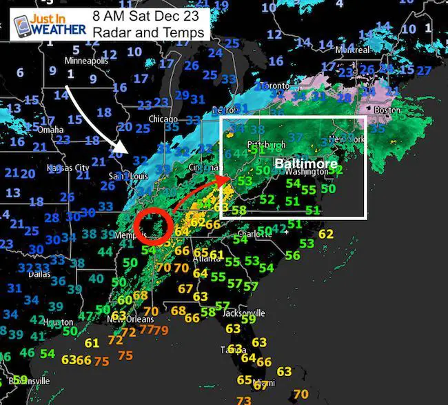
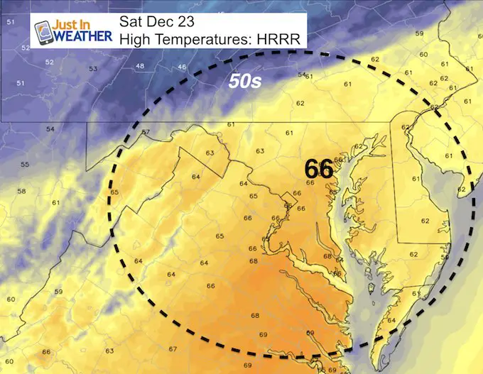
On this foggy eve of Christmas Eve, we have a soggy Saturday ahead. The travel and last minute shopping don’t invite this wet weather, but it will be warm. Temps will surge quite a bit and may exceed expectations. Below are the maps that may have your kids in shorts, but the rain may get out of here for the Ravens game. Next up will be timing the cold air and tracking the edge of snow, that some of us are still still could see around Midnight on Christmas. Next week will be much colder and I have a look at the large winter storm ‘possible’ next weekend.
Stats For December 23
Normal High: 43ºF
Record High: 69ºF in 1990
Normal Low: 26ºF
Record Low: 0ºF in 1960
Snow Record: 8.0″ in 1963
Sunrise: 7:24 AM
Sunset 4:48 PM
*Daylight = 7 seconds longer than yesterday
*Bay Water Temperature = 44ºF at Thomas Pt. Light House
Snow To Date (at BWI): 3.8″
Keep In Touch All Winter
Click here to sign up for email alerts…. Just in case you don’t get the post on your social media feed

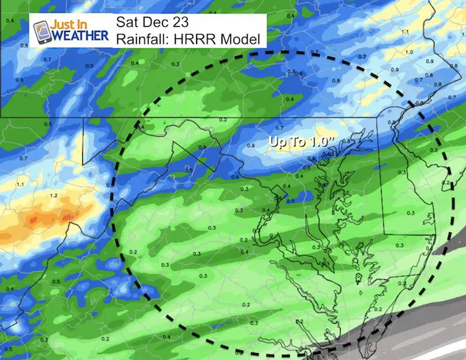
Rainfall Today:
The focus of the heaviest rain will be just north of Baltimore. This is on the edge of the steady rain and the heavy band that will swing through late afternoon. See the hourly slider simulation below.
—> slider: Radar Simulation Hourly Timeline
[metaslider id=56087]
Warm Day: High Temperatures
The Christmas Story
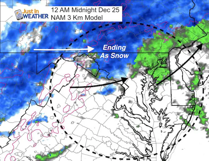
Rain showers will return late Sunday afternoon and evening. This may make the trip to loved ones homes or church wet. I would plan on the rain showers after 7 PM. Then we watch the colder air. It will be close to midnight with the changeover.. But I am not sold that the models are handling this well.
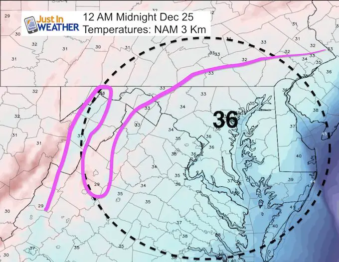
Here is the NAM 3 KM model that had done the next job with the snow we had lat week. I expect more wobbling of the snow line, so I just want to show this. It does not promise that snow will lay and stay on the ground, but a good chance of Christmas snow on the north side of Baltimore, west into the mountains and north into PA.
Christmas Temperatures
Midnight- The leading edge of the cold air…
Christmas Morning Freeze
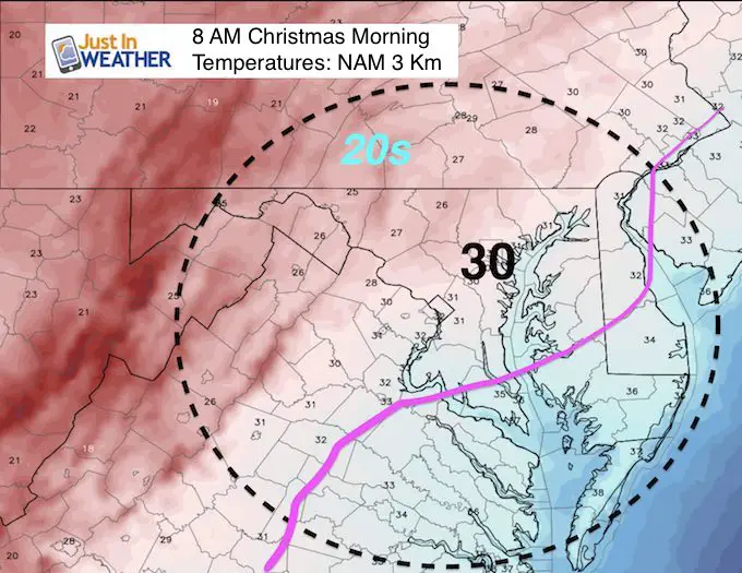
Before looking at the next storm with low confidence, I have high confidence in the temperature drop. Arctic air will finish the year and last into the start of January.
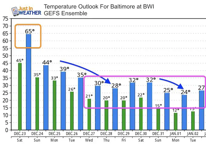
Temperature Outlook
Notice the days that are projected to only reach the 20s
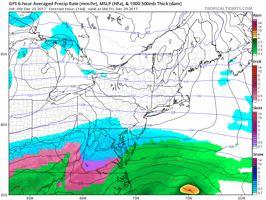
Storm Next Week?
I need to warn you that I do NOT think this is the final solution of this potential storm. Computer modeling has NOT been good a week away recently. This particular set up changes with each run and the famed European Model is less aggressive as of last night. That is an improvement from the prior run that didn’t show much.
But, here is the latest GFS Model to satisfy your itch for long range snow potential. FITF
Please share your thoughts, best weather pics/video, or just keep in touch via social media
-
Facebook: Justin Berk, Meteorologist
-
Twitter: @JustinWeather
-
Instagram: justinweather
FITF Gear

Snowstix- We Need You To Measure Snow Too
We are giving 10% of each sale to programs that benefit pediatric oncology patients.

 Get the award winning Kid Weather App I made with my oldest son and support our love for science, weather, and technology. Our 3 year anniversary of the release and our contribution to STEM education is this November. It has been downloaded in 60 countries, and works in both temperature scales. With your support we can expand on the fun introduction to science and real weather.
Keep In Touch All Winter
Click here to sign up for email alerts…. Just in case you don’t get the post on your social media feed
Also See:
My Winter Outlook 2017-2018 for more snow
La Nina Formed: What it could mean to our winter
NOAA Winter Outlook: Not The Best But Not The Worst For Snow
Two Farmers Almanacs Winter 2018 Outlooks
Winter Weather Folkore: Suggestions from Animals and Crops
First Frost and Freeze Dates For Maryland (southern PA and northern VA)
My Preliminary Winter Outlook Notes
Low Snow Winters In Baltimore: To Repeat Or Not Repeat
NOAA Ranks Blizzard 2016 4th Worst Snowstorm On Record
Blizzard 2016 Record Top Snowstorm: Area Totals
Extreme Weather of 2015 balanced out on both ends