 Wednesday December 20 2017
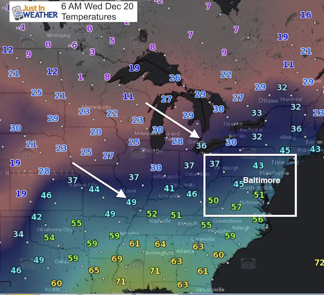
Back to reality today with temperatures staying in the 40s on this last day of Autumn. Yesterday did reach 60ºF at Baltimore’s BWI, but a quiet cold font moved through and you will notice the chill today. We have one more warm up this weekend before the pattern changes again. This will bring in rain Saturday that may get you wet at the Ravens game. The next surge of cold air looks faster on the computer models, but I have my suspicions about the accuracy of what that means. See more below.
Stats For December 20
Normal High: 44ºF
Record High: 67ºF in 1877
Normal Low: 27ºF
Record Low: 6ºF in 1942
Snow Record: 3.0″ in 1966
Sunrise: 7:22 AM
Sunset 4:47 PM
*Bay Water Temperature = 44ºF at Thomas Pt. Light House
Snow To Date (at BWI): 3.8″
Keep In Touch All Winter
Click here to sign up for email alerts…. Just in case you don’t get the post on your social media feed

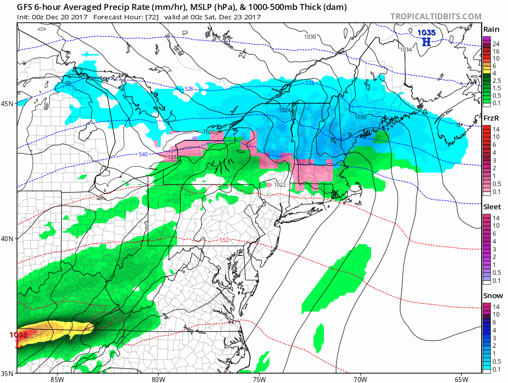
Weekend Rain
This large scale system is ahead of the arctic front. Low Pressure will ride along the mountains to our west. This is a pattern I identified in my winter outlook as one of the primary tracks. This brings warmer air ahead of it, so we will get only rain this weekend.
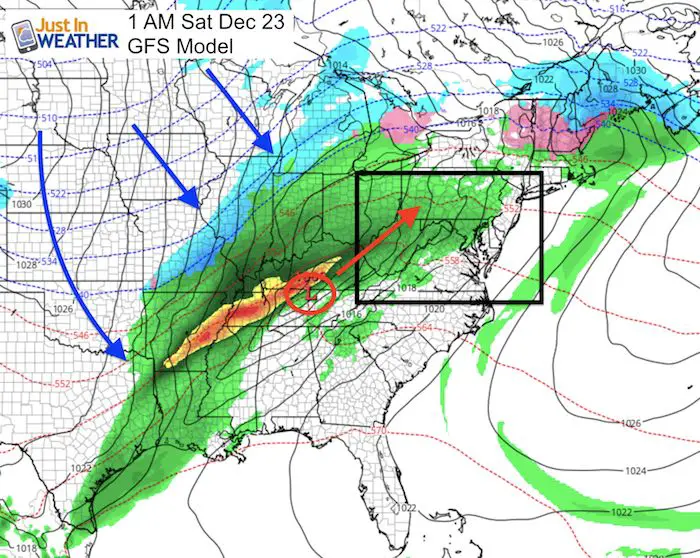
Storm Animation
This animation shows the rain moving in Saturday morning, then out Saturday night. There may be some breaks as the warmer air tends to push the rain up along the mountain ridges… but plan on a soggy Saturday if you go to the Ravens game or another outdoor event.
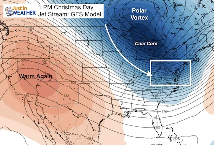
Christmas Day
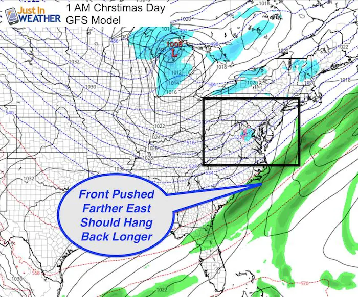
I Don’t Believe This Map
It is going to be colder for sure! In fact, the consensus among computer modeling now is a faster cold front that moves off of the coast and takes much of the moisture with it. The thing is, we still have 5 days and I don’t think this is fully accurate. Remember the last snow event we had last Friday? Also the one the weekend prior? Both were initially expected to be too far off of the coast, and only came back in line with our region that day or two beforehand.
Models tend to have bias or errors and this is the one I have identified in my winter outlook. The trend was for systems to verify farther east from the original forecast. Well, we have that now from what initially looked like Christmas rain. Now, I expect this to creep back west in the next few days of model runs. We still have time to prepare.
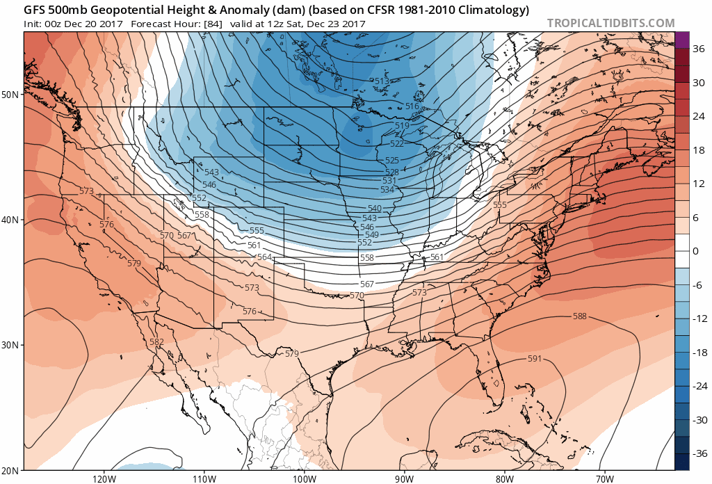
Jet Stream
One thing I can almost promise at this point: It will get MUCH COLDER on Christmas Day! This is the start of a pattern change, and there will be reinforcing cold shots through the first week of 2018.
Jet Stream Animation
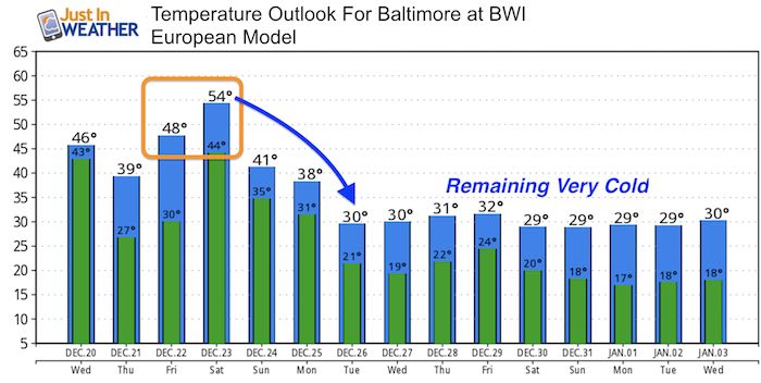
Temperature Outlook
The big cool down will be really big to close out the month. Whenever it arrives, it will be stronger and last longer that the previous arctic push.
-
Facebook: Justin Berk, Meteorologist
-
Twitter: @JustinWeather
-
Instagram: justinweather
FITF Gear

Snowstix- We Need You To Measure Snow Too
We are giving 10% of each sale to programs that benefit pediatric oncology patients.

 Get the award winning Kid Weather App I made with my oldest son and support our love for science, weather, and technology. Our 3 year anniversary of the release and our contribution to STEM education is this November. It has been downloaded in 60 countries, and works in both temperature scales. With your support we can expand on the fun introduction to science and real weather.
Keep In Touch All Winter
Click here to sign up for email alerts…. Just in case you don’t get the post on your social media feed
Also See:
My Winter Outlook 2017-2018 for more snow
La Nina Formed: What it could mean to our winter
NOAA Winter Outlook: Not The Best But Not The Worst For Snow
Two Farmers Almanacs Winter 2018 Outlooks
Winter Weather Folkore: Suggestions from Animals and Crops
First Frost and Freeze Dates For Maryland (southern PA and northern VA)
My Preliminary Winter Outlook Notes
Low Snow Winters In Baltimore: To Repeat Or Not Repeat
NOAA Ranks Blizzard 2016 4th Worst Snowstorm On Record