Tuesday December 19 2017
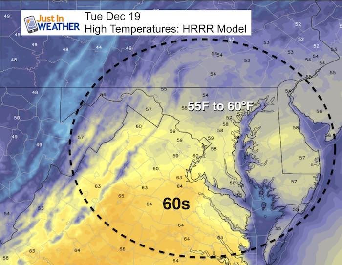
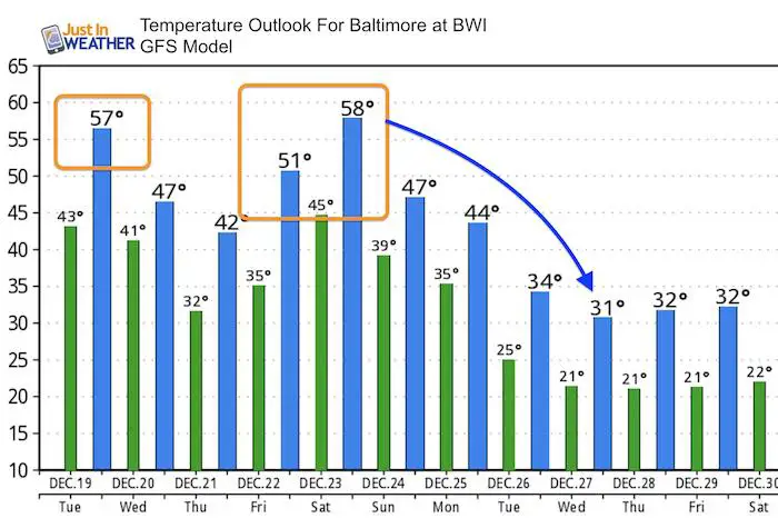
We have another warm day today that may push 60ºF in some spots, which should be warmer than the 56ºF mark Baltimore hit yesterday. This is also the anniversary of the largest December snow storm in Baltimore in 2009. That was measured at 17 inches of snow and was the first of 3 blizzards that season. Our warm up may seem ironic as the first day of Winter is two days away, but the arctic air is charging up and will reload into the US thanks to a gift by the Polar Vortex by Christmas. Locally we have two rain events on the way starting this weekend which could mean a wet Ravens game. Then leading into Christmas, but the timing of that cold air is expected to arrive at some point that day that will change rain over to snow for some.
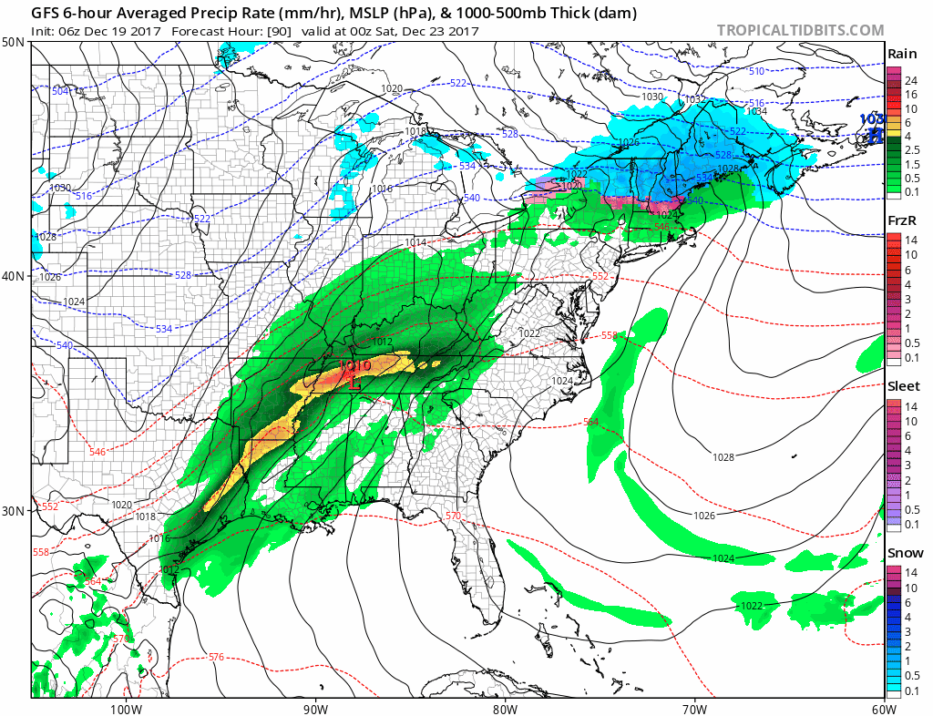
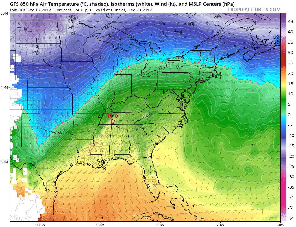
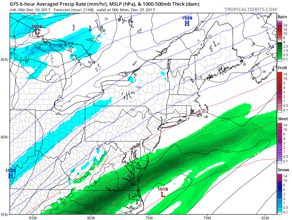
Here is a brief look through next week. Please note that I still do not like to lock in on specifics but the general theme will be rain this weekend and then colder at some point on Christmas. The maps below are suggestions but the timing of the cold air will determine if snow will be something you see or just read about nearby. It will be a close call.
Stats For December 17
Normal High: 44ºF
Record High: 66ºF in 1931
Normal Low: 27ºF
Record Low: 6ºF in 1989
Snow Record: 17.0″ in 2009
Sunrise: 7:22 AM
Sunset 4:46 PM
*Bay Water Temperature = 44ºF at Thomas Pt. Light House
Snow To Date (at BWI): 3.8″
Keep In Touch All Winter
Click here to sign up for email alerts…. Just in case you don’t get the post on your social media feed
High Temperatures Today
Looking Ahead:
The Jet Stream will be sending an arctic push courtesy of the Polar Vortex. This is some extreme stuff that will be in place on Christmas. The exact timing for our region is the tricky part of this forecast. But check out the core of the cold air below.
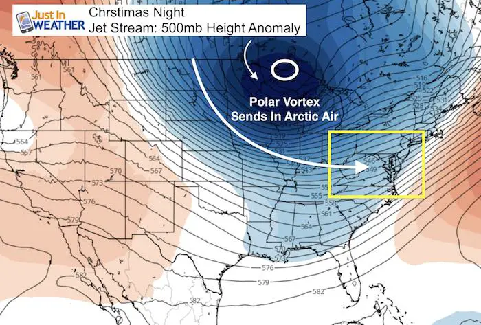
Source Of Cold Air
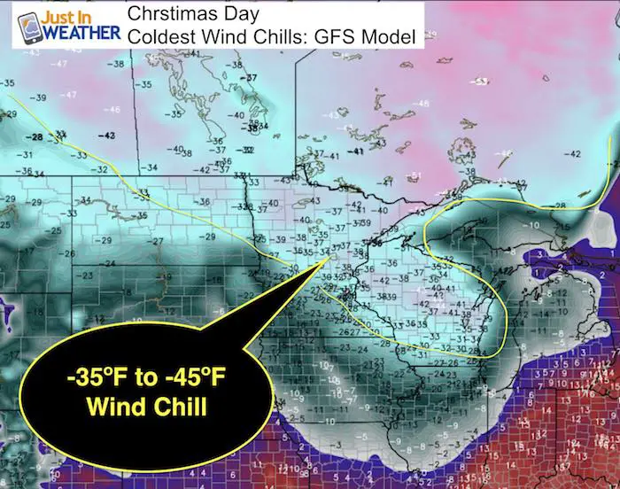
Northern Plains and Great Lakes on Christmas Day will have Wind Chills between -35ºF and -45ºF.
Storm Animation

Temperature Animation
Here is the animation of temperatures aloft at around 5,000 Ft. This is a good indication of the primary flow without influence of surface features. The arrival of the cold air by this GFS Model will be on Christmas Day. The precise hour of arrival could make the difference of getting accumulating snow, just flurries, or only rain ending. Then extremely cold air will enter the US for the last week of the year. Locally wil could spend a few days with highs staying below freezing in central Maryland.
Colors
- Green = Mild
- Blue and Purple = COLD
Closer Look
Temperature Outlook
After the mild day today. we will have one more warm up with the rain this weekend. Then…. It will get very cold! In fact, I believe we will verify colder than this model shows… meaning we could have days staying in the upper 20s to near 30ºF, especially if we get some snow cover in metro areas.
FITF Gear
We can promise all apparel orders in by midnight tonight will be delivered before Christmas.

Snowstix- We Need You To Measure Snow Too
We are giving 10% of each sale to programs that benefit pediatric oncology patients.

 Get the award winning Kid Weather App I made with my oldest son and support our love for science, weather, and technology. Our 3 year anniversary of the release and our contribution to STEM education is this November. It has been downloaded in 60 countries, and works in both temperature scales. With your support we can expand on the fun introduction to science and real weather.
Please share your thoughts, best weather pics/video, or just keep in touch via social media
-
Facebook: Justin Berk, Meteorologist
-
Twitter: @JustinWeather
-
Instagram: justinweather
Keep In Touch All Winter
Click here to sign up for email alerts…. Just in case you don’t get the post on your social media feed
Also See:
My Winter Outlook 2017-2018 for more snow
La Nina Formed: What it could mean to our winter
NOAA Winter Outlook: Not The Best But Not The Worst For Snow
Two Farmers Almanacs Winter 2018 Outlooks
Winter Weather Folkore: Suggestions from Animals and Crops
First Frost and Freeze Dates For Maryland (southern PA and northern VA)
My Preliminary Winter Outlook Notes
Low Snow Winters In Baltimore: To Repeat Or Not Repeat
NOAA Ranks Blizzard 2016 4th Worst Snowstorm On Record
Blizzard 2016 Record Top Snowstorm: Area Totals
Extreme Weather of 2015 balanced out on both ends