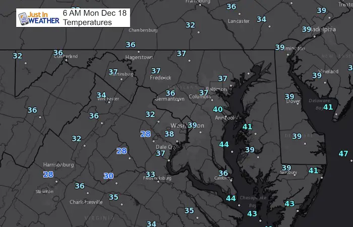
 Monday December 18
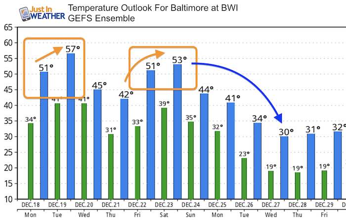
We had some rain overnight that may have made the ground we by you, but the air temperatures have stayed above freezing since. The pattern will remain mild all week even as the calendar passes the Winter Solstice this Thursday. There is a chance to reach 60ºF tomorrow, then another mild push this weekend as rain makes a return. The big question will be next week around Christmas Day when the next arctic surge will be knocking on our doorstep. There are some maps below but please consider that it is still a full week away and there is no agreement on the computer models with the timing.
Stats For December 18
Normal High: 44ºF
Record High: 72ºF in 2006
Normal Low: 27ºF
Record Low: 7ºF in 1919
Snow Record: 4.0″ in 1916
Sunrise: 7:21 AM
Sunset 4:46 PM
*Bay Water Temperature = 44ºF at Thomas Pt. Light House
Snow To Date (at BWI): 3.8″
Keep In Touch All Winter
Click here to sign up for email alerts…. Just in case you don’t get the post on your social media feed
High Temperatures
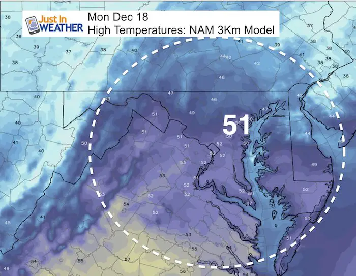
This Week
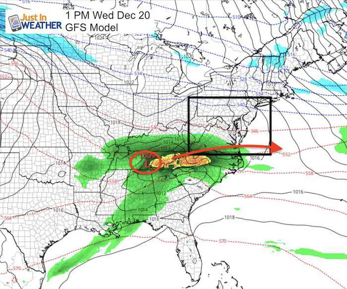
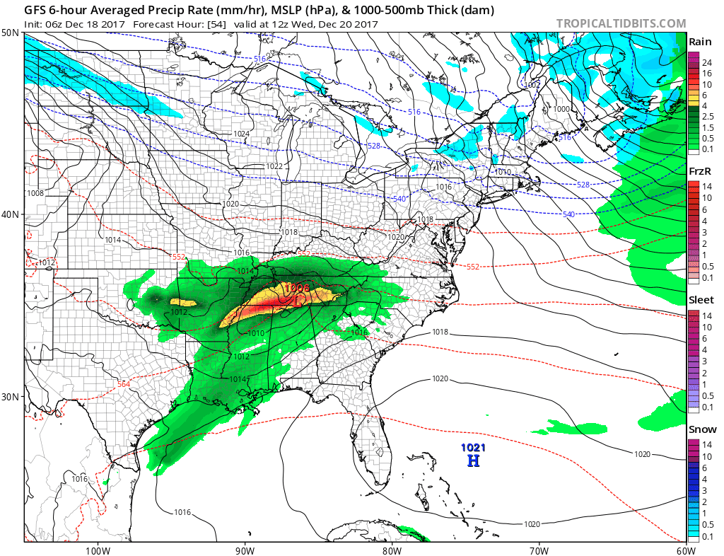
There will be one system in the south that is expected to miss us on Wednesday. I say ‘expected’ as prior systems had come back farther north and I still do not trust these models I show here. That seems like a contradiction, but I show these forecast plots as guidance and look for trends.

This weekend
A larger system and the storm track will be warmer to our west. This will bring in mild temperatures and rain. Snow will return to western Maryland and ski resorts out west.
Forecast Animation
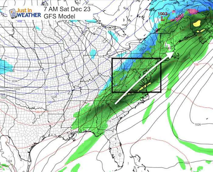
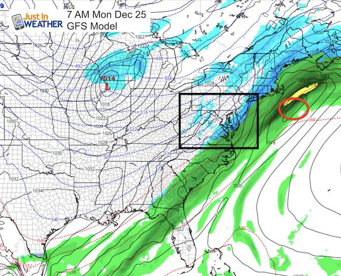
Christmas Outlook
Arctic air is rebuilding and will be trying to return around Christmas. There is a discrepancy on the timing and here the GFS Model shows it on our doorstep Christmas Day.
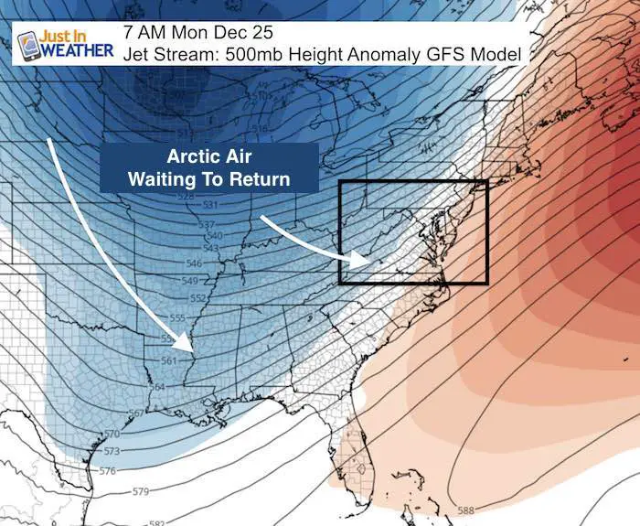
This will be associated with another storm and the transition from rain to snow. It is TOO EARLY to pin down. Remember the past 3 snow events ramped up in the final day or two… so this is still open for adjustment.
I need to mention that the European Model- not shown here… was colder and is now extending the warm air to hang on another two days. I will contrast the two here in my next report.
Temperature Outlook
The big cool down will be really big to close out the month. Whenever it arrives, it will be stronger and last longer that the previous arctic push.
-
Facebook: Justin Berk, Meteorologist
-
Twitter: @JustinWeather
-
Instagram: justinweather
FITF Gear

Snowstix- We Need You To Measure Snow Too
We are giving 10% of each sale to programs that benefit pediatric oncology patients.

 Get the award winning Kid Weather App I made with my oldest son and support our love for science, weather, and technology. Our 3 year anniversary of the release and our contribution to STEM education is this November. It has been downloaded in 60 countries, and works in both temperature scales. With your support we can expand on the fun introduction to science and real weather.
Keep In Touch All Winter
Click here to sign up for email alerts…. Just in case you don’t get the post on your social media feed
Also See:
My Winter Outlook 2017-2018 for more snow
La Nina Formed: What it could mean to our winter
NOAA Winter Outlook: Not The Best But Not The Worst For Snow
Two Farmers Almanacs Winter 2018 Outlooks
Winter Weather Folkore: Suggestions from Animals and Crops
First Frost and Freeze Dates For Maryland (southern PA and northern VA)
My Preliminary Winter Outlook Notes
Low Snow Winters In Baltimore: To Repeat Or Not Repeat
NOAA Ranks Blizzard 2016 4th Worst Snowstorm On Record