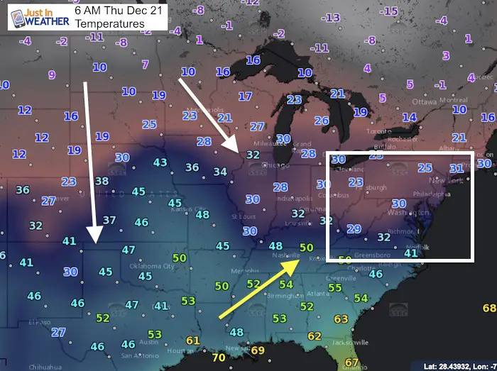
Thursday December 21 2017
We start the astronomical winter season today and it sure feels like it. The sun will be at the lowest angle in the sky of the year at it points to the Tropical of Capricorn at 11:28 AM. I have some interesting stats I will post later this morning as we celebrate some special things. We all feel the chill today and much colder air is on the way next week. But there is one blip in the pipeline. A storm with rain on Saturday will pump in warmer air, and may not rain all day if you are in Baltimore or south. So there could be some breaks at the Ravens game. Then the bottom falls out on thermometers on Christmas Day. There is still a chance for some snow and a larger storm by the end of next week.
Stats For December 21
Normal High: 44ºF
Record High: 71ºF in 2013
Normal Low: 27ºF
Record Low: 5ºF in 1942
Snow Record: 4.3″ in 1962
Sunrise: 7:23 AM
Sunset 4:47 PM
*Bay Water Temperature = 44ºF at Thomas Pt. Light House
Snow To Date (at BWI): 3.8″
Keep In Touch All Winter
Click here to sign up for email alerts…. Just in case you don’t get the post on your social media feed

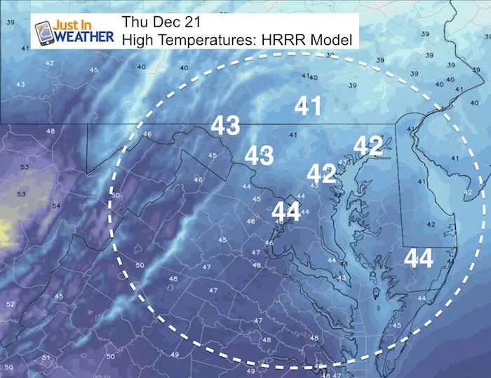
High Temperatures Today
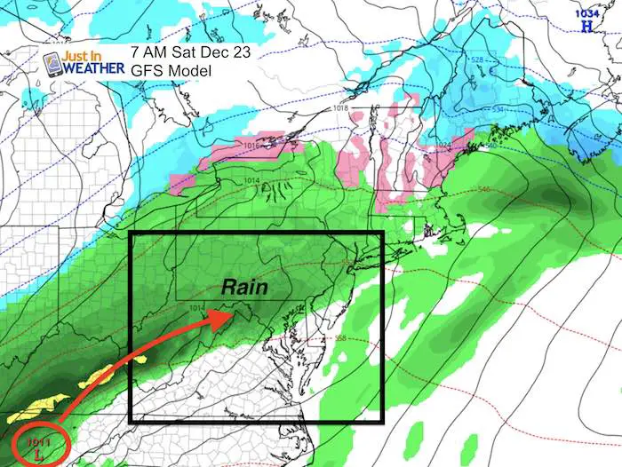
Saturday Outlook
The storm on the way is ahead of the arctic air. We will be on the warm side and get rain… But the specific track of Low Pressure will ride along the mountains and often this keeps more of the rain inland until the Low passes. That is why morning rain may lift north and west until the storm arrives with the rain spreading back across much of central Maryland and the Eastern Shore by evening.
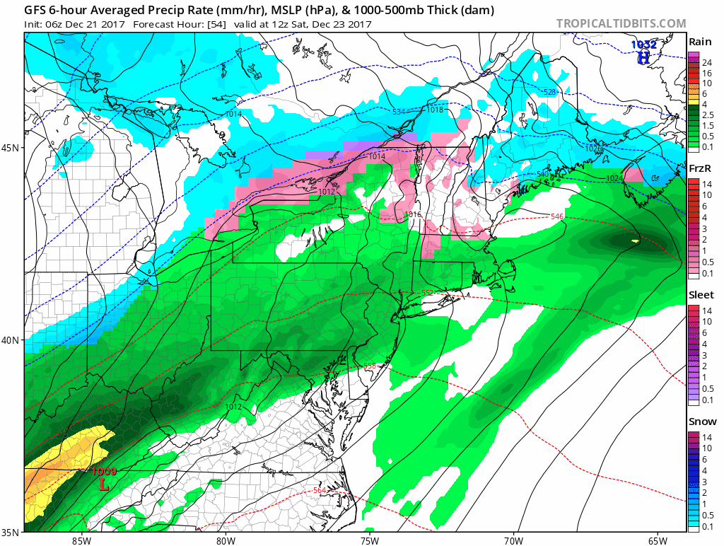
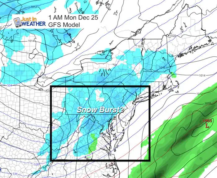
Storm Animation
This animation shows the flow of rain Saturday, then the push of the cold front on Christmas. This model shows a burst of light snow overnight and into Christmas morning… and I still think there is more adjusting to be done. There is a chance hanging on…
Christmas Day
Jet Stream
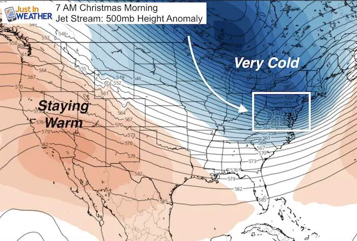
Temperature Outlook

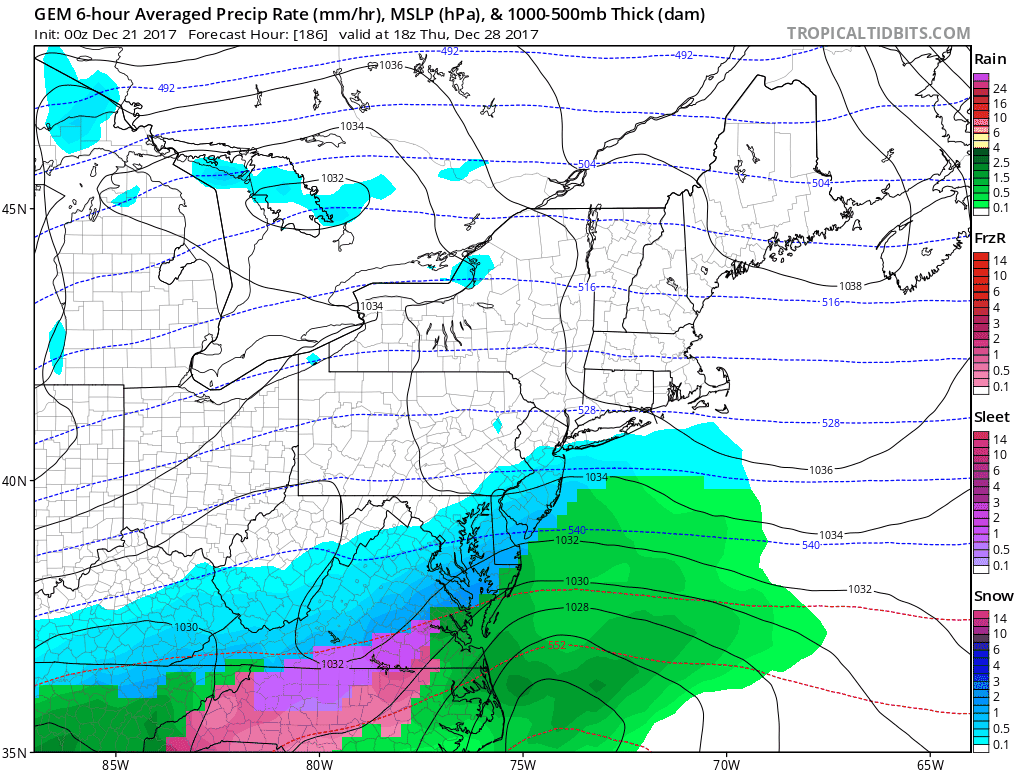
Next Week- Tracking Another Storm?
I do not like pushing specific weather events more than 1 week away, but since it is holiday season I figured I would show any chance on the horizon… This is the Canadian GEM Model showing the most aggressive look at a coastal storm sequence NEXT Thursday through Saturday. Stand by…. I am sure there will be changes but also something the play out in our favor. FITF
Please share your thoughts, best weather pics/video, or just keep in touch via social media
-
Facebook: Justin Berk, Meteorologist
-
Twitter: @JustinWeather
-
Instagram: justinweather
FITF Gear

Snowstix- We Need You To Measure Snow Too
We are giving 10% of each sale to programs that benefit pediatric oncology patients.

 Get the award winning Kid Weather App I made with my oldest son and support our love for science, weather, and technology. Our 3 year anniversary of the release and our contribution to STEM education is this November. It has been downloaded in 60 countries, and works in both temperature scales. With your support we can expand on the fun introduction to science and real weather.
Keep In Touch All Winter
Click here to sign up for email alerts…. Just in case you don’t get the post on your social media feed
Also See:
My Winter Outlook 2017-2018 for more snow
La Nina Formed: What it could mean to our winter
NOAA Winter Outlook: Not The Best But Not The Worst For Snow
Two Farmers Almanacs Winter 2018 Outlooks
Winter Weather Folkore: Suggestions from Animals and Crops
First Frost and Freeze Dates For Maryland (southern PA and northern VA)
My Preliminary Winter Outlook Notes
Low Snow Winters In Baltimore: To Repeat Or Not Repeat
NOAA Ranks Blizzard 2016 4th Worst Snowstorm On Record
Blizzard 2016 Record Top Snowstorm: Area Totals
Extreme Weather of 2015 balanced out on both ends