 Wednesday December 6
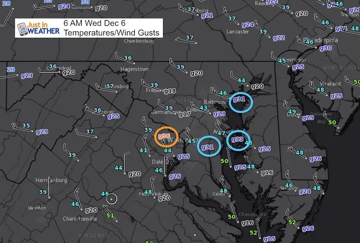
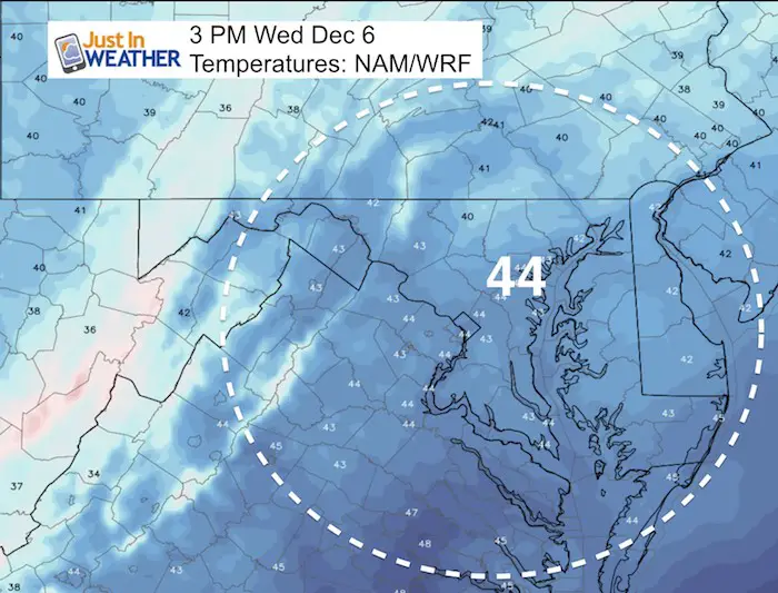
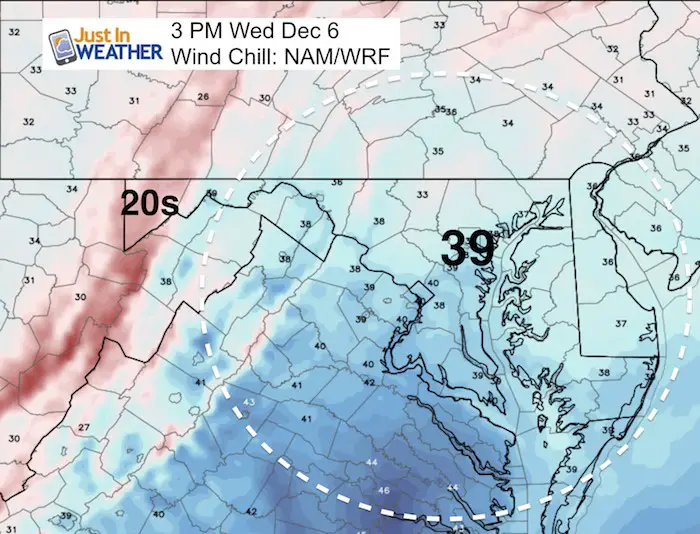
The arctic front has moved through and strong winds are ushering in the colder air. Wind gusts this morning have been measured over 30 mph. While the winds will ease a little, strong gusts expected all day will make for white knuckles over bridges and colder wind chills. Temperatures this afternoon will be close to 20 degrees colder than yesterday (high of 61ºF at BWI). There will be snow in Maryland this week, but nothing major. Flurries expected in the mountains and a mix of snow and sleet with the storm shifting off of the east coast Friday.
The outlook remains colder than average for at least the next two weeks. There will be energy in the pattern and I suspect we have a chance at a system next Tuesday and Wednesday to bring some wintry weather in place. Here’s the latest:
Stats For December 5
Normal High: 48ºF
Record High: 77ºF in 1998
Normal Low: 31ºF
Record Low: 13ºF in 2002
Snow Record: 6.8″ in 2004
Sunrise: 7:12 AM
Sunset 4:44 PM
Keep In Touch All Winter
Click here to sign up for email alerts…. Just in case you don’t get the post on your social media feed
Afternoon Temperatures/Wind Chills
Reminder: Yesterday was 61ºF at BWI
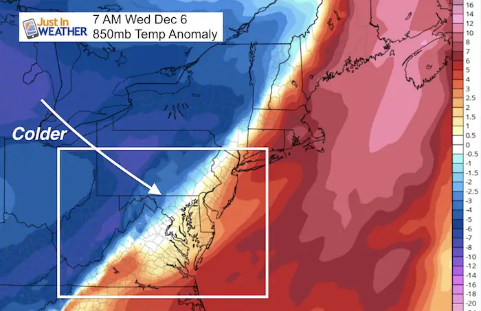
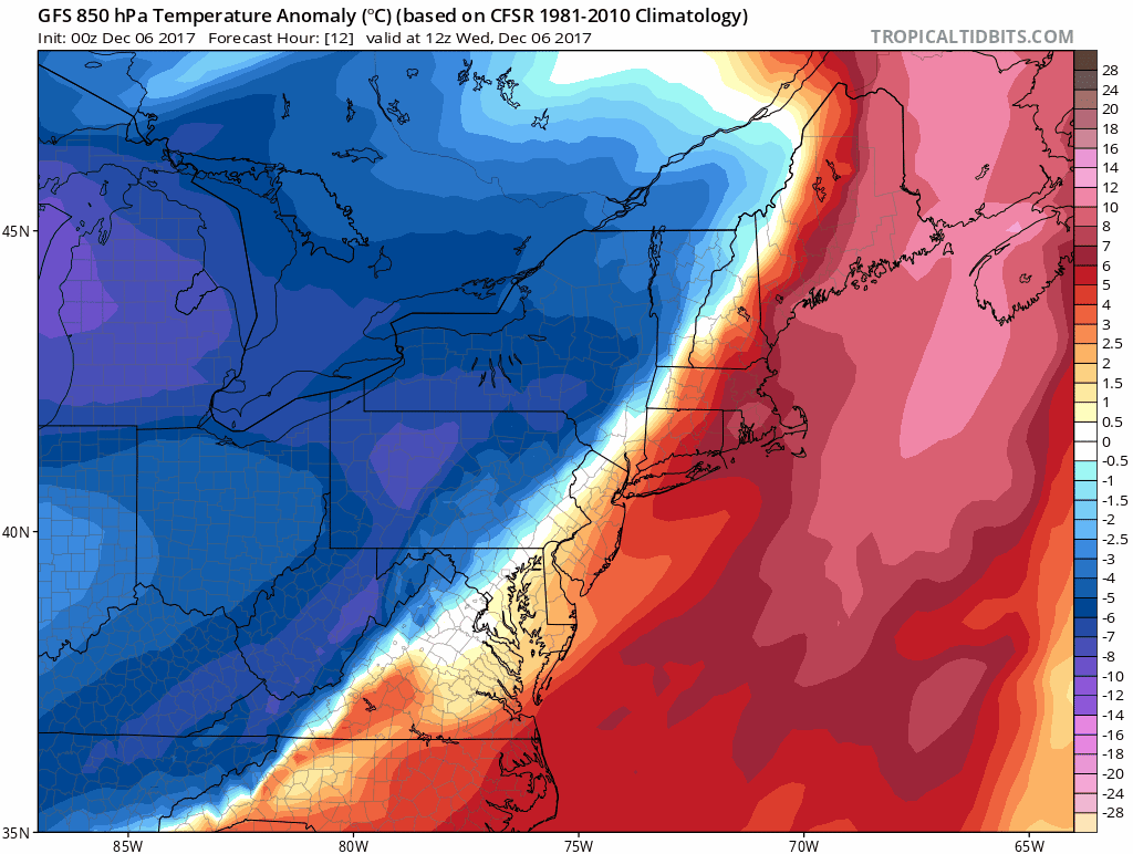
Cold Air Advection
This is the upper level 850mb view showing the unobstructed arrival of cold air at around 5,000 Ft.
Temperature Animation
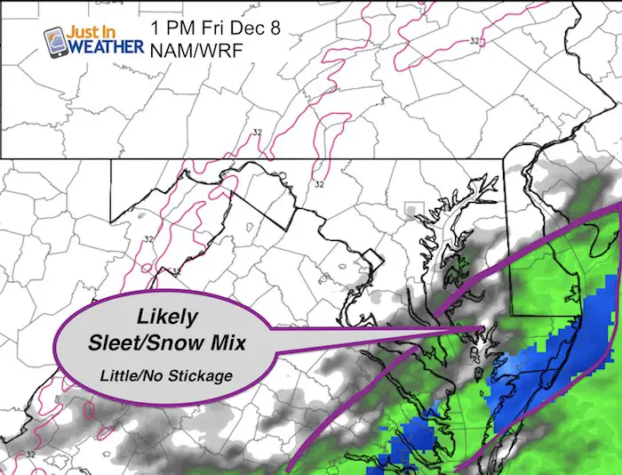
Coastal Friday:
The front stalls or crawls off of the east coast. This will be a test of my Atmospheric Memory Theory and Model Bias. The trend has shifted this east and the time to watch is Friday afternoon into Saturday morning. There will be cold enough air to develop sleet and snow mix… But not all will stick. The ground is still warm, but some may lay and stay on grassy areas/landscaping. I do not see a road issue on Delmarva or the beaches at this time. West of the Bay will be a non issue.
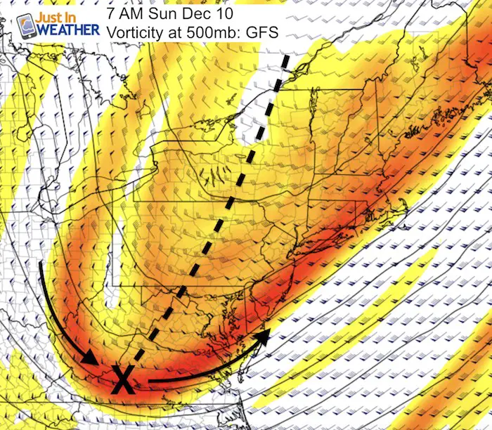
Weekend Flurries
There will be flurries and snow showers in the mountains. I am still watching this upper level disturbance Sunday to bring in a chance for flurries in the morning until early afternoon. The Vortex Max ‘X’ is swinging through to our south a good location, but the trough axis is not the most favorable. It looks like a back-slash but we would want the orientation like a forward slash. As long as it is positioned like this, system will be more progressive and shift farther east.
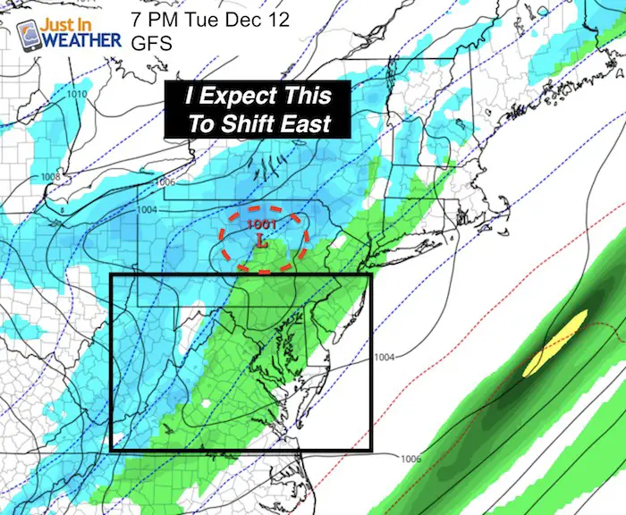
Next Week System:
The GFS Model shows a system passing into Pennsylvania, which would bring a snow/rain mix. But that location and track breaks up the moisture or central Maryland. If the model bias holds here was well, then there will be a shift east and make this worth watching for Tuesday and Wednesday.
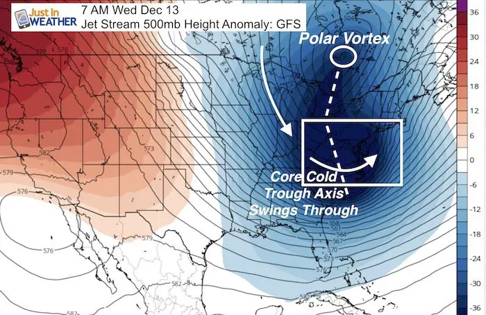
Watching the Upper Level Pattern For Signal Of Shift
I showed this jet stream view last night showing that trough axis shifted to that ‘forward slash’ orientation. That pivot is critical for us to get systems more likely to impact us with wintry weather.
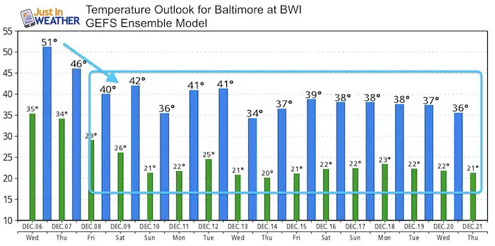
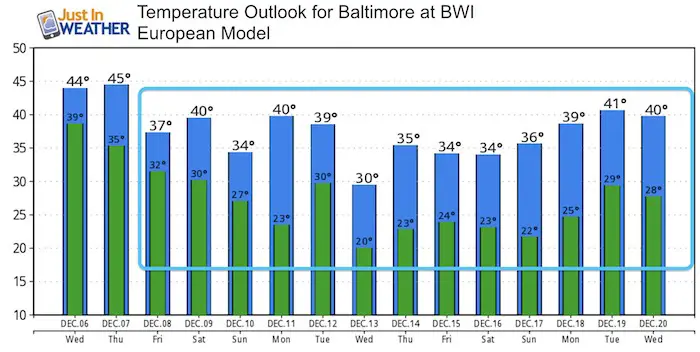
Temperature Outlook
Compare the GEFS and European Models
Get your FITF Gear Here
Snowstix- New Colors in 30″ and 36″
We are giving 10% of each sale to programs that benefit pediatric oncology patients.

Faith in the Flakes Online Store
PJ bottoms still inside out- They have to be to help bring on the snow.

 Get the award winning Kid Weather App I made with my oldest son and support our love for science, weather, and technology. Our 3 year anniversary of the release and our contribution to STEM education is this November. It has been downloaded in 60 countries, and works in both temperature scales. With your support we can expand on the fun introduction to science and real weather.
Please share your thoughts, best weather pics/video, or just keep in touch via social media
-
Facebook: Justin Berk, Meteorologist
-
Twitter: @JustinWeather
-
Instagram: justinweather
Also See:
My Winter Outlook 2017-2018 for more snow
La Nina Formed: What it could mean to our winter
NOAA Winter Outlook: Not The Best But Not The Worst For Snow
Two Farmers Almanacs Winter 2018 Outlooks
Winter Weather Folkore: Suggestions from Animals and Crops
First Frost and Freeze Dates For Maryland (southern PA and northern VA)
My Preliminary Winter Outlook Notes
Low Snow Winters In Baltimore: To Repeat Or Not Repeat
NOAA Ranks Blizzard 2016 4th Worst Snowstorm On Record