Friday December 1
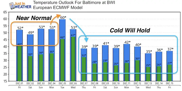
We start a brand new month today and the beginning of meteorological winter. We group seasons in 3 full month blocks that are just 3 weeks off from the solstice (December 21). We will have a dramatically brand new pattern to match it next week. This will be the coldest stretch this early in the season we have seen in years with highs across the region staying in the 30s. That also means our chances of getting some snow will grow. FITF But let’s not get ahead of ourselves. It is mild this morning, but the weekend will trend back to near normal. Here’s the breakdown plus some December stats:
Stats For December 1
Normal High: 50ºF
Record High: 75ºF in 2006
Normal Low: 32ºF
Record Low: 12ºF in 1967
Snow Record: 1.5″ in 1903
Sunrise: 7:07 AM
Sunset 4:44 PM
Stats For The Month Of December
Highs Cool from 50ºF on Dec 1st to 42ºF starting Dec 28th
Record High for the month: 77ºF on a few dates… Dec 6 and Dec 7 in 1998; Dec 29 in 1984
Lows Drops from 32ºF on Dec 1st to 25ºF starting on Dec 29th
Record Coldest for the month: -3ºF on Dec 29th in 1880
Snow: Average for the month = 3.0″
Snow: Biggest 1 day total = 17″ on Dec 19 in 2009
Sunlight loss between Dec 1 and Dec 21= 12 minutes and 17 seconds
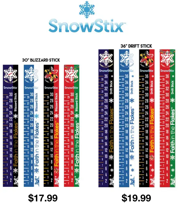
SnowStix Give-Away
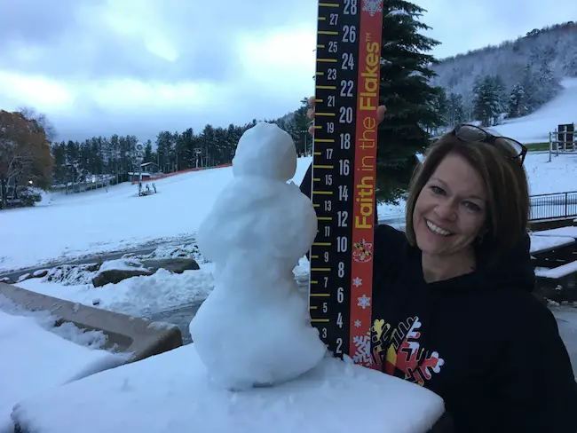
To celebrate the start of winter, I am giving away FIVE SnowStix on December 1. Since social media does not always show you my posts, email is the best way to guarantee for you to see. Click here to sign up for email alerts. Sign up before 5 PM Friday December 1, 2017 and you (along with everyone already on the list) will be automatically entered to win a free SnowStix to measure snow this winter.
Winners will be announced and contacted tonight
Earthquake Details: This was downgraded to M4.1 by the USGS. It was shallow that allowed a large area to feel it across central Maryland. Also down Richmond, VA and north of New York City.

Today
A cold front is moving through and taking the clouds with it. Cooler winds will filter in and hold our temps nearly steady most of the morning. Slight warming to the 50s this afternoon.
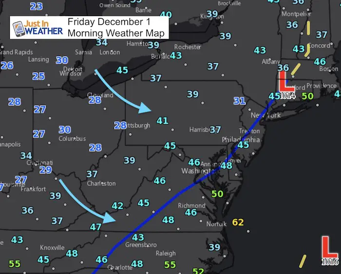
We will have a quiet weather pattern through the weekend. Next week will bring moderate with with a strong cold front. The arctic air will spill in behind it and be hear by the end of next week
High Temperatures
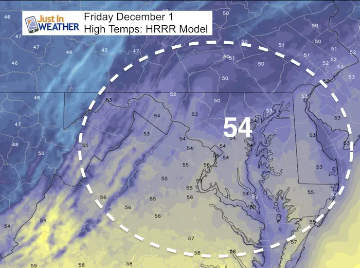
Temperature Outlook
This has a slightly lower high forecast for today, but the cold next week is the main focus and agreement across the spectrum.
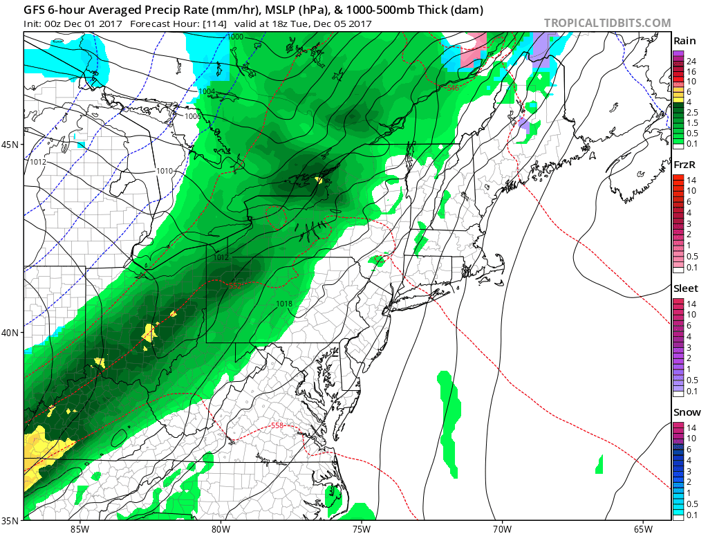
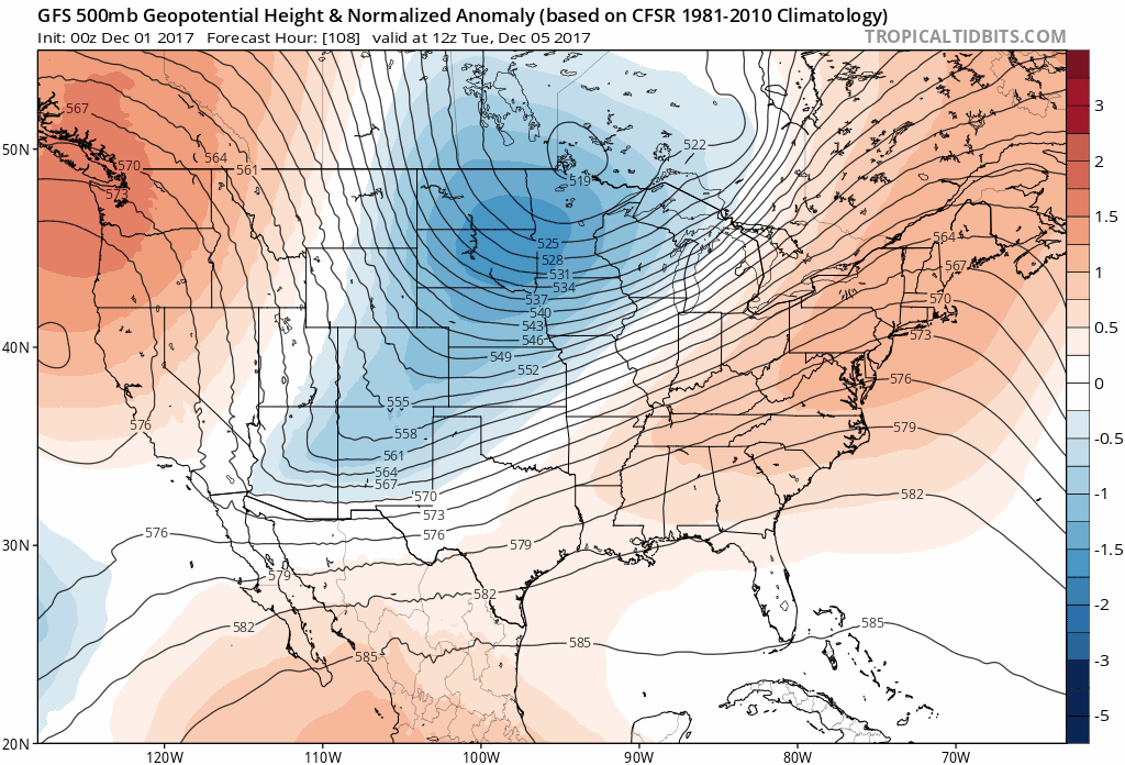
Next Storm: Next Tuesday and Wednesday
This model does show snow in western Maryland and the chance this may end with some flakes in the western suburbs. No stickage expected at this time.
Pattern Change
The core of the cold air will be moving in to the US next week. We will begin to really feel it by Friday December 8th. Then it should hold in place. See the animation below
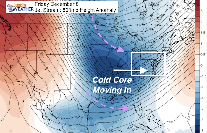
Jet Stream Animation
Faith in the Flakes Online Store
PJ bottoms still inside out- They have to be to help bring on the snow.

Snowstix- Ready For Delivery
We are giving 10% of each sale to programs that benefit pediatric oncology patients.
 Get the award winning Kid Weather App I made with my oldest son and support our love for science, weather, and technology. Our 3 year anniversary of the release and our contribution to STEM education is this November. It has been downloaded in 60 countries, and works in both temperature scales. With your support we can expand on the fun introduction to science and real weather.
Please share your thoughts, best weather pics/video, or just keep in touch via social media
-
Facebook: Justin Berk, Meteorologist
-
Twitter: @JustinWeather
-
Instagram: justinweather
Also See:
My Winter Outlook 2017-2018 for more snow
La Nina Formed: What it could mean to our winter
NOAA Winter Outlook: Not The Best But Not The Worst For Snow
Two Farmers Almanacs Winter 2018 Outlooks
Winter Weather Folkore: Suggestions from Animals and Crops
First Frost and Freeze Dates For Maryland (southern PA and northern VA)
My Preliminary Winter Outlook Notes
Low Snow Winters In Baltimore: To Repeat Or Not Repeat
NOAA Ranks Blizzard 2016 4th Worst Snowstorm On Record
Blizzard 2016 Record Top Snowstorm: Area Totals
Extreme Weather of 2015 balanced out on both ends