November 30 2017
Baltimore hit 67ºF yesterday but that is now a memory. We begin our slide back to near normal temperatures into the weekend. This will come with some showers overnight. A larger storm will arrive next week that marks the arctic front and a huge pattern change. Meteorological Winter begins December 1 and we will start to feel it next week. This is the most significant pattern chance this early in the season that we have seen in a few years. The long range does show some snow. I don’t like to lock in on forecast maps over a week away, but it does signal that ‘something’ will happen during the second week of December to bring the first flakes of the season.
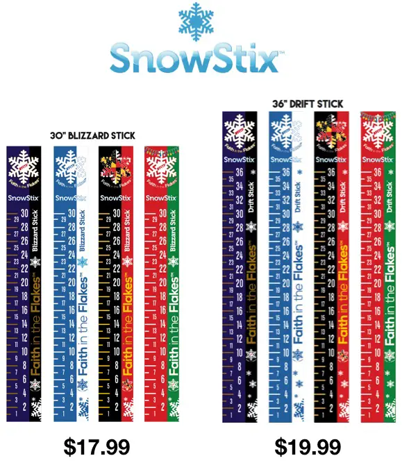
SnowStix Give-Away
To celebrate the start of winter, I am giving away FIVE SnowStix on December 1. Since social media does not always show you my posts, email is the best way to guarantee for you to see. Click here to sign up for email alerts. Sign up before 5 PM Friday December 1, 2017 and you (along with everyone already on the list) will be automatically entered to win a free SnowStix to measure snow this winter.
Stats For November 30
Normal High: 51ºF
Record High: 74ºF in 1933
Today is the first day of the calendar year that BWI should average a low at freezing.
Normal Low: 32ºF
Record Low: 12ºF in 1929
Sunrise: 7:06 AM
Sunset 4:44 PM
Today
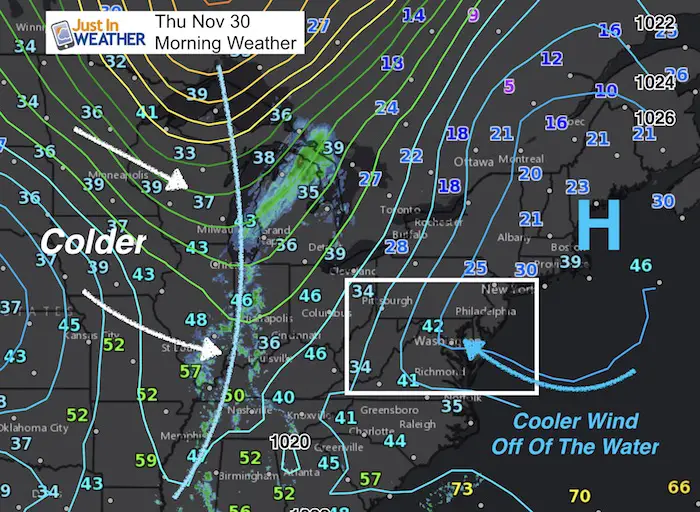
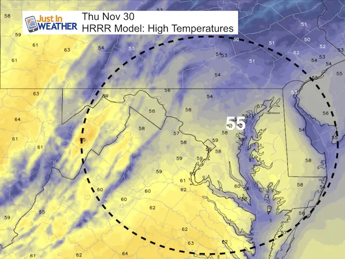
The cold front will arrive tonight. Usually we have a warm day prior to it arriving, but colder winds off of the water will hold us back into the 50s today. We should be 10 to 15 degrees cooler than yesterday.
High Temperatures
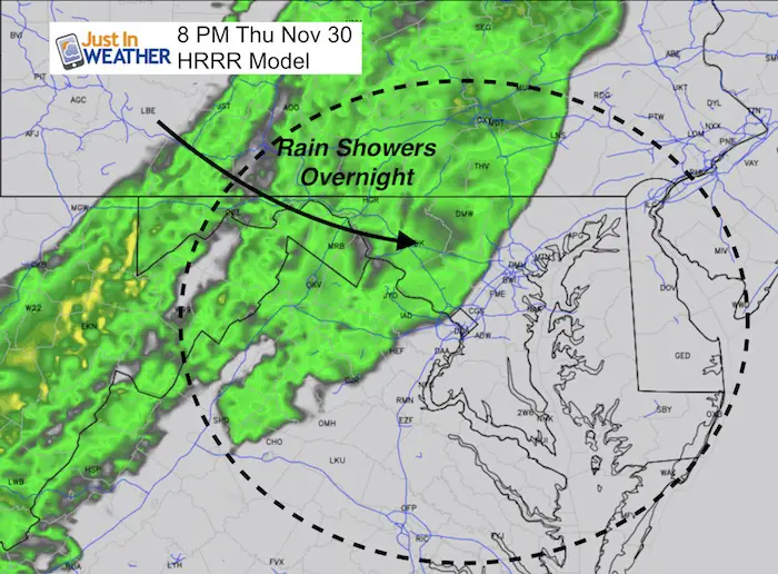
Rain Showers Tonight
The best chance for showers will be after dark and ending by tomorrow morning.
Larger Storm Next Week
Rain arrives with the arctic front next Tuesday and Wednesday. This could bring over 0.50″ of needed rain, then mark the colder air to filter in for a few days to follow.
Arctic Air By The End Of Next Week
This still shot of next Friday morning shows the core of the cold air settling in (shaded in blue) next week. Below is the animation to show how this evolves and then holds for much of December. This is the type of pattern that will introduce the chance of snow with following storms.
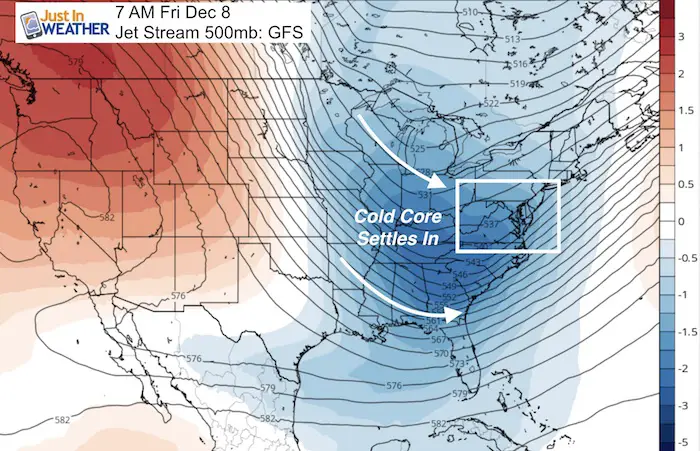
Animation Of The Jet Stream
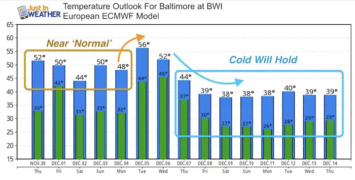
Temperature Outlook
The trend is back to ‘normal’ through the weekend. After the rain, the cold will hold!
Snow?
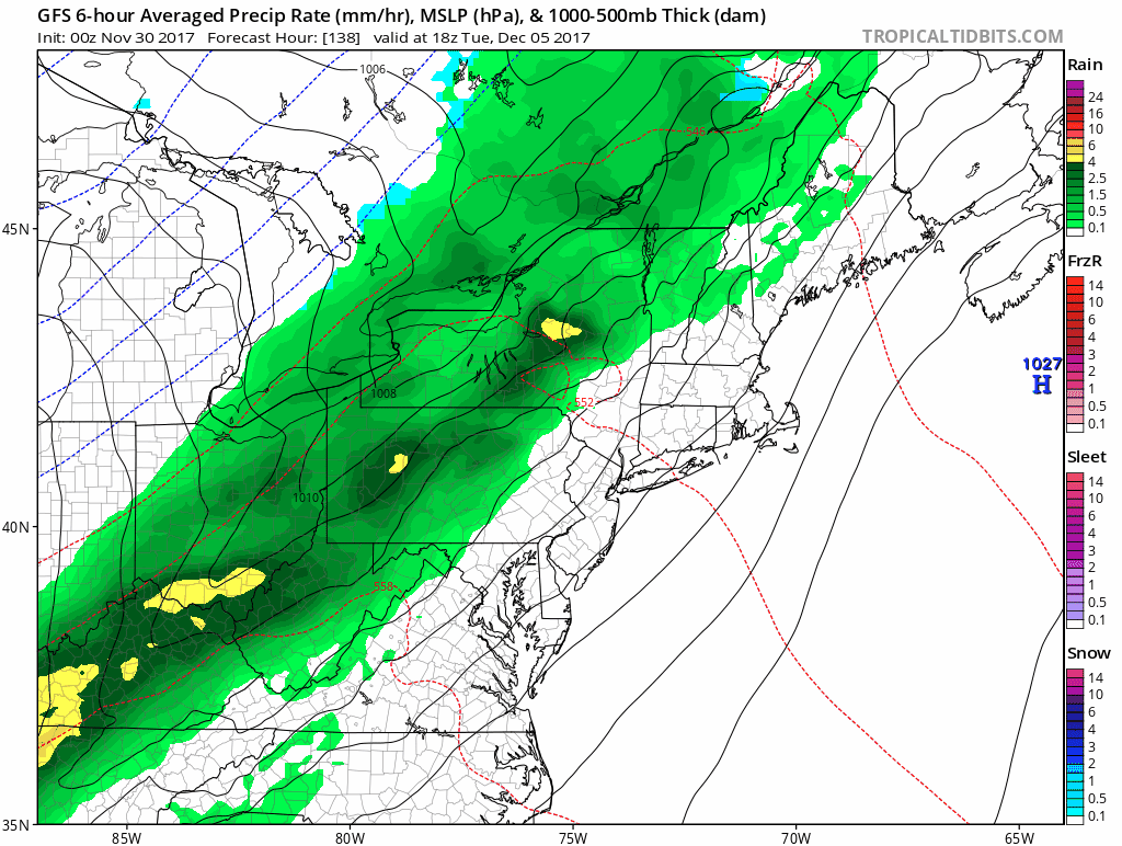
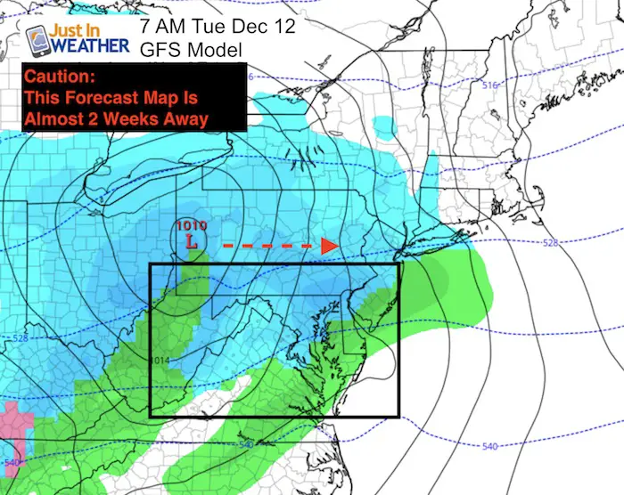
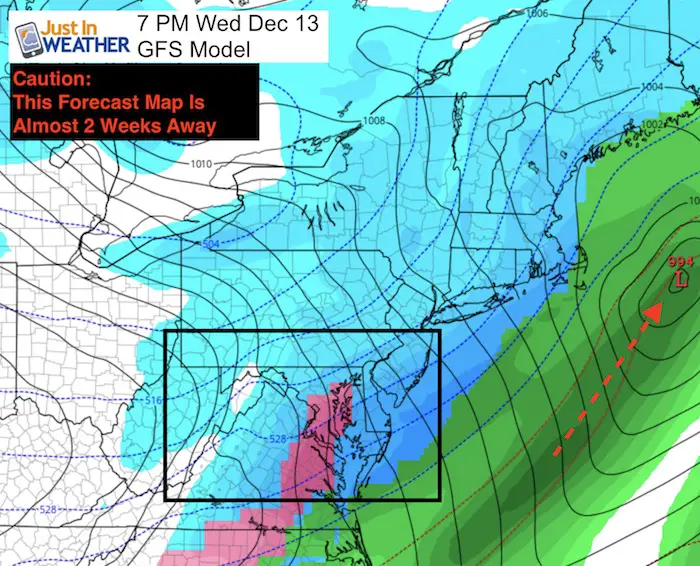
I have been a long time advocate for NOT showing surface weather maps beyond a week. I still believe in that. But I know there are other weather outlets that have discussed longer range weather. Quite a few people have asked me to discuss that and verify or dispute the prospects for snow. Well, as much as I love snow I can not lock in on specific events too far away.
Here is a look at the next 12 to 14 days showing the potential for snow. I can almost promise this will NOT play out like shown. Model error has verified storms farther east than shown just a few days away… I am showing these maps so we can look back and see how different the results will be.
First the Low on Dec 10 is shown on the GFS Model passing north. That is not favorable to us for snow, but it shows it on the map in blue.
Second, a larger event off of the coast is shown to bring wider spread of snow and ice for our region. As I mentioned in my winter outlook, there has been a trend with the tropical season for storms to end up farther off of the coast.
Faith in the Flakes Online Store
PJ bottoms still inside out- They have to be to help bring on the snow.

Snowstix- Ready For Delivery
We are giving 10% of each sale to programs that benefit pediatric oncology patients.
 Get the award winning Kid Weather App I made with my oldest son and support our love for science, weather, and technology. Our 3 year anniversary of the release and our contribution to STEM education is this November. It has been downloaded in 60 countries, and works in both temperature scales. With your support we can expand on the fun introduction to science and real weather.
Please share your thoughts, best weather pics/video, or just keep in touch via social media
-
Facebook: Justin Berk, Meteorologist
-
Twitter: @JustinWeather
-
Instagram: justinweather
Also See:
My Winter Outlook 2017-2018 for more snow
La Nina Formed: What it could mean to our winter
NOAA Winter Outlook: Not The Best But Not The Worst For Snow
Two Farmers Almanacs Winter 2018 Outlooks
Winter Weather Folkore: Suggestions from Animals and Crops
First Frost and Freeze Dates For Maryland (southern PA and northern VA)
My Preliminary Winter Outlook Notes
Low Snow Winters In Baltimore: To Repeat Or Not Repeat
NOAA Ranks Blizzard 2016 4th Worst Snowstorm On Record