 8 AM Sat Oct 7
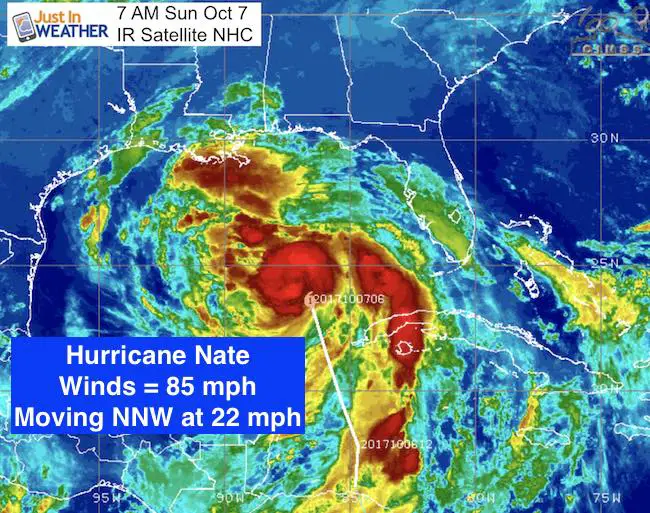
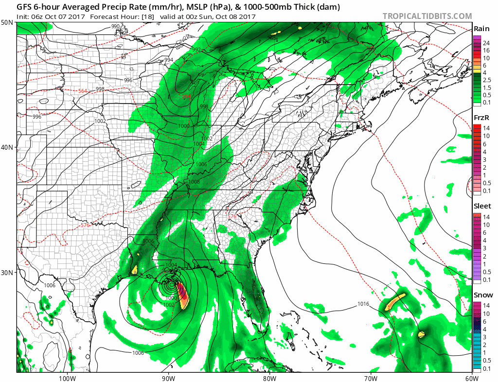
Hurricane Nate intensified last night and continues to grow stronger in the Gulf of Mexico. The reason it is stronger that expected is because it passes to the Easton Cancun and didn’t cross over the Yucatan Peninsula. That allowed it to maintain integrity and winds this morning are 80 mph. The forward speed is racing at 22 mph to the north. That will limit the time for it to grow much stronger, but it is expected to bring a high storm surge into the gulf coast with landfall as soon as tonight. A Hurricane Warning and Storm Surge Watch for possibly 8 Ft high water for parts of the gulf coast states. See the list below.
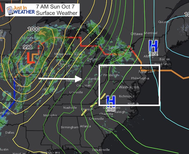
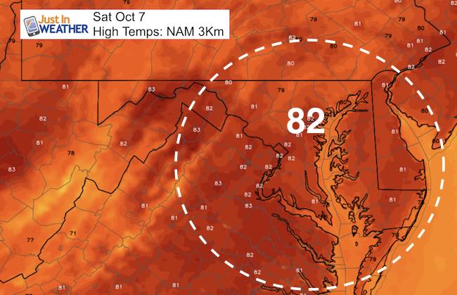
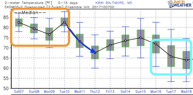
Locally we still have a very warm day back into the mid 80s. It is the cold front to our west that will funnel Nate our way and keep the chance of rain around for a few days. Showers will arrive Sunday but the tropical rain will reach us Sunday night and Monday. More on Nate below…
Hurricane Nate
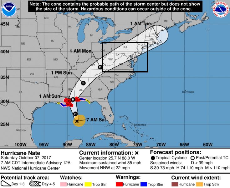
LOCATION…25.7N 88.0W
ABOUT 245 MI…395 KM SSE OF THE MOUTH OF THE MISSISSIPPI RIVER
MAXIMUM SUSTAINED WINDS…85 MPH…135 KM/H
PRESENT MOVEMENT…NNW OR 340 DEGREES AT 22 MPH…35 KM/H
MINIMUM CENTRAL PRESSURE…986 MB…29.12 INCHES
Trust in this Bust- The Shirt
This is not a forecast, but a fundraiser for breast cancer research at BCRF- the highest rated cancer research charity. This soft Bella T-Shirt is to promote the strength of the ‘good bust’ and the heart that beats strong beneath it. Proceeds will be donated in honor of my mother Linda Berk, a 3-time breast cancer survivor. Click on the shirt image to join us.

Tropical Storm Force Winds:
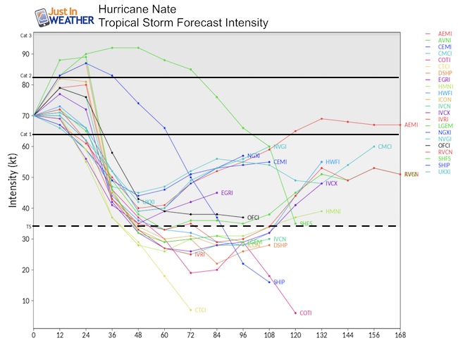
There is a very small chance the wind field holds together when Nate arrive. It will be gusty, but if we get winds over 40 mph, that will arrive Monday morning.

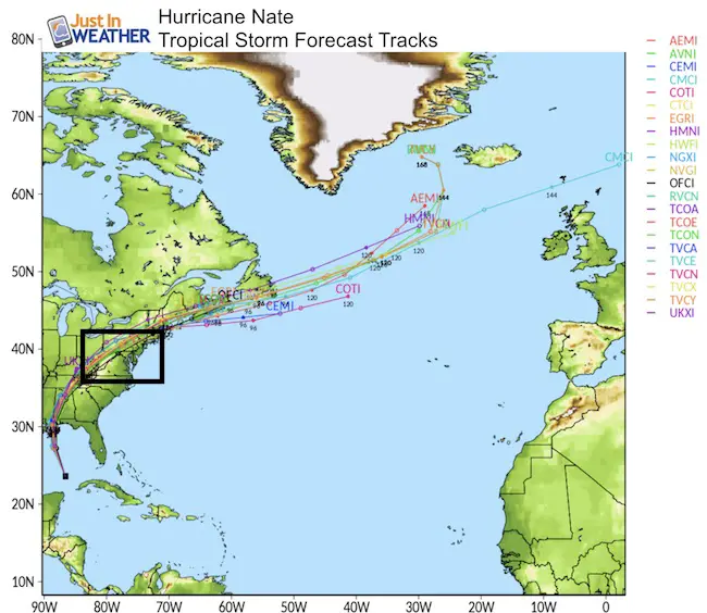
Animated Forecast
This is the GFS Model, which is pretty much in agreement with the package this morning. Note the Low tracking just west and north of Baltimore is subject to change, but we will have gusty winds and heavy rain.
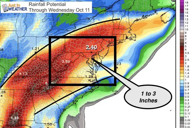
Rainfall Potential
National Hurricane Center Track
SUMMARY OF WATCHES AND WARNINGS IN EFFECT:
A Hurricane Warning is in effect for…
* Grand Isle Louisiana to the Alabama/Florida border
* Metropolitan New Orleans and Lake Pontchartrain
A Storm Surge Warning is in effect for…
* Morgan City Louisiana to the Okaloosa/Walton County Line Florida
* Northern and western shores of Lake Pontchartrain
A Tropical Storm Warning is in effect for…
* Lake Maurepas
* West of Grand Isle to Morgan City Louisiana
* East of the Alabama/Florida border to the Okaloosa/Walton County
Line.
A Hurricane Watch is in effect for…
* Lake Maurepas
* East of the Alabama/Florida border to the Okaloosa/Walton County
Line
* West of Grand Isle to Morgan City Louisiana
A Storm Surge Watch is in effect for…
* East of the the Okaloosa/Walton County Line to Indian Pass Florida
A Tropical Storm Watch is in effect for…
* East of the Okaloosa/Walton County Line to Indian Pass Florida
* West of Morgan City to Intracoastal City Louisiana
Outlook
When Nate passes through our region, the Rockies will have the opposite of a tropical set up. Colorado will be getting yet another snowstorm.

Temperatures
 Get the award winning Kid Weather App I made with my oldest son and support our love for science, weather, and technology. Our 3 year anniversary of the release and our contribution to STEM education is this November. It has been downloaded in 60 countries, and works in both temperature scales. With your support we can expand on the fun introduction to science and real weather.
Please share your thoughts, best weather pics/video, or just keep in touch via social media
-
Facebook: Justin Berk, Meteorologist
-
Twitter: @JustinWeather
-
Instagram: justinweather