Friday October 6
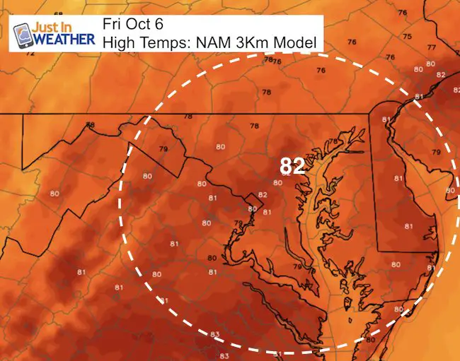
The hint of late summer is still in the air. Temperatures today will get back to around 80ºF along with some mugginess. That warm weather will hang around for a few more days, but the trade off will be much needed rain from Tropical Storm Nate early next week. The pattern will turn a little wet as we will have a chance of rain almost every day next week with a total of 1 to 3 inches in our region. The bulk of the rain will be on Monday with a chance of gusty winds and some severe storms. Here is a quick look at it all.
Today:
Warm and humid, but mostly dry.
Tropical Storm Nate:
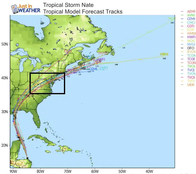
This will be a quick mover. The storm is north of Honduras and a Hurricane Watch is already posted around New Orleans. The cluster of computer models forecast tracks seems to be locking in on the landfall location and the trend to send the remaining Low Pressure our way Monday.
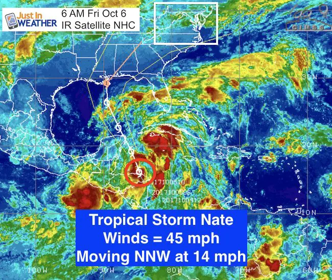
LOCATION…16.9N 85.1W
ABOUT 60 MI…95 KM ENE OF ISLA GUANAJA HONDURAS
ABOUT 275 MI…445 KM SSE OF COZUMEL MEXICO
MAXIMUM SUSTAINED WINDS…45 MPH…75 KM/H
PRESENT MOVEMENT…NNW OR 340 DEGREES AT 14 MPH…22 KM/H
MINIMUM CENTRAL PRESSURE…999 MB…29.50 INCHES
Forecast Tracks
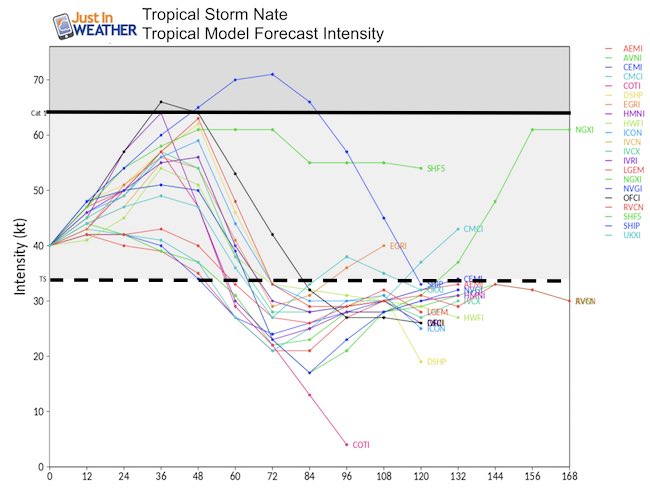
Forecast Intensity
The water in the Gulf of Mexico is warm, but the amount of time Nate will have to reach hurricane intensity will be small.
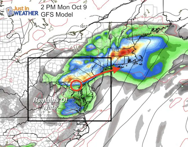
Tracking Nate Inland
Here is a look at the GFS Model plot for Monday afternoon. This will be a wet day with a chance of some gusty thunderstorms. See the animation below.
Trust in this Bust
This is not a forecast, but a fundraiser for breast cancer research. This soft Bella T-Shirt is to promote the strength of the ‘good bust’ and the heart that beats strong beneath it. Proceeds will be donated in honor of my mother Linda Berk, a 3-time breast cancer survivor. Click on the shirt image to join us.

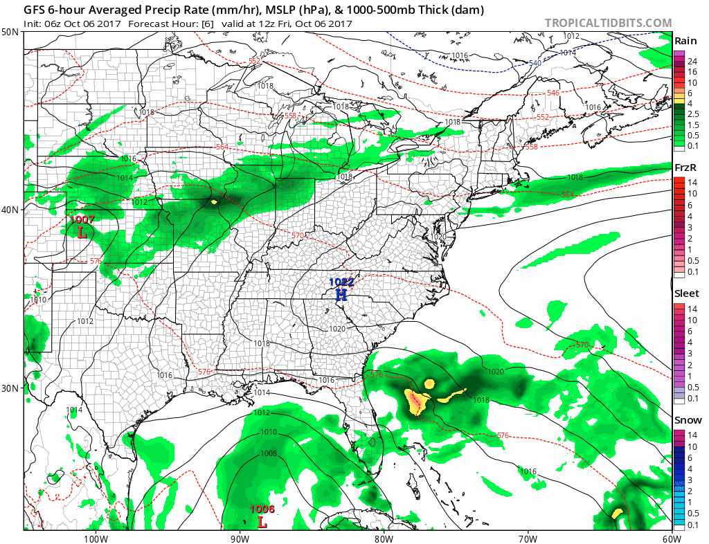
Tropical Nate Animation
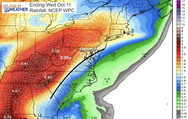
Rainfall Potential
Total for our region will be between 1 and 3 inches
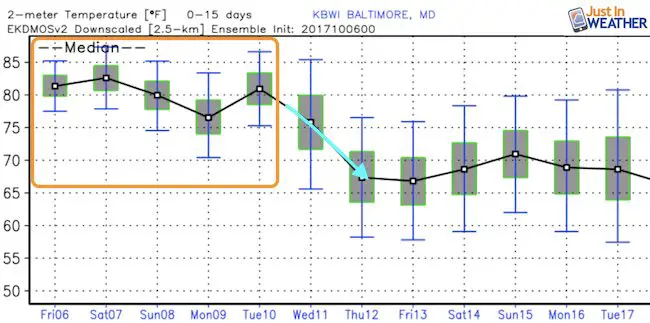
Temperature Outlook
Nate Recap: Watches and Warnings
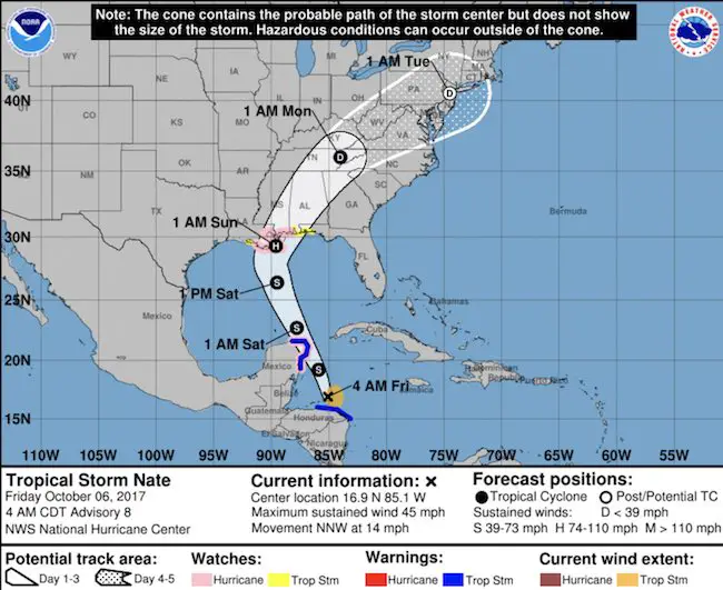
SUMMARY OF WATCHES AND WARNINGS IN EFFECT:
A Tropical Storm Warning is in effect for…
* Punta Castilla Honduras to the Honduras/Nicaragua border
* Punta Herrero to Rio Lagartos Mexico
A Storm Surge Watch is in effect for…
* Morgan City Louisiana to the Alabama/Florida border
* Northern and western shores of Lake Pontchartrain
A Hurricane Watch is in effect for…
* Morgan City Louisiana to the Mississippi/Alabama border
* Metropolitan New Orleans
* Lake Pontchartrain and Lake Maurepas
* Punta Herrero to Rio Lagartos Mexico
A Tropical Storm Watch is in effect for…
* Mississippi/Alabama border to the Okaloosa/Walton County Line
* West of Morgan City to Intracoastal City Louisiana
Please share your thoughts, best weather pics/video, or just keep in touch via social media
-
Facebook: Justin Berk, Meteorologist
-
Twitter: @JustinWeather
-
Instagram: justinweather
 Get the award winning Kid Weather App I made with my oldest son and support our love for science, weather, and technology. Our 3 year anniversary of the release and our contribution to STEM education is this November. It has been downloaded in 60 countries, and works in both temperature scales. With your support we can expand on the fun introduction to science and real weather.