 Sunday September 24
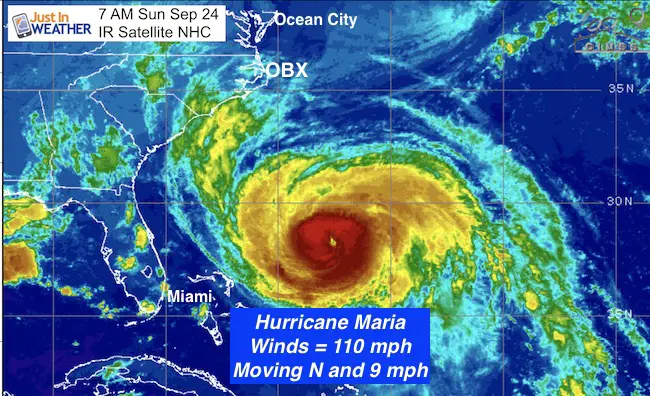
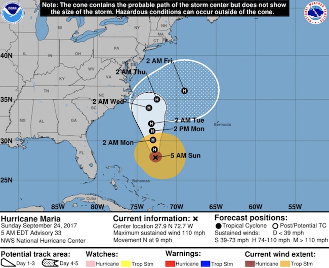
We have a heat wave that will reach its peak today and then start to break down. It has not been record setting for us, but definitely out of the ordinary. So have been the tropics. Hurricane Maria is weaker this morning and heading north. The winds of 110 mph make this a Category 2. The hurricane force winds reach 60 miles from the center. The tropical storm force winds are the part that could clip parts of Maryland as these reach 240 miles away. Please note that this is NOT the same beast it was in Puerto Rico. It will continue to weaken and I still see if moving east of OBX (The Outer Banks of North Carolina). But there will still be an impact on our shorelines. Here is the breakdown below:
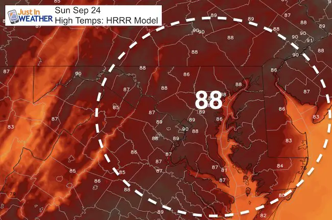
First- Our Heat!
Saturday brought a high of 89ºF to BWI. High Temps will be in the upper 80s to neat 90ºF again.
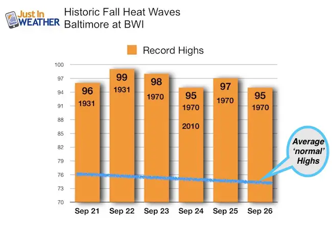
Compare to the Historic Heat Waves of 1931 and 1970 this time of the calendar year. The average high for Baltimore today should be 75ºF.
Temperature Outlook
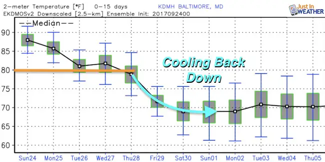
The same air mass that will end our heat wave will push Hurricane Maria off of the coast. Next weekend will be much cooler.
Back to Hurricane Maria
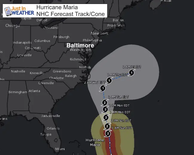
The forecast track and cone of uncertainty shows the push each of OBX as a Category 1 storm. The eye should remain off of the coast, but close enough to impact Cape Hatteras and OBX with hurricane force wind gusts.
Wind Field:
240 mile range of tropical storm force winds do include Ocean City. The arrival time would be Wednesday morning.

Waves
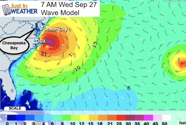
The closest approach of Maria will be Wednesday morning. The highest waves will be felt then, and some of the water will move up the Chesapeake Bay. High Tide at Annapolis on Wednesday is 10:47 AM. That is when the highest water would be expected. I don’t see a strong surge up the Chesapeake Bay, but water level could be similar to a Nor’Easter.
Forecast Models
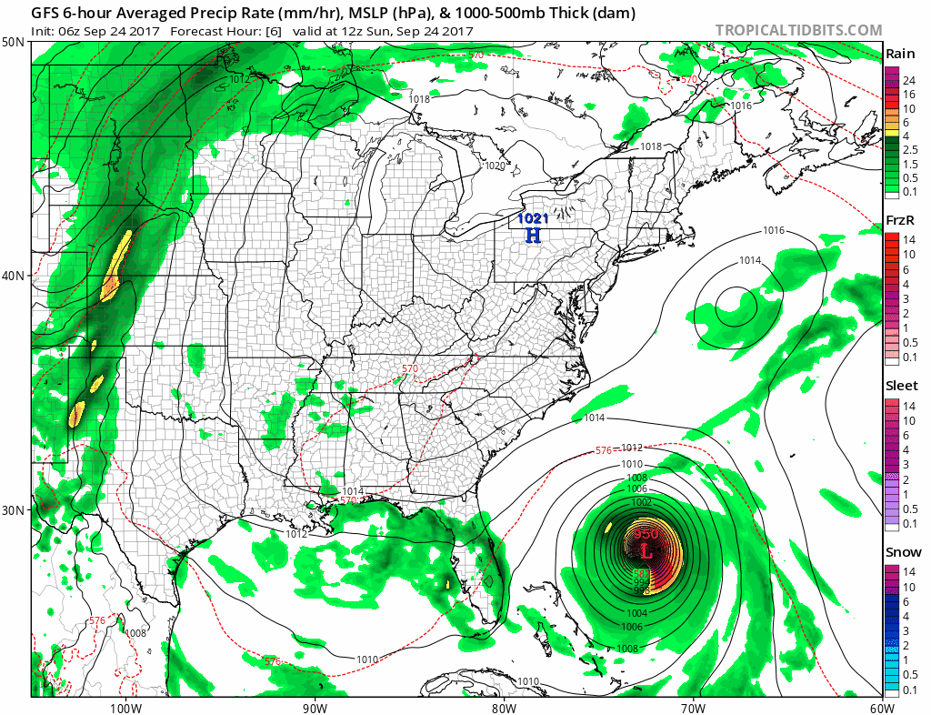
GFS Model- Showing the rain coverage. Some showers could reach Maryland on Tuesday and Wednesday. The outer bands may clip Ocean City, but the core of the rain will be confined to eastern North Carolina.
European Model
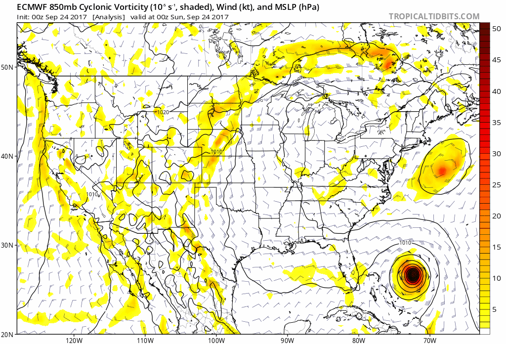
This mid level spin/vorticity shows the shame push off to the east on Wednesday

NHC Forecast Track
Please share your thoughts, best weather pics/video, or just keep in touch via social media
-
Facebook: Justin Berk, Meteorologist
-
Twitter: @JustinWeather
-
Instagram: justinweather
 Get the award winning Kid Weather App I made with my oldest son and support our love for science, weather, and technology. Our 3 year anniversary of the release and our contribution to STEM education is this November. It has been downloaded in 60 countries, and works in both temperature scales. With your support we can expand on the fun introduction to science and real weather.