 Monday September 25
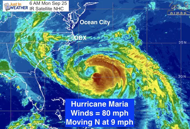
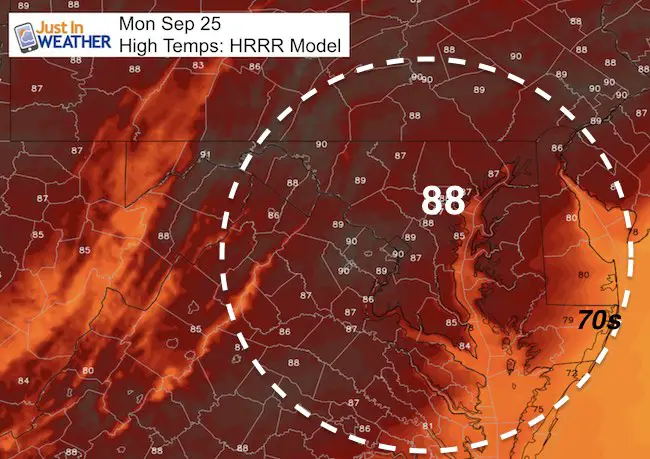
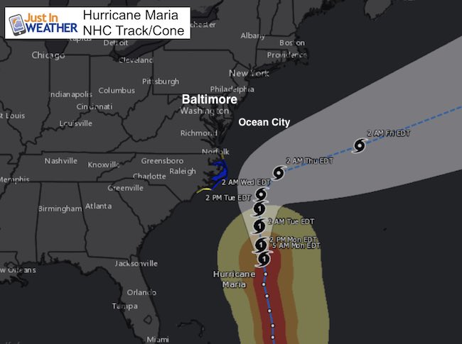
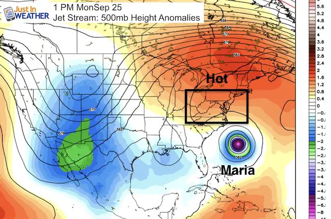
Our late summer extension of heat is still with us. Temps will again be close to 90ºF and feel like the mid 90s. Meanwhile Hurricane Maria is down to 80 mph winds this morning and passing farther east. This seems to be following the trend that Maria and Jose showed… thankfully this time the only impact will be high surf and some wind. This will include Ocean City. On Wednesday, the same element that will end our heat will take Maria farther away and we can finally say goodbye.
Summer-Like Again Today:
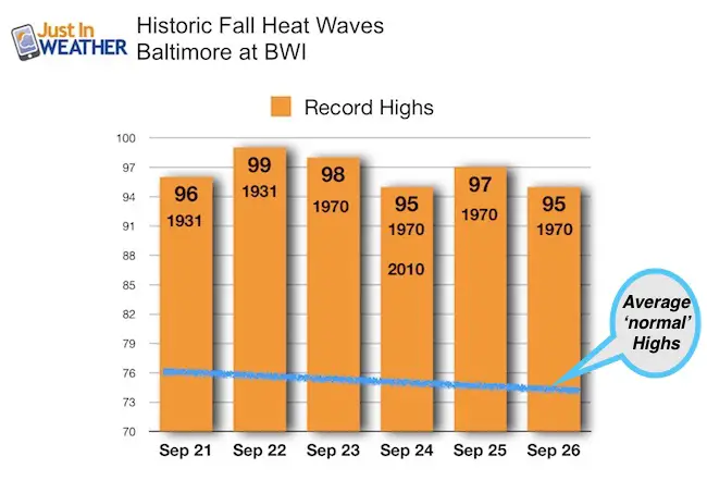
Still Not A Record for Baltimore
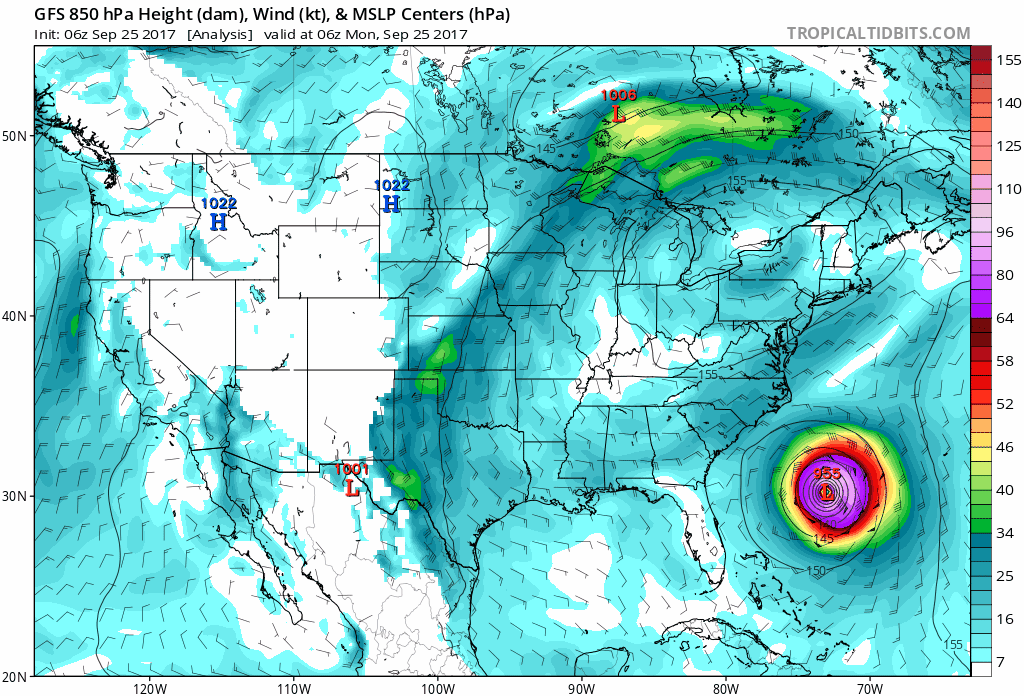
Maria Update
A Tropical Storm Warning is in effect for…
* Cape Lookout to Duck
* Albemarle and Pamlico Sounds
A Tropical Storm Watch is in effect for…
* North of Duck to the North Carolina/Virginia border
* North of Surf City to south of Cape Lookout
A Storm Surge Watch is in effect for…
* Cape Lookout to Duck
Animation:
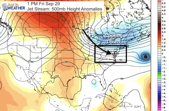
The front will be dry, but usher in colder air…
Jet Stream: The Reason For Our Cool Down And Pushing Maria Away
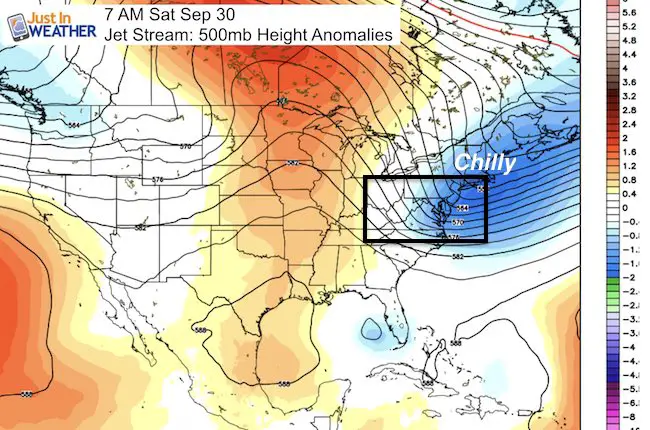
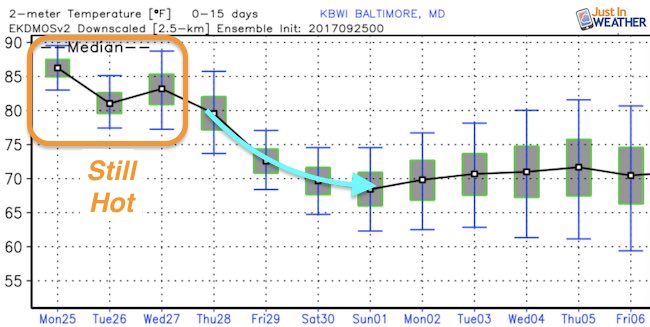
Temperature Outlook
Highs may stay in the 60s next weekend. Especially outside of Baltimore
Lows into the lower 50s next weekend. The suburbs will be in the 40s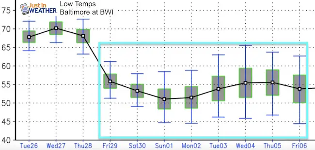
Please share your thoughts, best weather pics/video, or just keep in touch via social media
-
Facebook: Justin Berk, Meteorologist
-
Twitter: @JustinWeather
-
Instagram: justinweather
 Get the award winning Kid Weather App I made with my oldest son and support our love for science, weather, and technology. Our 3 year anniversary of the release and our contribution to STEM education is this November. It has been downloaded in 60 countries, and works in both temperature scales. With your support we can expand on the fun introduction to science and real weather.