 Friday September 22
In these last few hours of summer, the temperatures feel like mid July. The Autumnal Equinox is at 4:02 PM EDT today. Yesterday Baltimore hit 88ºF, 12 degrees higher than the average expected of 76F. We could get close to 90ºF over the weekend. This warm pattern is in part thanks to Hurricanes Harvey and Irma helping to push the jet stream farther north, but it will not last forecast. In fact the break and arrival of Fall weather expected just in time to help push Hurricane Maria well off of the east coast. The models have had a tough time with Jose and Maria, but it appears we will be spared.
The warm weather this weekend and countless flocking to SunFest in Ocean City will be marred by rough surf. Jose is down to a Post Tropical Cyclone but still has winds of 50 mph off of the coast. So the waves will be high and rip currents will plague the battered beaches all weekend. Meanwhile, we will continue with temps in the 80s until the middle of next week. The pattern will break, but we have to wait a little longer.
Stats:
- Average high today = 76ºF
- Record = 99ºF in 1931
Our outlook is below, but first we need to see the latest on Hurricane Maria
Update On Maria
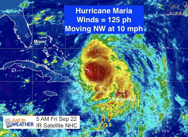
5 AM Update
LOCATION…21.6N 70.6W
ABOUT 35 MI…55 KM ENE OF GRAND TURK ISLAND
ABOUT 490 MI…790 KM ESE OF NASSAU
MAXIMUM SUSTAINED WINDS…125 MPH…205 KM/H
PRESENT MOVEMENT…NW OR 315 DEGREES AT 7 MPH…11 KM/H
MINIMUM CENTRAL PRESSURE…959 MB…28.32 INCHES
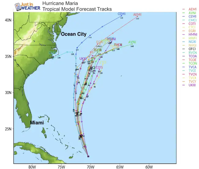
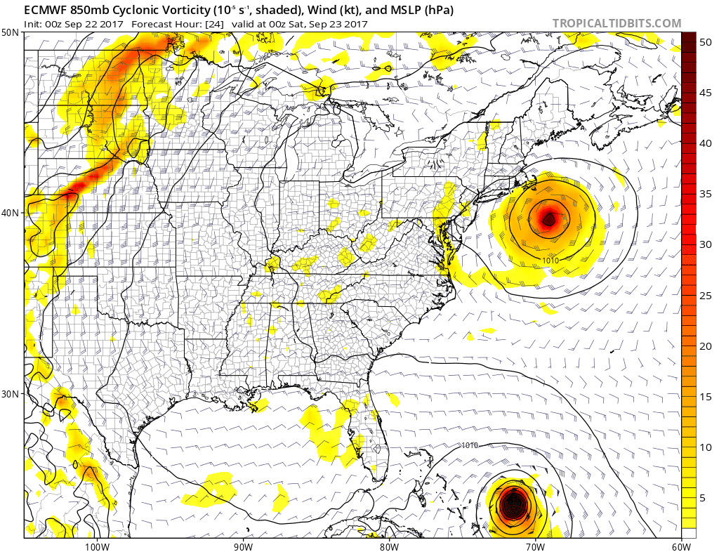
The tropical models have shown the trend to stay farther east… and the path will be east of where Irma was in relation to Ocean City. Then we wait for our cold front to help kick this (and the heat) off of the coast.
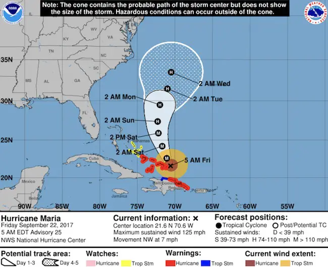
National Hurricane Center- Forecast Track/Cone
European Model Animation
Our Outlook
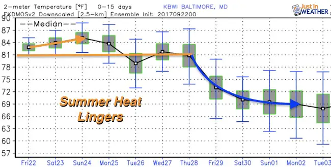
Temperature Trend
I wanted to start with the basics… The break of out heat. Note that we should be in the mid 70s and will get back there next week.
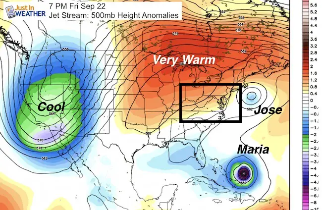
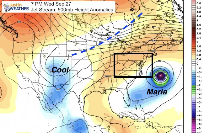
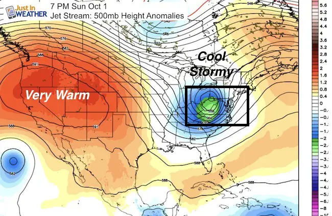
A look at the jet stream gives more insight into the pattern that will develop. Note the break down of our warm ridge and flipping with the cool pattern on the west coast. October will start off cool and stormy for us.
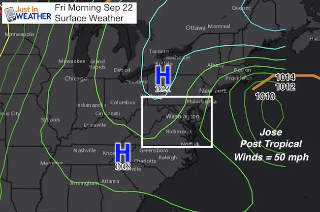
Approaching Cold Front will move Maria away and begin to cool us down next Thursday and Friday
Surface Weather:
The long range outlook shows a storm moving into the Ohio Valley. This is a similar location to where Harvey and Irma remains passes. That could give insight into the pattern we could see this winter. Note that this is 10 days away and subject to a lot of adjustment on timing and location.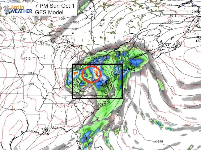
Please share your thoughts, best weather pics/video, or just keep in touch via social media
-
Facebook: Justin Berk, Meteorologist
-
Twitter: @JustinWeather
-
Instagram: justinweather
 Get the award winning Kid Weather App I made with my oldest son and support our love for science, weather, and technology. Our 3 year anniversary of the release and our contribution to STEM education is this November. It has been downloaded in 60 countries, and works in both temperature scales. With your support we can expand on the fun introduction to science and real weather.