 Friday September 15
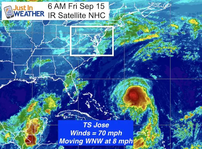
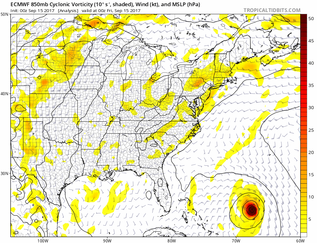
Jose is a tropical storm this morning and moving closer to the US east coast. Winds are down to 70 mph and currently a tropical storm. It was looping over the past few day, while waiting for Irma to pass on by. It churned up colder water causing it to weaken, but will restrengthen now that it is moving back over warmer water and the heat source is fuel. This will get close enough so that tropical storm force winds could reach Ocean City this weekend. The forecast animation below shows something even more concerning next week.
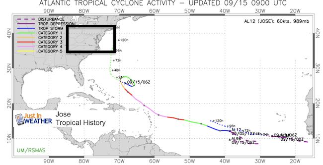
Summary from 5 AM Advisory
LOCATION…25.9N 68.7W
ABOUT 360 MI…575 KM NE OF THE SOUTHEASTERN BAHAMAS
ABOUT 500 MI…805 KM SSW OF BERMUDA
MAXIMUM SUSTAINED WINDS…70 MPH…110 KM/H
PRESENT MOVEMENT…WNW OR 290 DEGREES AT 8 MPH…13 KM/H
MINIMUM CENTRAL PRESSURE…989 MB…29.21 INCHES
Outlook
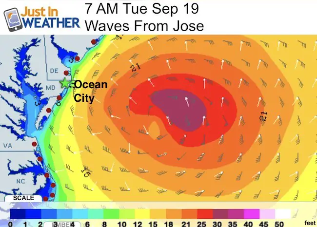
Close Enough
This Wave Model shows the closest passage of the eye east of Ocean City by next Tuesday morning. It will be building closer with increasing waves over the weekend.
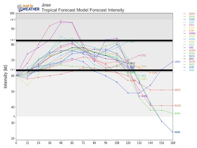
Intensity
Jose will strengthen back to a hurricane, perhaps as soon as today. The potential will bring it back to a Category 2 as it passes east of Ocean City. The wind field shows a 25% chance that tropical storm force winds will reach the coast by Monday night. However the waves ahead of the storm will arrive this weekend.
Track
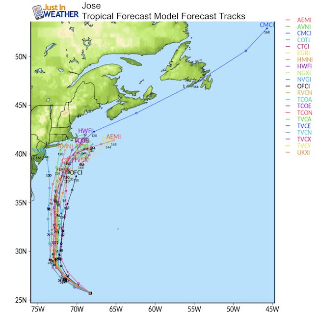
The tropical forecast models show this staying off of the cast for the next 5 days. Beyond that it gets interesting. See the animation below

Long Range Potential
The trusted European Model has been showing a persistent storm trying to linger off of the coast, perhaps doing another loop, and then making its way onshore somewhere near the Mid Atlantic. However, I need to point out the this is MORE THAN 1 WEEK AWAY! While this and other models keep showing some landfall, the timing and location has been changing with each run. So I can not put much weight on this, but it is worth close monitoring and concern. Don’t lose sleep over this, but keep watching for any consistent trend.
History Of Looping
Other Storms
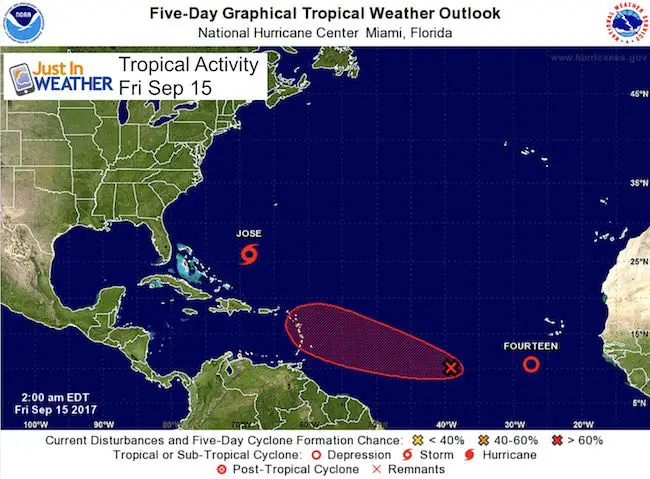
This week is the peak of hurricane activity in the Atlantic historically. There are two more systems in the same Cape Verde region of the western Atlantic that are showing signs of life. This was where Irma came from
Please share your thoughts, best weather pics/video, or just keep in touch via social media
-
Facebook: Justin Berk, Meteorologist
-
Twitter: @JustinWeather
-
Instagram: justinweather
Keep on Trekking
Continue to be part of our Maryland Trek and Support Cool Kids Campaign. This was our best event yet and we want the message to carry throughout the year.
Proceeds go to programs that help children and their families ensuring cancer treatment.

 Get the award winning Kid Weather App I made with my oldest son and support our love for science, weather, and technology. Our 3 year anniversary of the release and our contribution to STEM education is this November. It has been downloaded in 60 countries, and works in both temperature scales. With your support we can expand on the fun introduction to science and real weather.