 Thursday September 14
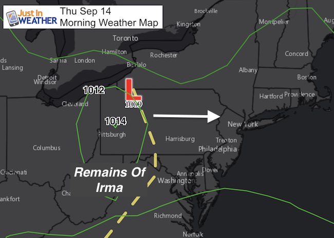
Rain showers have wet the pavement this morning and showers for a few more hours will actually give way to just a warm and muggy day. This is the benefit of the Ghost of Irma passing through. Not much remains of the core circulation, but enough to generate a little rain. Most of the day will be cloudy but another round of showers and some thunderstorms will develop over the mountains to our west. We will watch that for this evening.
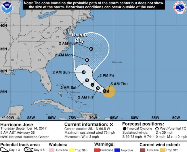
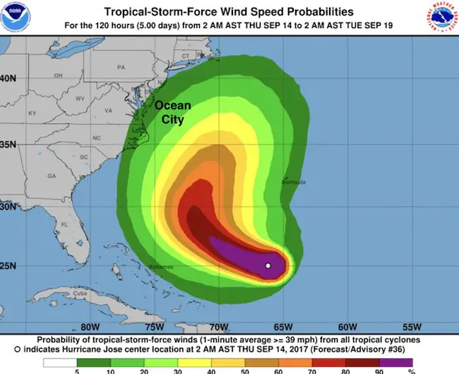
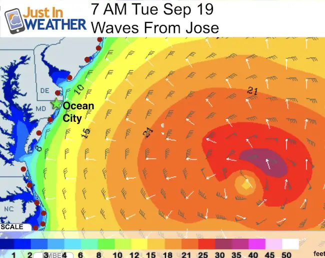
The next few days will hold on to more clouds and remain warm… Hurricane Jose is going to be passing offshore and likely miss us. But the impact will be felt in Ocean City. More on that below.
—-> slider: Radar Simulation
Showers this morning
[metaslider id=53069]
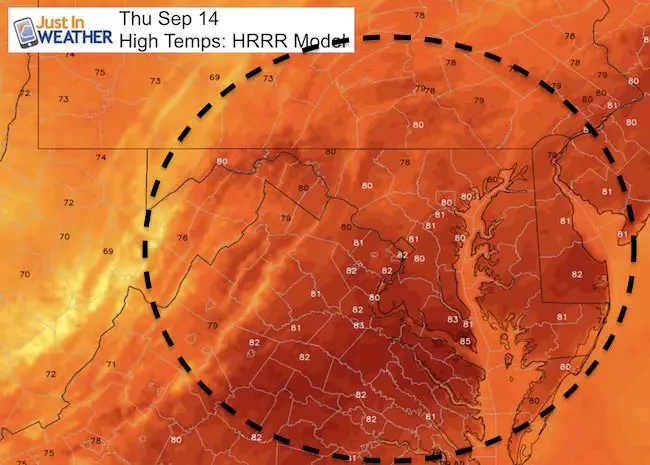
Warm Afternoon
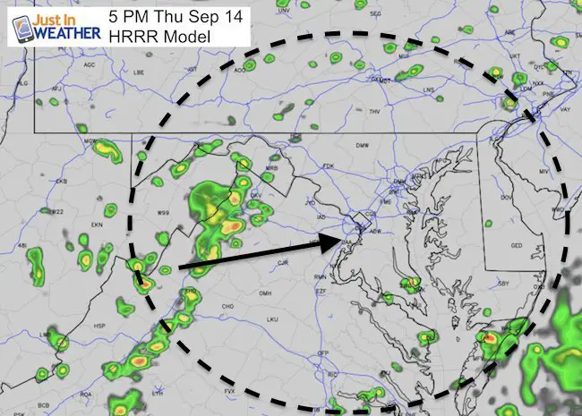
Afternoon Storms Could Arrive This Evening
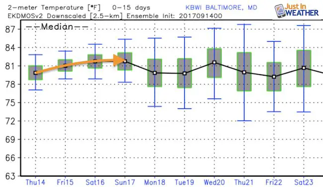
Temperature Outlook
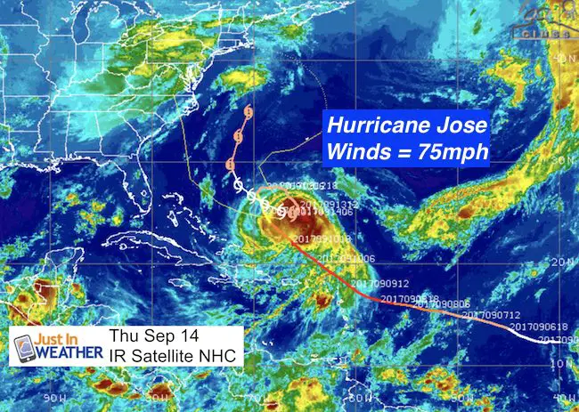
Hurricane Jose
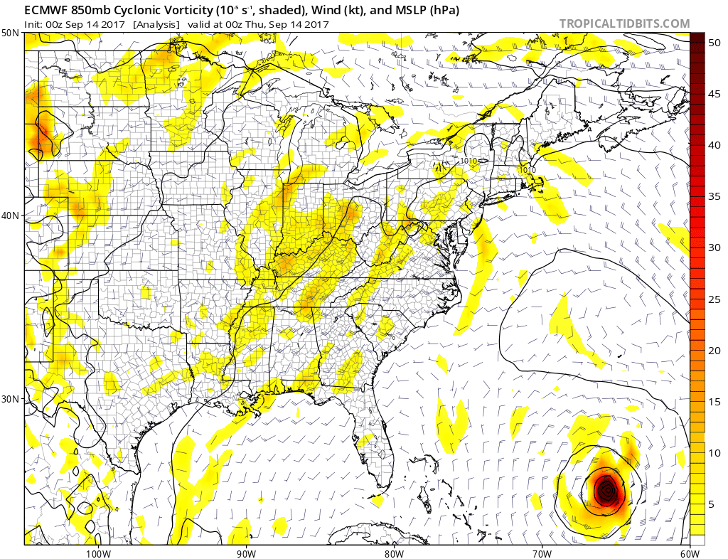
European ECMWF Model Forecast
Hurricane Irma: National Hurricane Center Track
5 AM Stats
LOCATION…25.1N 66.5W
ABOUT 445 MI…715 KM ENE OF THE SOUTHEASTERN BAHAMAS
ABOUT 510 MI…815 KM SSW OF BERMUDA
MAXIMUM SUSTAINED WINDS…75 MPH…120 KM/H
PRESENT MOVEMENT…W OR 270 DEGREES AT 3 MPH…6 KM/H
MINIMUM CENTRAL PRESSURE…986 MB…29.12 INCHES
Jose: Wave Model
Please share your thoughts, best weather pics/video, or just keep in touch via social media
-
Facebook: Justin Berk, Meteorologist
-
Twitter: @JustinWeather
-
Instagram: justinweather
Keep on Trekking
Continue to be part of our Maryland Trek and Support Cool Kids Campaign. This was our best event yet and we want the message to carry throughout the year.
Proceeds go to programs that help children and their families ensuring cancer treatment.

 Get the award winning Kid Weather App I made with my oldest son and support our love for science, weather, and technology. Our 3 year anniversary of the release and our contribution to STEM education is this November. It has been downloaded in 60 countries, and works in both temperature scales. With your support we can expand on the fun introduction to science and real weather.