 8:30 AM September 11
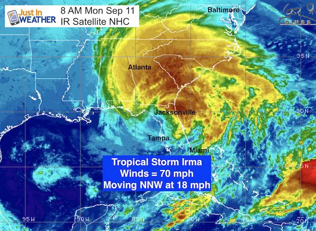
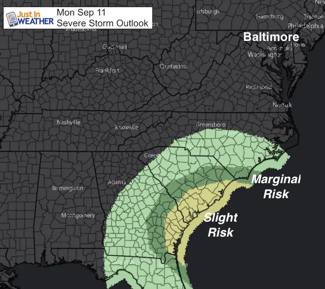
Tropical Storm Irma may have a better ring to it, but do not be lulled by the downgraded status. Winds have slowed to 70 mph, but the storm is still a potent wind machine as it pushes through northern Florida and heads into Georgia today. This is a huge storm! The tropical storm force winds extend 415 miles away from the center. Flooding has already been an issue around Jacksonville this morning, and severe weather risk extends up the coast to South Carolina today. Warnings for tornados and flooding will continue to pop up as this rolls farther inland and eventually spins itself out.
8 AM Advisory Stats
LOCATION…29.5N 82.9W
ABOUT 30 MI…50 KM NNE OF CEDAR KEY FLORIDA
ABOUT 105 MI…170 KM NNW OF TAMPA FLORIDA
MAXIMUM SUSTAINED WINDS…70 MPH...110 KM/H
PRESENT MOVEMENT…NNW OR 340 DEGREES AT 18 MPH…30 KM/H
MINIMUM CENTRAL PRESSURE…970 MB…28.64 INCHES
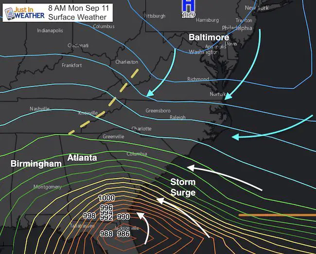
We are protected in the Mid Atlantic thanks to blocking High Pressure, but that is enhancing the winds along the coast, which is increasing the storm surge from northerner Florida to Georgia and into the Carolinas. Some of this water will reach the Mid Atlantic, but the track if Irma farther inland will limit that impact north of OBX.
Severe Weather Outlook = Tornado Threat
This is in addition to the wind that around the immediate central Low Pressure
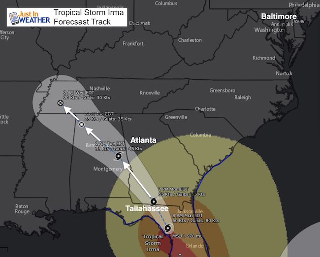
Tropical Storm Irma Track
Note the storm should be downgraded again to a Tropical Depression around the time it passes southwest of Atlanta an over
Birmingham
Warnings
CHANGES WITH THIS ADVISORY:
The Storm Surge Warning is discontinued from south of the
Flagler/Volusia County line to Jupiter Inlet.
The Hurricane Warning from Sebastian Inlet to Fernandina Beach is
changed to a Tropical Storm Warning.
The Hurricane Warning from Anclote River to Indian Pass is changed
to a Tropical Storm Warning.
The Hurricane Watch from north of Fernandina Beach to Edisto Beach
is discontinued.
SUMMARY OF WATCHES AND WARNINGS IN EFFECT:
A Storm Surge Warning is in effect for…
* South Santee River southward to the Flagler/Volusia County line
* Cape Sable northward to the Ochlockonee River
* Tampa Bay
A Tropical Storm Warning is in effect for…
* Bonita Beach to the Okaloosa/Walton County Line
* Jupiter Inlet to the South Santee River
* Lake Okeechobee
Full Forecast
Click here to see the latest on how Irma will bring us rain later this week and the outlook for Hurricane Jose to turn off of the east coast next week
Please share your thoughts, best weather pics/video, or just keep in touch via social media
-
Facebook: Justin Berk, Meteorologist
-
Twitter: @JustinWeather
-
Instagram: justinweather
Keep on Trekking
Continue to be part of our Maryland Trek and Support Cool Kids Campaign. This was our best event yet and we want the message to carry throughout the year.
Proceeds go to programs that help children and their families ensuring cancer treatment.

 Get the award winning Kid Weather App I made with my oldest son and support our love for science, weather, and technology. Our 3 year anniversary of the release and our contribution to STEM education is this November. It has been downloaded in 60 countries, and works in both temperature scales. With your support we can expand on the fun introduction to science and real weather.