 Tuesday September 5
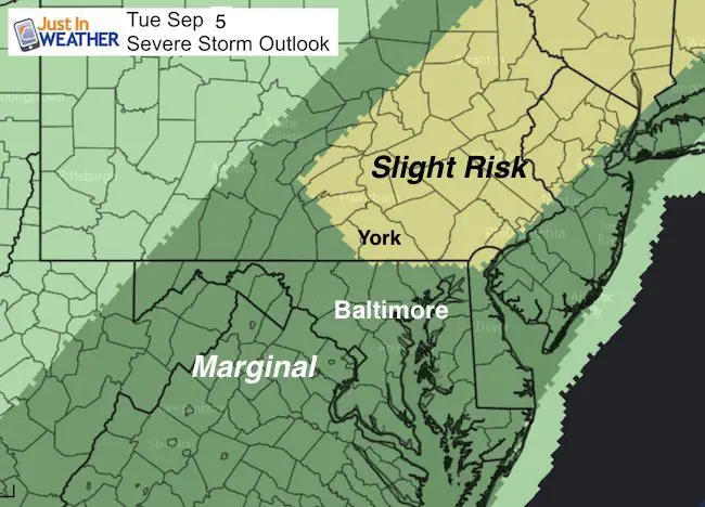
Warm winds and a hazy sky today are indicators that the weather we have will not last much longer. A cold front is approaching form the west and will arrive with the potential for thunderstorms. There is a slight risk of storms turning severe near and north of the Maryland/Pennsylvania line. Only a marginal risk across central Maryland through this evening.
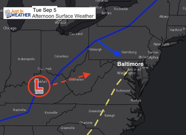
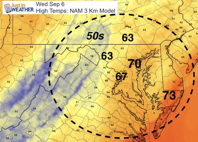
The cold front will stall as a developing area of Low Pressure will ride along it and bring more rain Wednesday. At that time, temperatures will be cooler and most of us will spend the day in the 60s. Here is a quick look.
Note: Hurricane Irma has winds now up to 185 mph, making it tied with the strongest Atlantic Hurricane on record. I will have new information in my next report by 5 PM. See the prior update here.
—> slider: Simulated Radar
[metaslider id=52596]
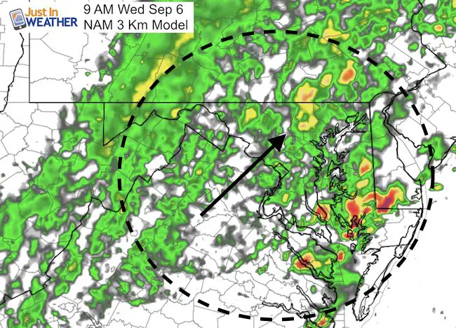
Wednesday Rain
Showers redeveloping during the morning
Day Temps Remain Chilly
More Rain And Some Storms In The Evening
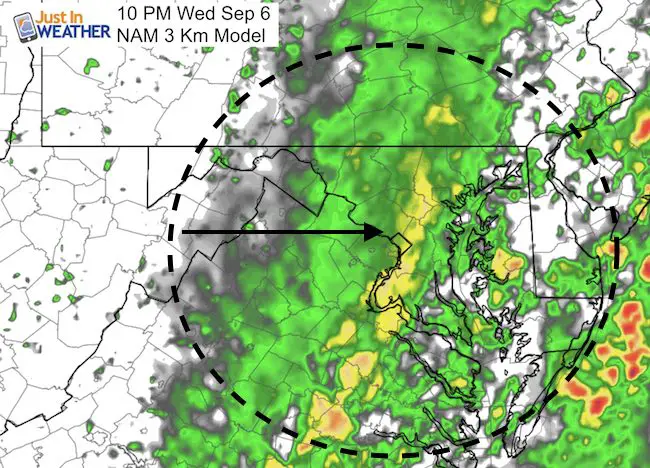
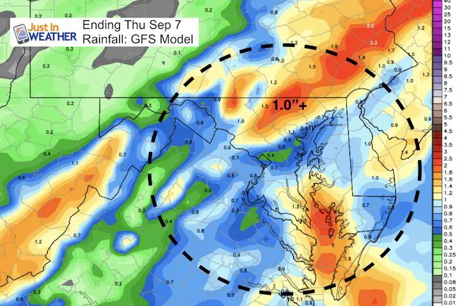
Total Rainfall
Thursday
The storm will move out and we get a chance to dry out, just as we track Hurricane Irma getting closer to the weekend hit on the southern US.
Keep on Trekking
Continue to be part of our Maryland Trek and Support Cool Kids Campaign. This was our best event yet and we want the message to carry throughout the year.
Proceeds go to programs that help children and their families ensuring cancer treatment.

Please share your thoughts, best weather pics/video, or just keep in touch via social media
-
Facebook: Justin Berk, Meteorologist
-
Twitter: @JustinWeather
-
Instagram: justinweather
 Get the award winning Kid Weather App I made with my oldest son and support our love for science, weather, and technology. Our 3 year anniversary of the release and our contribution to STEM education is this November. It has been downloaded in 60 countries, and works in both temperature scales. With your support we can expand on the fun introduction to science and real weather.