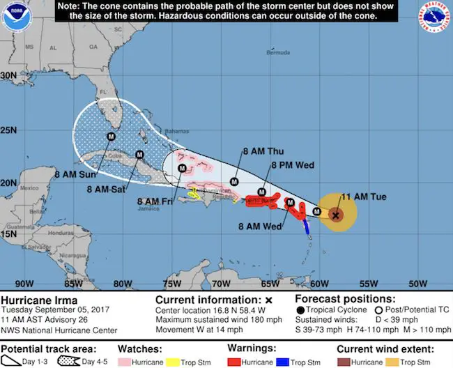
 11 AM Tuesday September 5
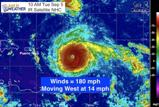
Hurricane Irma has reached a level that less than 1% of systems achieve. The latest air force reconnaissance shows that this storm has winds of 180 mph, placing it as a Category 5. Yes one hundred and eighty mph sustained winds. Gusts well over 200 mph. This is the strongest level of all hurricanes. It is moving west at 14 mph and expected to pass on the north side of the Northern Caribbean Islands. This will bring catastrophic winds, storm surge, and rain. Waves themselves are 50 to 100 Ft high. The worst part will stay north of the Islands but will hit south Florida this weekend.
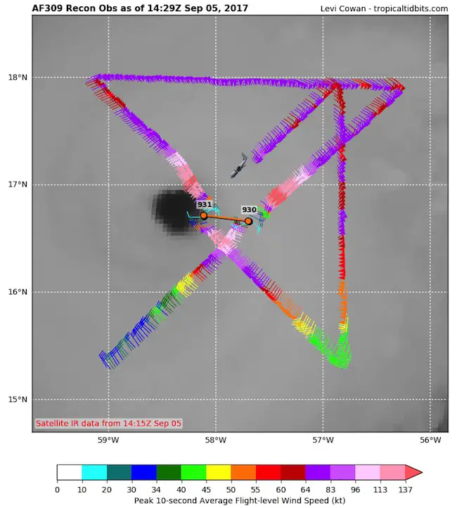
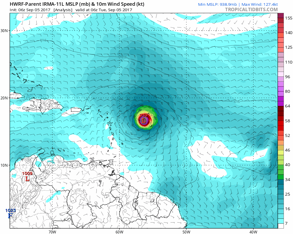
- Minimum pressure is an astounding 931 mb (27.50 inches)
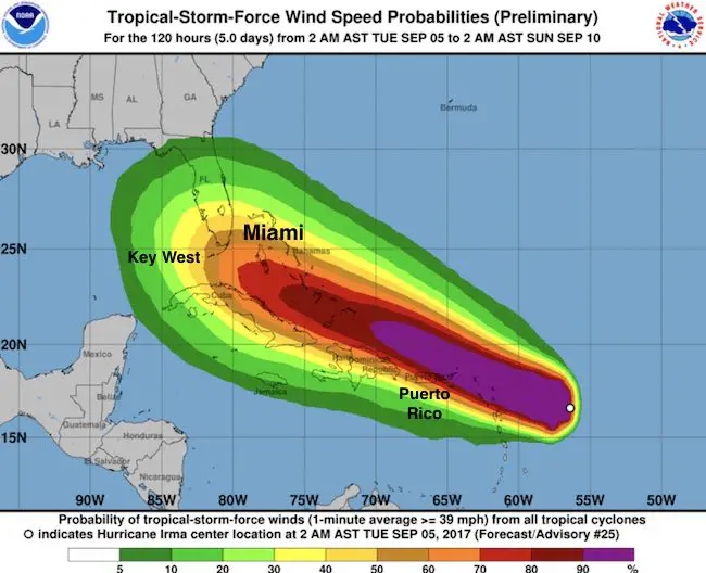
- Hurricane-force winds extend outward up to 60 miles from the center.
- Tropical-storm-force winds extend outward up to 160 miles.
Air Force Recon Mission
Since 1924 there has been 32 hurricanes documented reaching Category 5. That is about one out of every 3 years. There have been 5 years with more than one Cat 5 in a single season. These include 1932, 1933, 1961, 2005, and 2007.
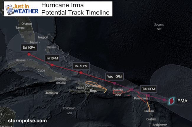
Forecast Track:
The US mainland interest will be Saturday night or Sunday morning in south Florida.
SUMMARY OF 1100 AM AST…1500 UTC…INFORMATION
———————————————–
LOCATION…16.8N 58.4W
ABOUT 225 MI…365 KM E OF ANTIGUA ABOUT 230 MI…370 KM ESE OF BARBUDA
MAXIMUM SUSTAINED WINDS…180 MPH…285 KM/H
PRESENT MOVEMENT…W OR 270 DEGREES AT 14 MPH…22 KM/H
MINIMUM CENTRAL PRESSURE…931 MB…27.50 INCHES
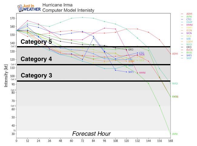
Intensity Forecast
Expectation is to hold as a Cat 5 or slightly weaker Cat 4. But the pressure shown on the maps below show it has room to grow stronger.
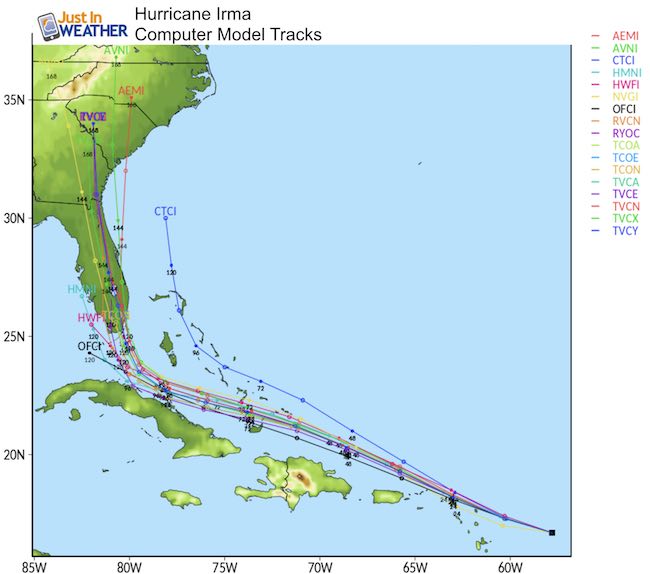
Forecast Maps:
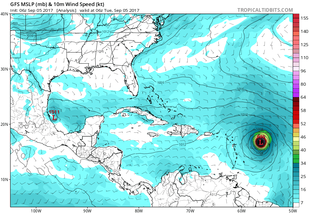
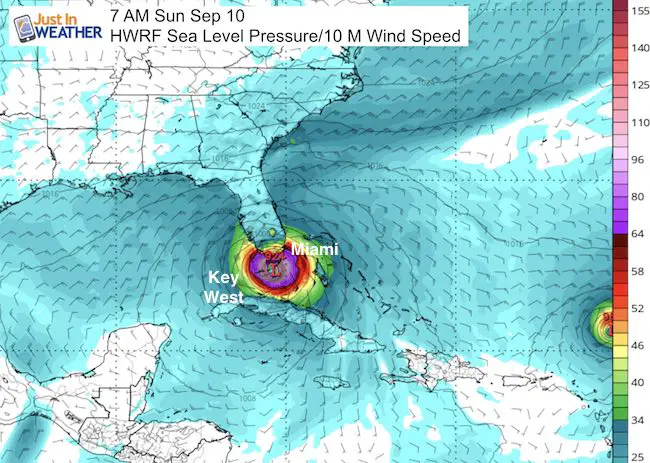
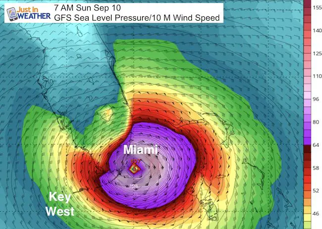
The GFS model is showing Miami as the target, but I am leaning with the south trend of the HWRF model hitting the Keys and then moving north up the Penninsula to on the Gulf coast side of Florida. See the still comparison for Sunday morning below the animations.
HWRF-P
This is the model I think is on point now… Passing south of Miami and hitting the Florida Keys head on. This would still put Miami on the strong side of the storm but away from the eye wall. The turn to north will take place over Florida or on state’s Gulf Coast side.
GFS Model
I think this is turning to soon. Considering the trend to stay south, that is why the HWRF above looks like a better solution.
Comparing Sunday Morning
I don’t agree with this one…
Outlook- Where to next?
The trend south makes the north turn later. This would hit the southeast with flooding rain into Georgia and South Carolina… up the mountains. The impact on the Mid Atlantic would bring rain but a weaker storm after Tuesday or Wednesday.
Storm Surge
It should be noted that these forecasts are for the weaker side of the storm. The most intense impacts are on the right side of forward motion, which currently is the north side.
British and U.S. Virgin Islands except St. Croix…7 to 11 ft
Northern coast of Puerto Rico…3 to 5 ft
Southern coast of Puerto Rico and St. Croix…1 to 2 ft
RAINFALL: Irma is expected to produce total rain accumulations
of 8 to 12 inches with isolated maximum amounts of 18 inches across
the northern Leeward Islands. Irma is expected to produce total
rain accumulations of 4 to 10 inches with isolated maximum amounts
of 15 inches across northeast Puerto Rico and the British and U.S.
Virgin Islands, and amounts of 2 to 4 inches over southwest Puerto
Rico, the southern Leeward Islands, and Saint Croix. This rainfall
may cause life-threatening flash floods and mudslides.
Keep on Trekking
Continue to be part of our Maryland Trek and Support Cool Kids Campaign. This was our best event yet and we want the message to carry throughout the year.
Proceeds go to programs that help children and their families ensuring cancer treatment.

Please share your thoughts, best weather pics/video, or just keep in touch via social media
-
Facebook: Justin Berk, Meteorologist
-
Twitter: @JustinWeather
-
Instagram: justinweather
 Get the award winning Kid Weather App I made with my oldest son and support our love for science, weather, and technology. Our 3 year anniversary of the release and our contribution to STEM education is this November. It has been downloaded in 60 countries, and works in both temperature scales. With your support we can expand on the fun introduction to science and real weather.