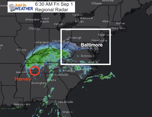
 The circulation of former Major Hurricane Harvey still dominates the radar map, but it is down to a tropical depression and will continue to weaken as it impacts our area. There are two main elements we will get, but only for a few days. A chilly rain will start of some showers today. A steady rain will arrive with gusty winds Saturday. The final burst could be some heavy storms Saturday evening, and gusty west winds Sunday. Labor Day Monday will be calmer and warming back into the 80s. Here’s a look at the maps.
slider —> Harvey Circulation
Local interest in the Charles St 12 mile race. This race course from Towson to Baltimore is mostly facing south and slightly downhill. Runners should be aware that the system will keep temps in the 60s and bring a head wind that will counter any expected benefit from the course. It will be damp, so high quality moisture wicking socks will be a must.
[metaslider id=52206]
Showers This Afternoon
The best chance for rain early today will be over Virginia and the mountains of WV and western MD. This will sneak into southern Maryland by this afternoon. Some sprinkles or showers may spread into metro areas, but it will be light.
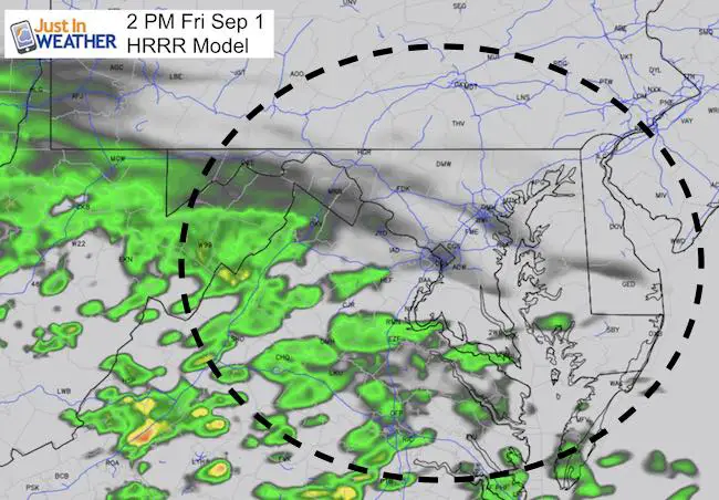
slider —> Saturday Radar Simulation
The showers most of the day will be light to moderate. It will be a gusty wind and temps in the 60s that will make it feel worse.
[metaslider id=52233]
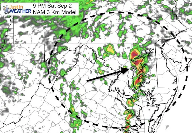
Saturday Night Storm?
One last burst from Harvey will come in the form of evening burst of heavy rain or storms.
Notes:
Saturday: Wet but there will be breaks in the showers. I doubt we get flooding as totals will be less than 1 inch locally. Perhaps 1 to 2 inches in southern Maryland and the beaches.
Sunday: Windy but dry
Monday: Light winds, sunshine, and back to the 80s.
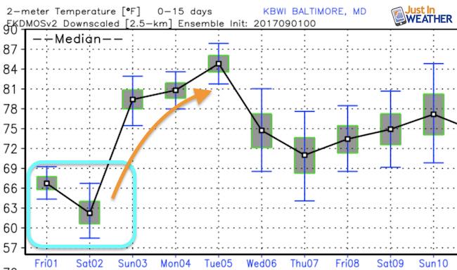
Temperature Outlook
Average temps should be in the lower 80s. The next two days will be 15 to 20 degrees cooler than that. But a big bounce for the second part of the Labor Day weekend. Tuesday’s start to school in Maryland will be warm for kids… to wear shorts without complaints from parents.
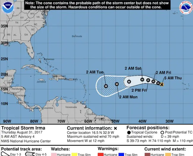
Irma – A Major Hurricane
HOLDING STEADY WITH 115-MPH WINDS…
This storm is still more than 5 days away from any landfall. But it will continue to strengthen
SUMMARY OF 500 AM AST…0900 UTC…INFORMATION
———————————————-
LOCATION…18.2N 36.5W
ABOUT 840 MI…1350 KM WNW OF THE CABO VERDE ISLANDS
ABOUT 1665 MI…2680 KM E OF THE LEEWARD ISLANDS
MAXIMUM SUSTAINED WINDS…115 MPH…185 KM/H
PRESENT MOVEMENT…WNW OR 300 DEGREES AT 12 MPH…19 KM/H
MINIMUM CENTRAL PRESSURE…967 MB…28.56 INCHES
Keep on Trekking
Continue to be part of our Maryland Trek and Support Cool Kids Campaign. This was our best event yet and we want the message to carry throughout the year.
Proceeds go to programs that help children and their families ensuring cancer treatment.

Please share your thoughts, best weather pics/video, or just keep in touch via social media
-
Facebook: Justin Berk, Meteorologist
-
Twitter: @JustinWeather
-
Instagram: justinweather
 Get the award winning Kid Weather App I made with my oldest son and support our love for science, weather, and technology. Our 3 year anniversary of the release and our contribution to STEM education is this November. It has been downloaded in 60 countries, and works in both temperature scales. With your support we can expand on the fun introduction to science and real weather.