Thursday June 8
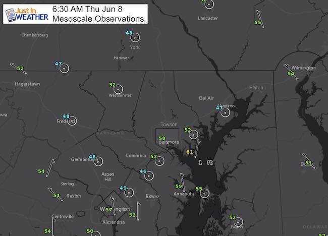
This morning temperatures dropped into the 40s in a few places, highlighting the chill of this air mass. But we are about the turn the corner. The observations at 6:30 AM already showed some warming from the early sun, so this is not the coolest of the day, as BWI briefly reached the 40s as well. What is really interesting is the contrast of low 60s as well thanks to the influence of the water.
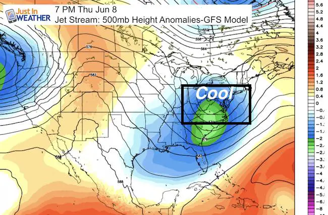
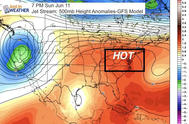
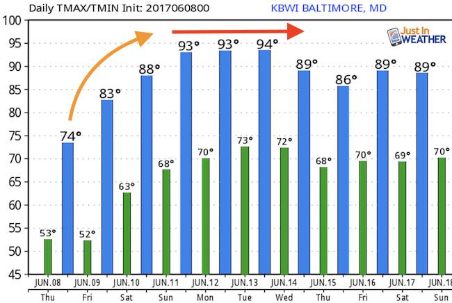
A storm will be passing off of the coast with no direct impact on us. The coastal waters will be rough and temps will remain cool thanks to a Northeast wind on the back side… but once this storm passes we will see a dramatic change. Temperatures are forecast to jump about 10 degrees a day into the weekend. Then we should see between 3 and 5 days in the 90s for a notified Heat Wave.
Check this out:
—-> slider
[metaslider id=48585]
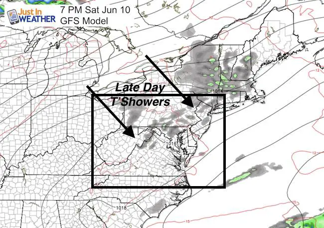
We may stay mostly dry for nearly a full week. But a small chance of afternoon/evening T’showers on Saturday
Jet Stream
Temperature Outlook
 Get the award winning Kid Weather App I made with my oldest son and support our love for science, weather, and technology. Our 3 year anniversary of the release and our contribution to STEM education is this November. It has been downloaded in 60 countries, and works in both temperature scales. With your support we can expand on the fun introduction to science and real weather.
Get $1000 Off LASIK
Plus enter to win free sunglasses

Maryland Trek 2017
Be part of my 4th annual hike and bike across Maryland this August. See my trek page and sign up for information to do one day, the whole week, or even sponsor this great event.
Milestones this year:
- I will do my 1000th mile
- We aim to reach $100,000 for Cool Kids Campaign

Please share your thoughts, best weather pics/video, or just keep in touch via social media
-
Facebook: Justin Berk, Meteorologist
-
Twitter: @JustinWeather
-
Instagram: justinweather
Faith in the Flakes
The store is closing for the season. Next week we wil be shifting back to spring mode. This will include a severe weather STEM assembly program.
-
Sign up for email updates on new posts
Since you may miss some posts via social media, click here for email alerts as a way to make sure you don’t miss any. *You may have to refresh that page once for your browser to clear out the images.
Also See: