Wednesday June 7
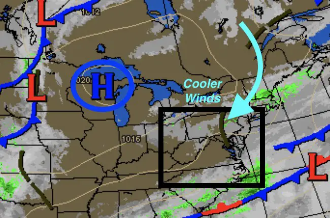 A shift in wind direction is all it takes to change our weather. High Pressure of the Great Lakes helped to bring in an unusually cool air mass thanks to winds from the NorthEast. Today will be the coolest day of the week as most of us stay in the 60s. While it may look like much of May, or will only last for another day. Once a strong storm passes well off of the coast, we can get the winds to shift back to the warmer SouthWest and really pump in the heat in a hurry. It will feel like summer this weekend and last for a while.
Here’s a quick look at the maps telling the story
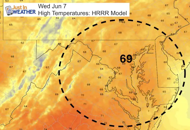
Today’s High Temps
Clouds will remain, but the morning drizzle and showers should push southend west by lunchtime.
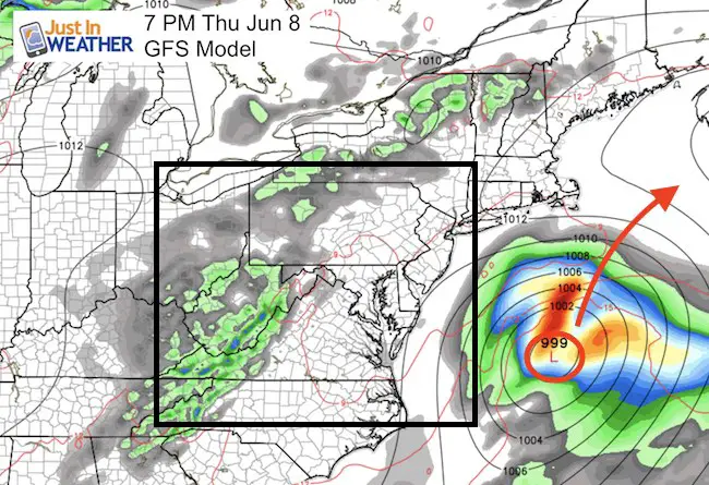
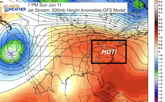
Waiting For The Storm To Pass Off Of The Coast
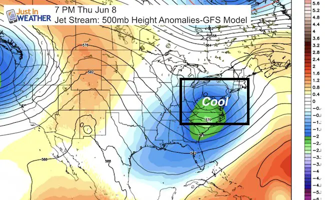
Jet Stream Shows The Pattern Change
Thursday
Sunday
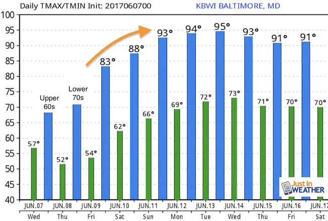
Temperature Outlook
 Get the award winning Kid Weather App I made with my oldest son and support our love for science, weather, and technology. Our 3 year anniversary of the release and our contribution to STEM education is this November. It has been downloaded in 60 countries, and works in both temperature scales. With your support we can expand on the fun introduction to science and real weather.
Get $1000 Off LASIK
Plus enter to win free sunglasses

Maryland Trek 2017
Be part of my 4th annual hike and bike across Maryland this August. See my trek page and sign up for information to do one day, the whole week, or even sponsor this great event.
Milestones this year:
- I will do my 1000th mile
- We aim to reach $100,000 for Cool Kids Campaign

Please share your thoughts, best weather pics/video, or just keep in touch via social media
-
Facebook: Justin Berk, Meteorologist
-
Twitter: @JustinWeather
-
Instagram: justinweather
Faith in the Flakes
The store is closing for the season. Next week we wil be shifting back to spring mode. This will include a severe weather STEM assembly program.
-
Sign up for email updates on new posts
Since you may miss some posts via social media, click here for email alerts as a way to make sure you don’t miss any. *You may have to refresh that page once for your browser to clear out the images.
Also See: