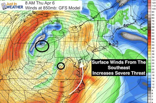
 Thursday April 6 – Today is the day the strong spring storm reached the Mid Atlantic. There will be showers and thunderstorms the morning into the afternoon. The Low Pressure will be redeveloping overhead, with will help the surface winds come from the dangerous Southeast direction enhancing the severe storm threat in central Maryland It will also provide more spin aloft to increase the local risk for supercell that can produce e damaging hail and isolated tornadoes. The most active time wil be between 10 AM and 3 PM. Here is a lot at the maps that help tell the story.
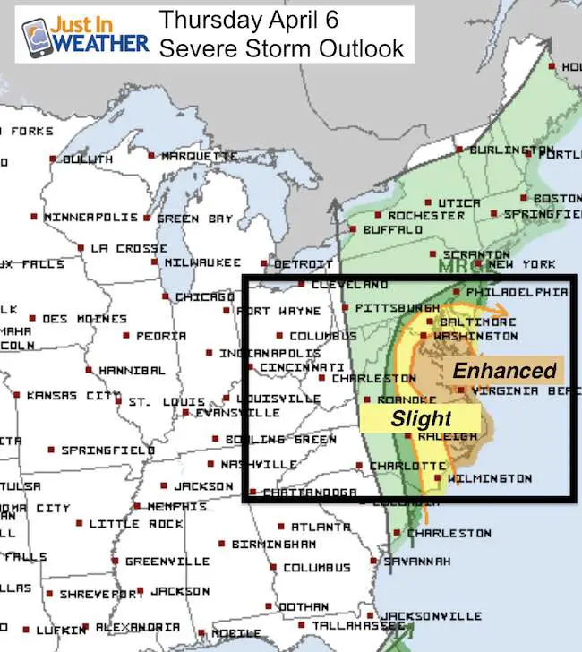
—> slider Severe Storm Risk
Tornadoes, large hail over quarter size, and winds over 58 mph. Note the percentages are the odds that an individual storm can turn severe with these conditions. Ex: Tornado Threat of 5% means that each storm has a 5% chance of a funnel cloud forming. That means most storms will NOT do that, but still a high risk for our region and worth paying attention to.
[metaslider id=46348]
—> slider Simulated Radar
[metaslider id=46300]
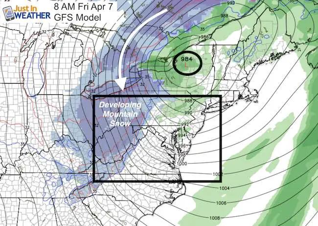
Snow Behind The Storm
Yes, moderate snow will fall, lay and stay in western Maryland Friday
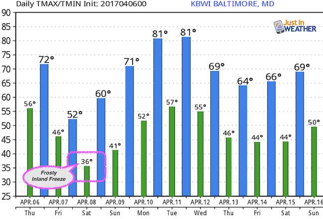
Temperature Outlook
Storm Smart: My STEM Assembly Program
Click here to see the details and how this educational program is also a fundraiser for schools. We can start scheduling for May now.
 Get the award winning Kid Weather App I made with my oldest son and support our love for science, weather, and technology. Our 3 year anniversary of the release and our contribution to STEM education is this November. It has been downloaded in 60 countries, and works in both temperature scales. With your support we can expand on the fun introduction to science and real weather.
Please share your thoughts, best weather pics/video, or just keep in touch via social media
-
Facebook: Justin Berk, Meteorologist
-
Twitter: @JustinWeather
-
Instagram: justinweather
Faith in the Flakes
The store is closing for the season. Next week we wil be shifting back to spring mode. This will include a severe weather STEM assembly program.
-
Sign up for email updates on new posts
Since you may miss some posts via social media, click here for email alerts as a way to make sure you don’t miss any. *You may have to refresh that page once for your browser to clear out the images.
Also See:
Extreme Weather of 2015 balanced out on both ends