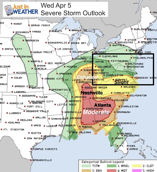
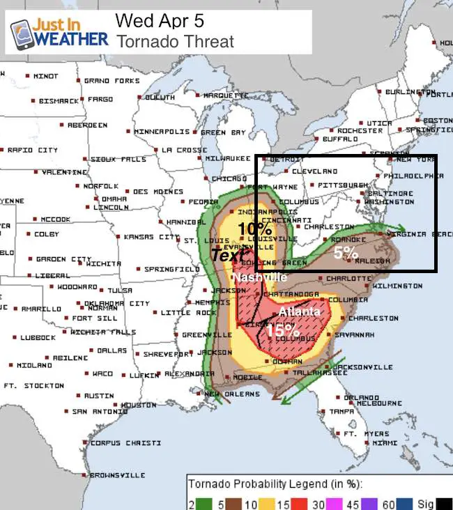
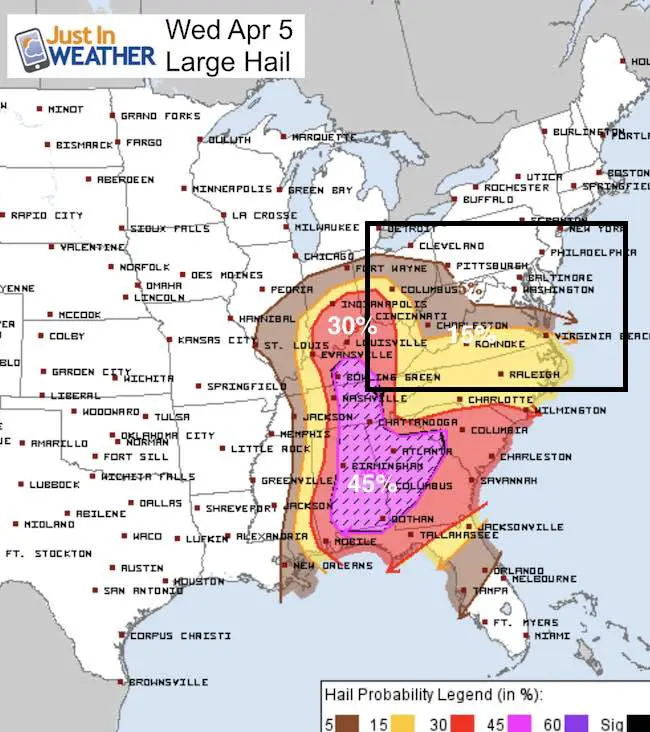
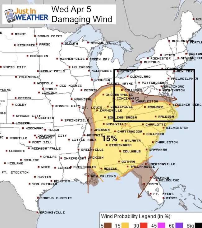
 Wednesday April 5 – April is prime tome for severe storms and this first week of the month is proving itself. The biggest severe storm outbreak of the year is projected for today with a large area of enhanced risk for destructive weather. Atlanta and Nashville are among the many areas that could see supercell develop into destructive tornados. In addition, large hail and damaging winds, with local flooding area ll possible. The peak of the storm is today, but there will be enough energy for our region tomorrow.
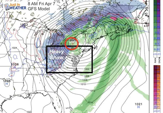
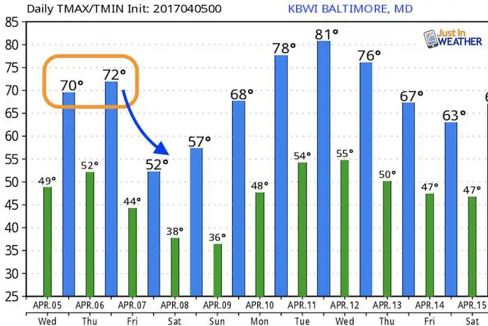
Quick outlook today locally: Quiet and mild with temps reaching close to 70ºF. The Orioles game should get in without a problem, but rain tonight and storms could arrive as soon as Thursday morning. Then Low Pressure will redevelop overhead and drag in cold air. We could see heavy snow in western Maryland Friday morning wil 6 inches or more possible to lead into the weekend.
Today’s Severe Storm Breakdown:
—> slider Tracking The Storm
Winds
[metaslider id=46257]
—> slider Tracking The Storm
[metaslider id=46278]
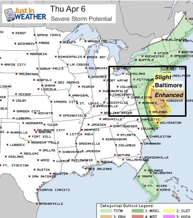
Severe Storm Threat Thursday
Snow Friday- In Western Maryland
Temperature Outlook
 Get the award winning Kid Weather App I made with my oldest son and support our love for science, weather, and technology. Our 3 year anniversary of the release and our contribution to STEM education is this November. It has been downloaded in 60 countries, and works in both temperature scales. With your support we can expand on the fun introduction to science and real weather.
Please share your thoughts, best weather pics/video, or just keep in touch via social media
-
Facebook: Justin Berk, Meteorologist
-
Twitter: @JustinWeather
-
Instagram: justinweather
Faith in the Flakes
The store is closing for the season. Next week we wil be shifting back to spring mode. This will include a severe weather STEM assembly program.
-
Sign up for email updates on new posts
Since you may miss some posts via social media, click here for email alerts as a way to make sure you don’t miss any. *You may have to refresh that page once for your browser to clear out the images.
Also See:
My Winter Outlook for 2016-2017: Colder with snow spread out more
NOAA Winter Outlook for 2016 to 2017
La Nina Formed: What it could mean to our winter
Farmers Almanacs Split On Cold And Snow
Extreme Weather of 2015 balanced out on both ends
Low Snow Winters In Baltimore: Records Might Surprise You