April 4 – The current system will bring us a band of showers this morning that could have a rumble thunder. It will come with warmer winds and be followed by afternoon temperatures in the mid 70s. After one quiet day tomorrow, the action will pick back up on Thursday. That is when we will have a chance for severe storms, followed by the cold side of the storm and heavy snow to end the weekend in western Maryland.
This morning, a band of showers may have local downpours. There is a slight chance of more showers developing this afternoon.
—> slider Today
[metaslider id=46220]
Warm Afternoon
Highs in the mid 70s
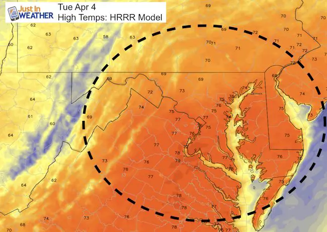
Strong Winds Increase Towards Evening
Next Storm:
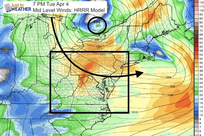
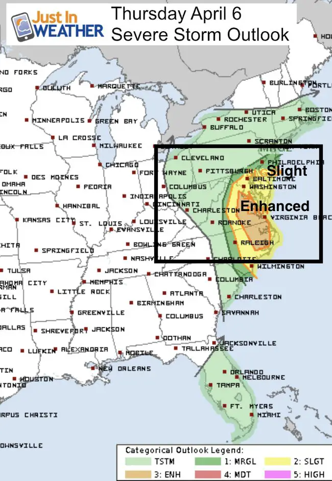
Rain may build in Wednesday Night, but Thursday will be a very active day as the next storm will pulse with energy over the Mid Atlantic. We have a Slight to Enhanced risk for severe storms.
—> slider Storm Track
We will go from heavy rain and thunderstorms to a system that will end with moderate to heavy snow in the mountains. Over 6 inches of snow in Garrett County possible Friday
[metaslider id=46234]
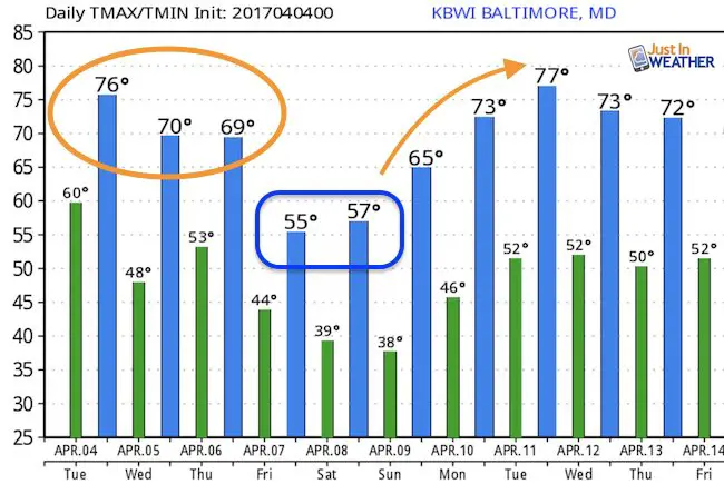
Temperature Outlook: Warmer Next Week
After the chill Friday and Saturday, the pattern settles back into the 70s next week.
 Get the award winning Kid Weather App I made with my oldest son and support our love for science, weather, and technology. Our 3 year anniversary of the release and our contribution to STEM education is this November. It has been downloaded in 60 countries, and works in both temperature scales. With your support we can expand on the fun introduction to science and real weather.
Please share your thoughts, best weather pics/video, or just keep in touch via social media
-
Facebook: Justin Berk, Meteorologist
-
Twitter: @JustinWeather
-
Instagram: justinweather
Faith in the Flakes
The store is closing for the season. Next week we wil be shifting back to spring mode. This will include a severe weather STEM assembly program.
-
Sign up for email updates on new posts
Since you may miss some posts via social media, click here for email alerts as a way to make sure you don’t miss any. *You may have to refresh that page once for your browser to clear out the images.
Also See:
My Winter Outlook for 2016-2017: Colder with snow spread out more
NOAA Winter Outlook for 2016 to 2017
La Nina Formed: What it could mean to our winter
Farmers Almanacs Split On Cold And Snow
Extreme Weather of 2015 balanced out on both ends
Low Snow Winters In Baltimore: Records Might Surprise You