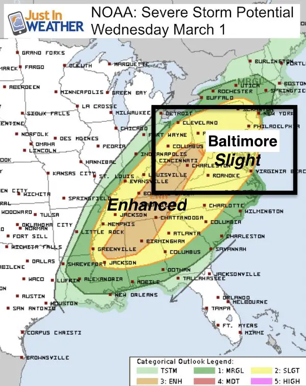
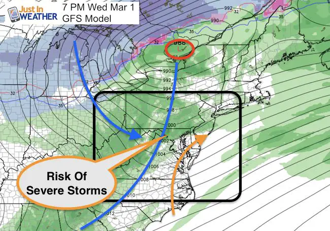
4: 20 PM Tuesday February 28 Rain moving in this afternoon is just in time for the evening commute. This will make for a wet ride home and last beyond sunset. Some of the rain might be moderate in central Maryland as seen in the simulated radar below. Note, we need the rain and for those of you tired of winter, it signifies the next warm up. Temperatures will hold steady or rise overnight. Wednesday will be a warm day, but a bumpy ride as another round of severe storms are possible in the afternoon. The severe storm outbreak in the MidWest today is the peak of the activity, but a signal of the energy in the atmosphere. March will roar in like a Lion and never trust that the weather will bring all month long.
Simulated Radar —> slider HRRR Model
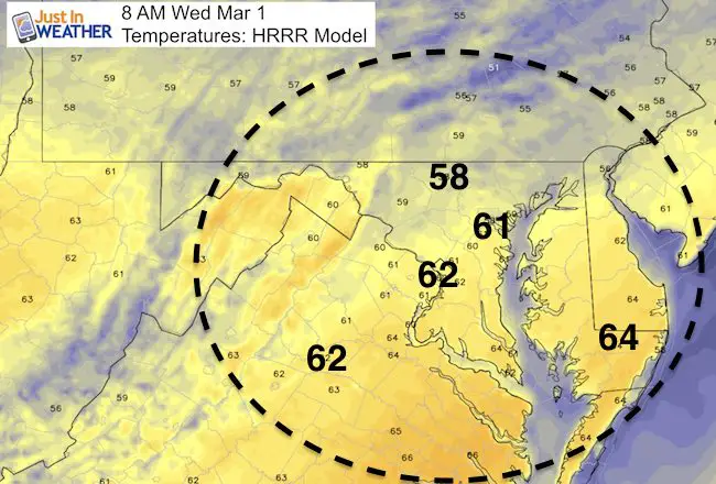
Temperatures Rising Overnight
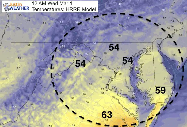
It should be warming in the morning and set up the 70s during Wednesday to feed into the severe storms.
Next Storm:
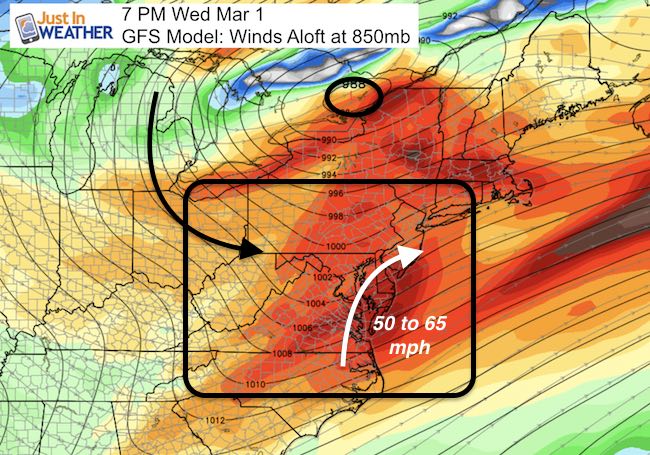
Another surge of warm air will arrive with rain showers on Tuesday. The strong cold front could trigger anther round of severe storms as highlighted by NOAA’s Storm Prediction Center. Winds could breach the 60 mph mark along with large hail, and an isolated tornado again. Timing is mid afternoon to evening. More on that in my next report.
 Get the award winning Kid Weather App I made with my oldest son and support our love for science, weather, and technology. Our 3 year anniversary of the release and our contribution to STEM education is this November. It has been downloaded in 60 countries, and works in both temperature scales. With your support we can expand on the fun introduction to science and real weather.
Please share your thoughts, best weather pics/video, or just keep in touch via social media
-
Facebook: Justin Berk, Meteorologist
-
Twitter: @JustinWeather
-
Instagram: justinweather
Faith in the Flakes Online- Flannel PJs Printed Inside Out
Store Now Open

- We’ve added Flannel PJ Pants that will be printed inside out. They have to be, to make it snow ?
- Free Personal Delivery for orders of 20 items or more to schools and businesses.
- Click this image for the online store.
- Look for more items to be added soon.
- Also see the info for the STEM Assembly Spirit Wear program: Put your school name on the shirts and raise money for you PTO/PTA in the process.
Sign up for email updates on new posts
Since you may miss some posts via social media, click here for email alerts as a way to make sure you don’t miss any. *You may have to refresh that page once for your browser to clear out the images.
FITF SNOW STICKS
 Available in 2 Ft, 30 Inches, and 3 Ft Sizes. Also with Orange/Black or Purple/Black. Click on the image to see the options offered by my friend Thatcher at Signs By Tomorrow in Timonium.
Go to http://www.signsbytomorrow.com/timonium/ to order yours today! Click the ‘Request a Quote’ button at the top of the page. In comment box include color, size and payment information. Please indicate whether you’d like to have us UPS ship them to you or if you would like to pick up in our store. Snow Sticks will ship or will be ready for pick up in our store 48 hrs after order is placed, Mon-Fri.
Also See:
My Winter Outlook for 2016-2017: Colder with snow spread out more
NOAA Winter Outlook for 2016 to 2017
La Nina Formed: What it could mean to our winter
Farmers Almanacs Split On Cold And Snow
Extreme Weather of 2015 balanced out on both ends
Low Snow Winters In Baltimore: Records Might Surprise You