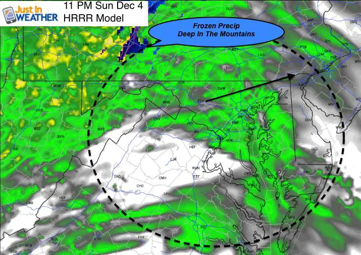
 Sunday December 4 – The next system is on the way, and there has been some chance of frozen precip with it. It could start with some flakes or sleet, but that would be overnight and warmer air will be moving in and rain will dominate. Below I will do my typical comparison of two commuter models, which are in some agreement on the upcoming week. The main difference is that the Canadian GEM Model is colder and brings snow closer to the northern Baltimore suburbs and southern PA. Since this is the first of the season, it will hep determine if this or the GFS Model has a better handle on the location of the cold air. But as we see here, the HRRR Model shows the snow confined deep into the mountains tonight.
Monday December 5th is Faith in the Flakes Day. Not because it will snow, but the history of our first snow on that date. I will have more on that in my next post. But if you have a FITF shirt, wear it proudly and take pics. I will make a piston Facebook Monday afternoon for everyone to share their pics. The ones with top 5 likes by Tuesday will get snowstick.
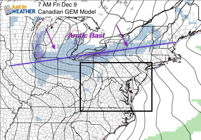
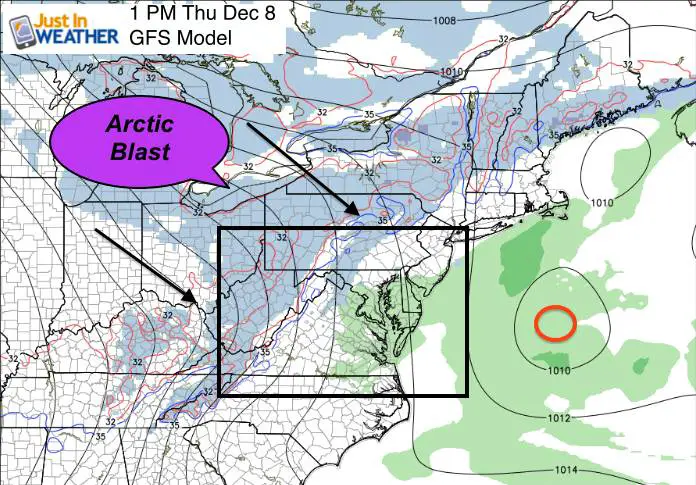
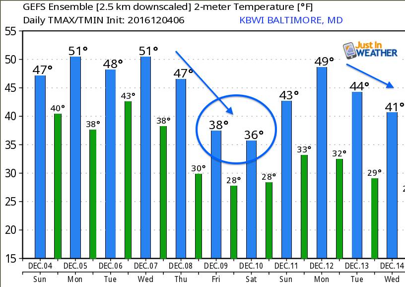
One thing I think is important is the atmospheric memory. The two systems this week look a lot like the track and timing of last week’s rain. Both within a day of each other, then followed by cold air. This time, the cold will be an arctic blast and pattern change. High temperatures next weekend will be in the 30s with wind chills in the teens and 20s. While the end of week storm looks nothing like it had a few days ago, the chance of snow showers from the Great Lakes is still alive and well.
Canadian Model —> slider
This is the colder solution with snow closer to Baltimore and southern PA
Arctic Blast = Lake Effect Snow
Friday into next weekend…
GFS Model —> slider
This is the slightly warmer solution with less snow ahead of rain makers… but still two systems and arctic air to follow.
[metaslider id=40834]Arctic Blast = Lake Effect Snow
Thursday into next weekend…
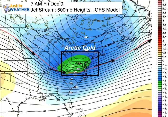
Jet Stream = Pattern Change
Temperature Outlook
Faith in the Flakes Online- Flannel PJs Printed Inside Out
Store Now Open

- We’ve added Flannel PJ Pants that will be printed inside out. They have to be, to make it snow ?
- Free Personal Delivery for orders of 20 items or more to schools and businesses.
- Click this image for the online store.
- Look for more items to be added soon.
- Also see the info for the STEM Assembly Spirit Wear program: Put your school name on the shirts and raise money for you PTO/PTA in the process.
FITF SNOW STICKS
 Available in 2 Ft, 30 Inches, and 3 Ft Sizes. Also with Orange/Black or Purple/Black. Click on the image to see the options offered by my friend Thatcher at Signs By Tomorrow in Timonium.
Go to http://www.signsbytomorrow.com/timonium/ to order yours today! Click the ‘Request a Quote’ button at the top of the page. In comment box include color, size and payment information. Please indicate whether you’d like to have us UPS ship them to you or if you would like to pick up in our store. Snow Sticks will ship or will be ready for pick up in our store 48 hrs after order is placed, Mon-Fri.
Please share your thoughts, best weather pics/video, or just keep in touch via social media
- Facebook: Justin Berk, Meteorologist
- Twitter: @JustinWeather
- Instagram: justinweather
 Get the award winning Kid Weather App I made with my oldest son and support our love for science, weather, and technology. Our 3 year anniversary of the release and our contribution to STEM education is this November. It has been downloaded in 60 countries, and works in both temperature scales. With your support we can expand on the fun introduction to science and real weather.
Also See:
My Winter Outlook for 2016-2017: Colder with snow spread out more
NOAA Winter Outlook for 2016 to 2017
La Nina Formed: What it could mean to our winter
Farmers Almanacs Split On Cold And Snow
Extreme Weather of 2015 balanced out on both ends
Low Snow Winters In Baltimore: Records Might Surprise You