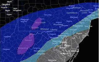
First Call For Snowfall: Friday March 4
Tuesday March 2 - We had rain overnight that is already moving away. Strong winds and colder air today has already opened up the Lake Effect snow inland. This will
Tuesday March 2 - We had rain overnight that is already moving away. Strong winds and colder air today has already opened up the Lake Effect snow inland. This will
February 15 10:15 AM Update- The cold will hold longer. That has been my suggestion for a few days, and now there is more support to how it. One of

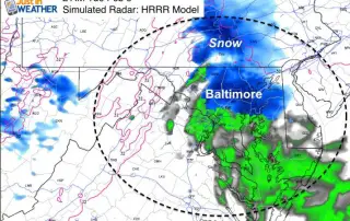
February 15 5:50 AM Update - Light snow had moved through early this morning and dropped a coating of snow in central Maryland. It wasn't heavy but due to the

February 14 9:45 PM Update: The one good thing about this storm, is that it arrives on a holiday… With schools closed. With that out of the equation, we still need
February 14 - A Winter Storm Warning (pink) has been posted for Monday into Tuesday for areas that should remain colder for longer and add ice on top of snow. The
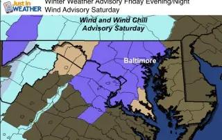
February 12- Update to try and simplify the advisories. Winter Weather Advisory (purple shade): Central Maryland and northern Virginia this afternoon through midnight. General dusting to 1 inch of snow. Some

February 9 at 6:30 AM- If your school delayed this morning to wait it out, it was the best call. The storm is developing right now, directly overhead. As of
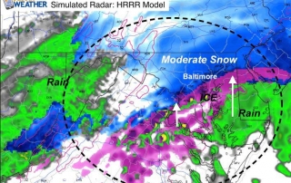
February 8- The radar this evening looks like a scattered mess and temperatures are still warm. AS I've been saying for a few days, this will be a snow developing

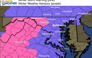
February 8- A Winter Storm Warning has been issued for southern Pennsylvania from their National Weather Service Office in State College PA. This fits with the warning in central Maryland. All

February 8- A Winter Storm Warning has been issued for central Maryland, contrasted with A Winter Weather Advisory or Winter Storm Watch in other places. This is a classic example