July 23 Weather Storm Forecast And A Brief Heat Break In View
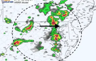
Thursday July 23 2020 The storms that erupted yesterday broke the heat and led to some local flooding, especially in Baltimore City. Some areas received as between 2 to 3
Thursday July 23 2020 The storms that erupted yesterday broke the heat and led to some local flooding, especially in Baltimore City. Some areas received as between 2 to 3
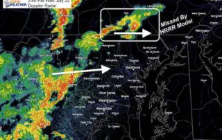
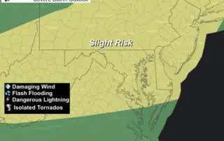
Wednesday July 22 2020 A Sever Thunderstorm Watch has been issued for most of our region through this evening. We have already had warnings issued in PA, western Maryland, and
Wednesday July 22 2020 The storms that crossed the region yesterday provided some relief from the heat, but added to the humidity. You should feel it today and another Heat
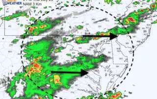
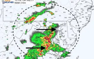
Tuesday July 21 2020 While we are deep into this heat wave, the conditions today are more favorable for strong thunderstorms. Some of these have the potential to reach severe
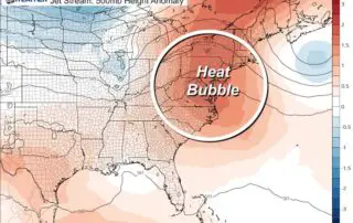
Tuesday July 21 2020 We are turning the corner in this heat wave today It will still be hot, but likely staying below 100ºF in Baltimore this time. By dropping
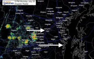
July 20 2020 This is the second day in a row with temperatures reaching 100ºF. Many would welcome a thunderstorm to relieve the heat and humidity, but only a lucky
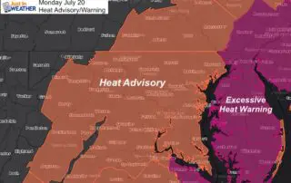
July 20 2020 Today should be the worst of this stretch. Temps will be comparable or a little hotter than yesterday when BWI reached 100ºF. The humidity will make it

Tuesday July 14 2020 Today may be the best weather we will have for a few weeks. A cold front brought morning showers to southern Maryland, now High Pressure is
Monday July 13 2020 This week is the middle of the climatological hottest time of the year. Yes, this is summer. The 'normal high' in Baltimore is 88ºF, so reaching
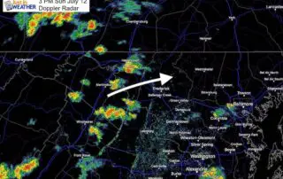
Sunday Afternoon July 12 2020 We have ourselves a more comfortable day with respect to humidity, but it's still hot. Plenty of stations reported 90ºF temperatures. Add in a cold