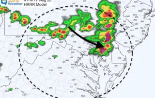
August 28 Severe Weather Potential Friday: New Rain Timeline
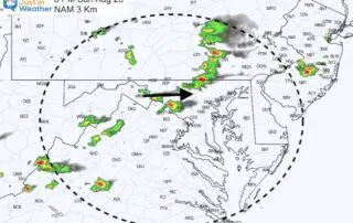
Friday August 28 2020 This is our last hot day for a while. We have a cold front to the north that will stir up many storms today, the then
Friday August 28 2020 This is our last hot day for a while. We have a cold front to the north that will stir up many storms today, the then
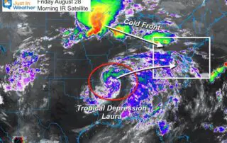
Friday August 28 2020 Today should be our last hot day for a while. Temps will reach the 90s, then break with strong storms that may turn severe today. That
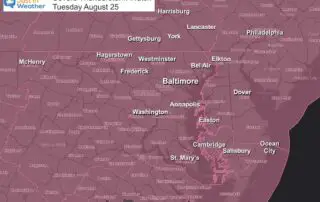
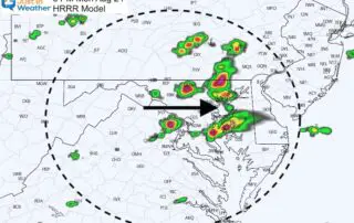
Tuesday August 25 2020 A cold front will ignite a line of storms this evening. It has been developing in central PA this afternoon and will drop south into Maryland
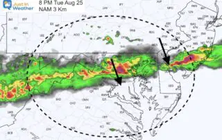
Tuesday August 25 2020 A cold front will bump into the hot and humid air we have in place today and this evening. A line of strong and severe thunderstorms

Tuesday August 25 2020 The headlines have been about the tropics, but today we have a local increased risk for severe storms. That timeline is below, plus a quick look
Monday August 24 2020 Strong and severe thunderstorms locally on Sunday has resulted in many areas starting this morning with fog. That will burn off, but the atmosphere is primed
Sunday August 23 2020 This morning has started off very humid. A few spotty showers have mainly pushed to the Eastern Shore of Maryland. A few more storms are expected
Saturday August 22 2020 There is a lot to cover in this morning report and I wanted to simplify it for you. We have had local rain and the short
Friday August 21 2020 Something strange is afoot at the Circle K. Locally the humidity returns for us, brining back more heat and some showers and storms into the weekend.
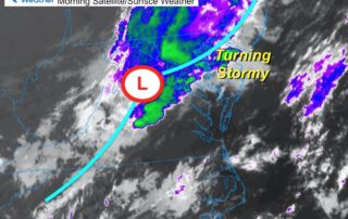

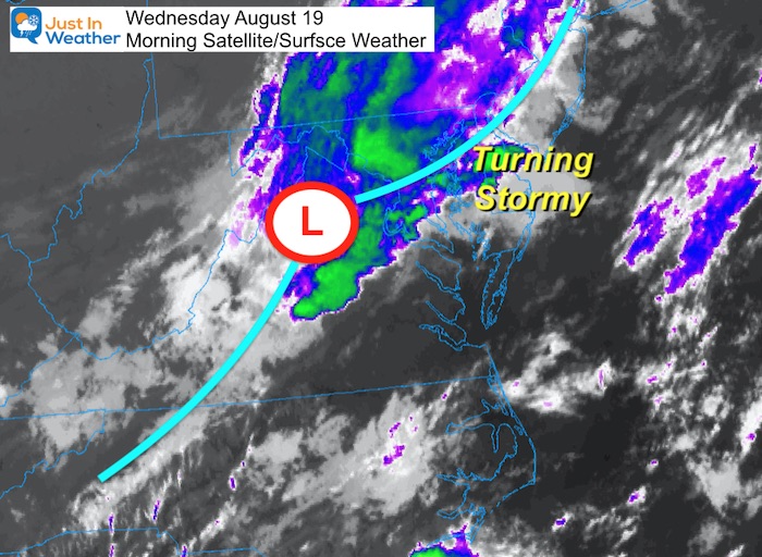
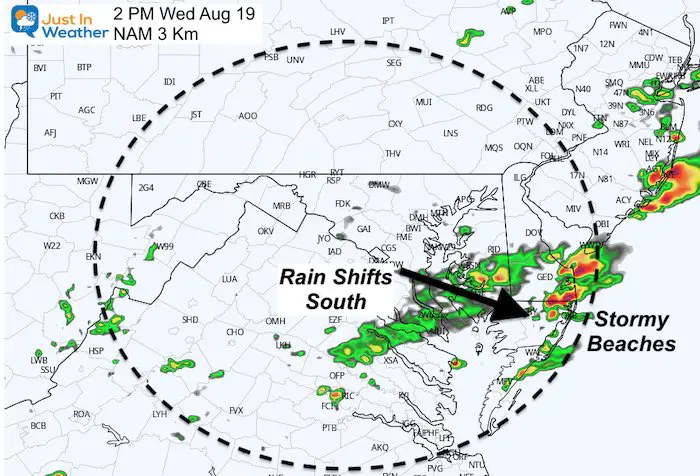
Wednesday August 19 2020 This morning began with rain and even some rumbles of thunders on Maryland's Eastern Shore. But we will get some clearing this afternoon. An area of