June 14 Winds Bring In More Clouds Keeping Us Cool
Sunday June 14 2020 Today is Flag Day and you will be able to see them flapping in the breeze. We are still caught in-between a stalled front on the
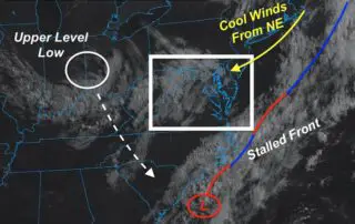
Sunday June 14 2020 Today is Flag Day and you will be able to see them flapping in the breeze. We are still caught in-between a stalled front on the
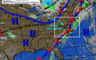
Friday June 12 2020 A new air mass is moving in and most of the region has a clear sky this morning. The morning satellite shows the clouds still hugging
Thursday June 11 2020 Something really interesting is unfolding today. The air is thick this morning across much of our region. The cold front that will bring in a cooler
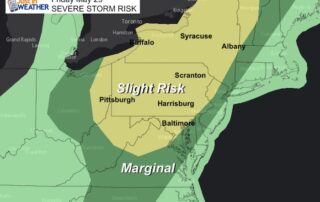
Wednesday June 10 2020 The local focus on storms may be two-fold: One round this evening, then another close to sunrise on Thursday. Then we will watch that front cross
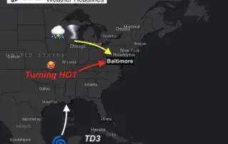
Tuesday June 9 2020 Temperatures will be cranking up for a few days. We can look west at the remains of Cristobal for shifting the upper level winds to allow

Sunday June 7 We finally pushed the heat and humidity out of our region. The air will have a crisp feel as we can see the clearing on the satellite
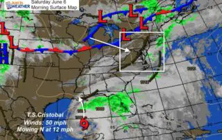
Saturday June 6 2020 The worst of our weather with this pattern has passed. There will be some showers this afternoon and evening, but this is the transition to a
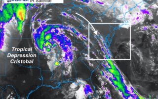
Tuesday June 2 2020 As if we didn't have enough going on, the weather is going to make some headlines. A few rain showers have reached the region this morning,
Friday May 29 2020 The humidity is about to break after one more hot and steamy day. The ingredients are with us to help feed developing storms this afternoon in
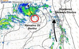
Thursday May 28 2020 You will definitely notice the muggy feel in the air. The remnant Low of Tropical Storm Bertha is moving into Ohio, but dragging very humid air