April 25 Weather Next Event Brings Heaviest Rain Sunday Morning
Saturday April 25, 2020 Good morning. If you woke up early enough, you might have seen thick fog. That is burning off and we will have sun for a few
Saturday April 25, 2020 Good morning. If you woke up early enough, you might have seen thick fog. That is burning off and we will have sun for a few

Friday April 24 This morning began with rain and some fog, but this is the tail end of this event. The bulk of the rain will be shifting east, but

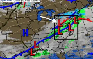
Thursday April 23 2020 A large and very active storm complex is crossing the southern US. This was responsible for 26 tornado reports yesterday. A video below shows a very
Wednesday April 22 Today is the 50th anniversary of Earth Day our small part of the planet almost hit a 145 year old record low. The temperature dropped to 35ºF
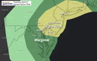
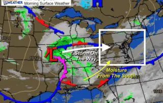
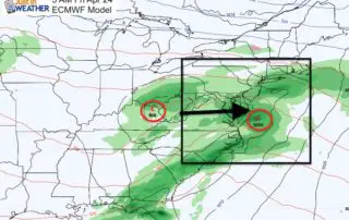
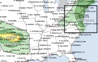
Tuesday April 21 2020 A quiet start this morning is not going to last. A strong cold front will provide some strong lines of storms that may turn severe mid
Monday April 20 Yesterday brought over 100 severe storm reports to the southern US. Today, rain will be passing through southern Maryland today, along with some severe storms in the

April 18 2020 Another cold night ahead that is unfavorable for sensitive vegetation. Another Frost Advisory has been issued for Sunday morning April 19. Temperatures are expected to drop into
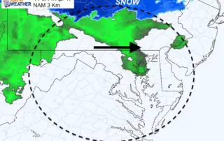
Saturday April 18 2020 We are in an active weather pattern that missed us all winter. Just imagine if all of this was snow. Hmmm. But instead we are in
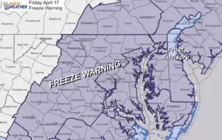
Friday April 17 2020 We got the freezing temperatures as expected. In fact even Ocean City's airport reported a temperature down to 30ºF. That is a rare accomplishment this late
April 16, 2020 The sky has clear and temperatures are about to drop into the lower 30s and upper 20s for most of our region. In my last report, I