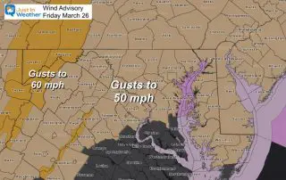
March 26 Weather Wind Advisory With Warm Up Next Storm Sunday
Friday March 26 2021 Morning Surface Weather Low Pressure is moving through the Great Lakes this morning and will be responsible for pulling in very strong winds by mid day

Friday March 26 2021 Morning Surface Weather Low Pressure is moving through the Great Lakes this morning and will be responsible for pulling in very strong winds by mid day
March 25 2021 The strong storm and severe weather outbreak on Thursday has been responsible for sending rain showers our way overnight. These will end in the morning, but the
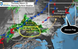
Thursday March 25 2021 The remnants of the record rainfall yesterday has resulted in areas of thick fog. We saw a return of school delays on Maryland’s Eastern Shore. But
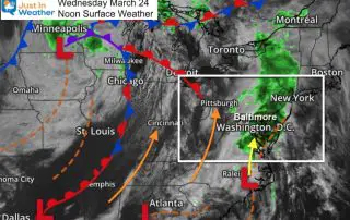
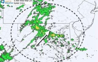
Wednesday March 24 2021 So far this rain event has lived up to expectations and then some. This is only the third day this month with measurable rain in Baltimore
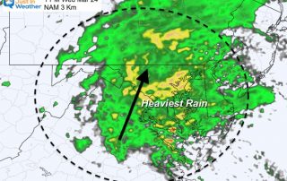
Wednesday 24 2021 This will be a rare rainy day for us this month. After a very busy winter, Baltimore’s BWI only has had two other days this month with
Tuesday March 23 2021 A shift in the wind makes all the difference. This morning may start off with sun, but it is not as chilly. BWI started in the
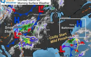
Monday March 22 2021 Yesterday we saw the full effect of the stronger sun angle with dry air and ground. Baltimore started at 28ºF and reached 64ºF in the afternoon.
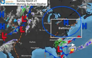
Sunday March 21 2021 A quick glance at the weather map and all looks quiet. High Pressure is in control and we will have a mostly clear sky throughout the
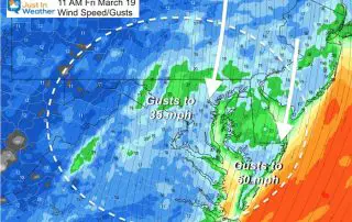
Friday March 19 2021 The storm is pulling away. It did bring the expected thunder yesterday to Annapolis and southern Maryland. But the rain total at BWI was 0.56”, underperforming.
Thursday March 18 2021 The large storm complex dominant the eastern US has brought us bands of rain all day, but we remain on the cold side of things. That