Normal First Frost And Freeze Dates Map For Maryland
October 17, 2018 Frost is likely to develop for some suburban areas the week. After a very wet summer and warm start to October, many areas are actually right on
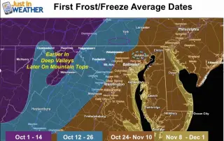
October 17, 2018 Frost is likely to develop for some suburban areas the week. After a very wet summer and warm start to October, many areas are actually right on
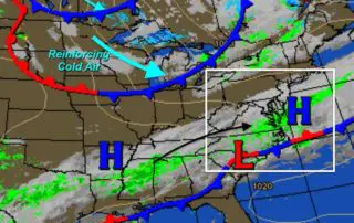
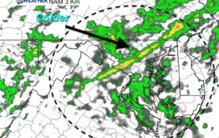
Wednesday October 17 2018 It might seem cool this morning, but colder air is on the way. Yes, it is October and we should expect falling temperatures. Sometimes that arrives
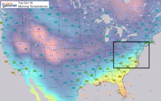
Tuesday October 16 2018 We are done with the wet weather for a while. That is probably the most important thing I could share this morning. We still have some
Monday October 15 2018 This may come as a surprise, but the Baltimore area only had 4 days of rain this month. That is before today. The rainfall has also
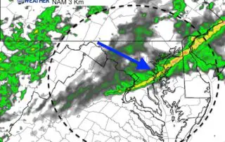
Monday October 15 2018 Today will be the warmest day of the week, and it comes with rain. Showers are with us this morning and will be scattered for much
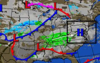
Sunday October 14 2018 Rain is moving in today for us as the overall weather map looks a bit like winter. Quite the contrast from a major hurricane just a
Saturday October 13 2018 A band of rain this morning is the mark of our pattern change. Fall is really here now and will stay. It is interesting how Hurricane
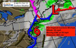
Friday October 12 Michael is now off the coast and The National Hurricane Center has identified it as Post Tropical Cyclone. It is moving to the ENE at 29 mph,
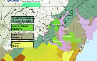
Thursday October 11 2018 If this was a winter storm, the northern edge of the precipitation would be the low confidence zone. I realize that starting off with that you
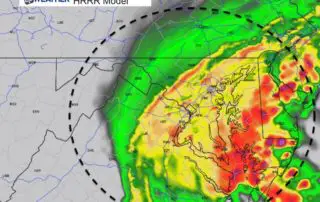
Thursday October 11 2018 Rain has already passed through this morning but the bulk of what we will see will be tonight. The impact of Tropical Storm Michael will be