Sunday October 3
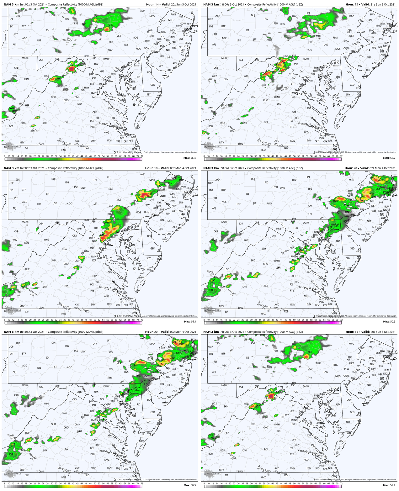
This morning starts off with areas of thick fog, especially near the Bay, rivers, and some reservoir lakes. An Advisory has been issued around the Northern Chesapeake Bay counties to metro Philadelphia. That will burn off within a few hours of sunrise.
The day will be mostly sunny and warm, with summer heat pushing many into the 80s.
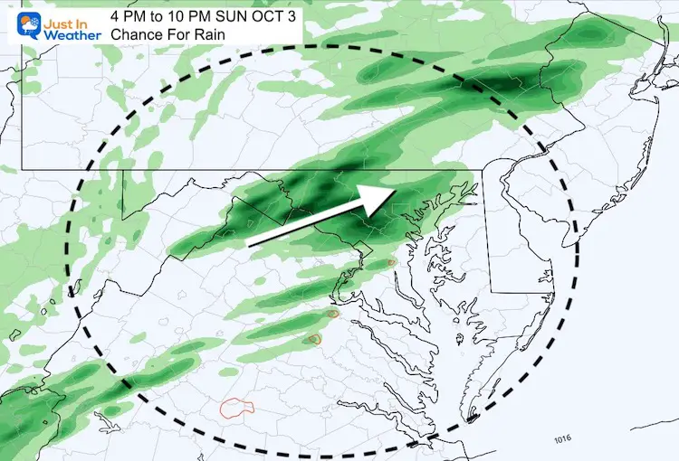
Late day showers will arrive, mainly west and north of the cities (see the maps below). Places south and east of Baltimore should remain dry… but more showers are possible overnight and Monday morning…
Morning Surface Weather
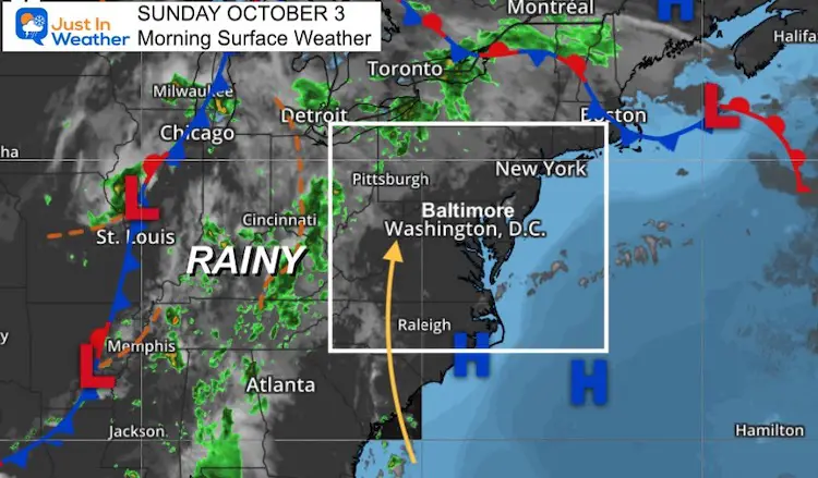
Morning Temperatures
Dense Fog Advisory has been issued around the Northern Chesapeake Bay counties to metro Philadelphia.
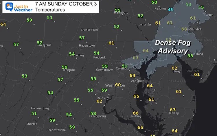
Afternoon Temperatures
Note: Our local Offical recording station at BWI tends to be warmer than models and surroundings.
My 7-Day forecast below is based on this location… So temps for most locations will be a little cooler.
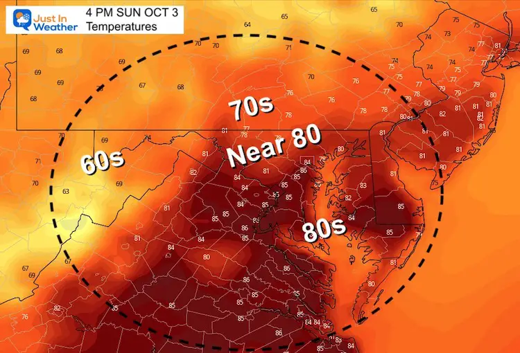
Weather Almanac: Climate Data
TODAY October 3
Normal Low in Baltimore: 50ºF
Record 34ºF in 1974
Normal High in Baltimore: 71ºF
Record 92º F 1919
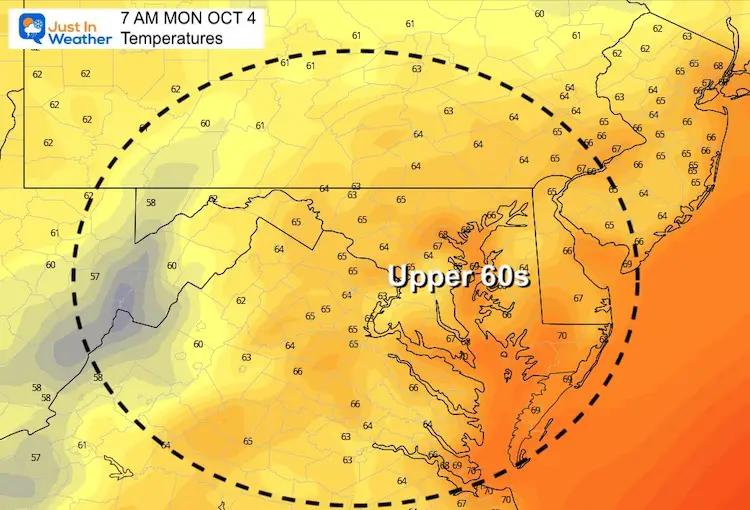
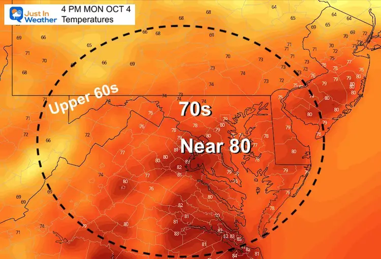
Temperatures Monday
Morning
Afternoon
Late Day Shower?
It looks like the suburbs once again NorthWest of Baltimore have the best chance of showers after 5 PM through the evening.
Animation 4 PM to 10 PM
Rain Footprint Through Evening
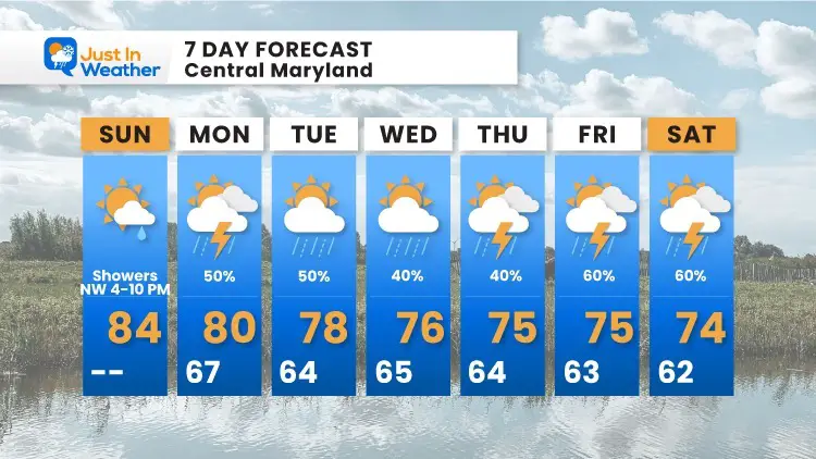
7 Day Forecast
The pattern will be unsettled, but not a complete washout. There will be a chance of showers just about every day.
14 Local Maryland Pages (and York PA)
We have made a page for Maryland Weather which gives you the current conditions for 14 present area locations.
Maryland Trek Gear
Maryland Trek 8 Says THANK YOU!
Running Total Raised $116,438
During 329 Miles From Wisp To Ocean City
To Honor Kids In Cancer Treatment and Support FREE Programs At Just In Power Kids
Please share your thoughts, best weather pics/video, or just keep in touch via social media


