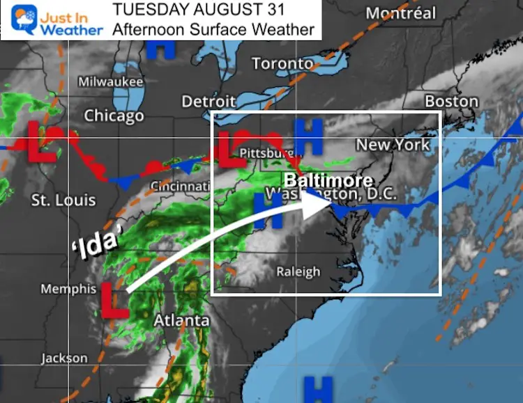
Tuesday Afternoon August 31
What we are calling Ida is no longer a tropical system and not being tracked by The National Hurricane Center. However, it was once a high end Category 4 Hurricane and there is still some potent energy left with that storm.
Below is a live radar plus an update on the tracking and rain forecasts. But first some highlights.
Surface Weather
“Smells like the Gulf” – This storm has such strong circulation, that particulates are still flying about. Often with a system like this, you may notice smells from plants, salt, and even the southern shore that is familiar to the Gulf Coast region.
Live Radar
Highlights
- The impact on our region we not be the same all around. The core Low is expected to pass close to Baltimore. The heaviest rain will be to the north, and there may be a sharp line of rain much of the day, keeping areas south and east dry.
- The ‘worst’ weather is expected between 6 PM, until the Low passes after midnight.
- Winds will increase during the afternoon and evening as the core Low approaches. Steady winds may be 20 to 30 mph, with frequent gusts over 40 mph.
- Outdoor activities and after school sports will most likely be cancelled.
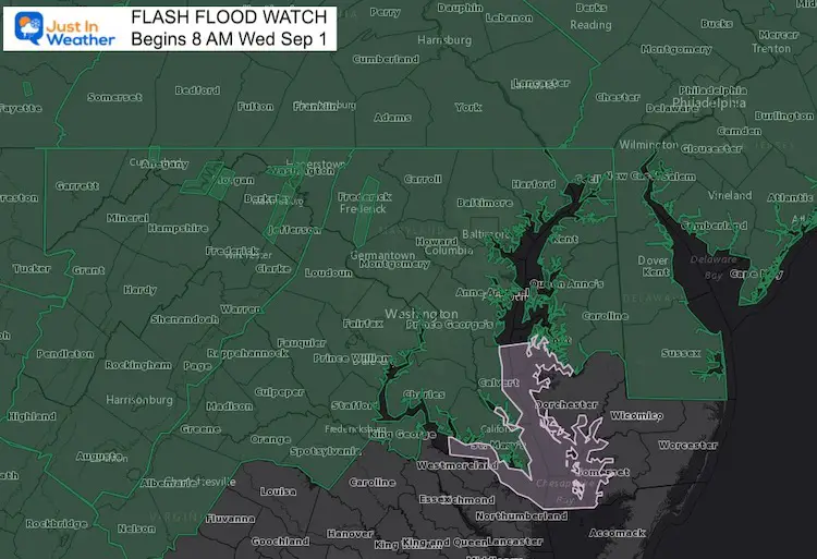
Flooding:
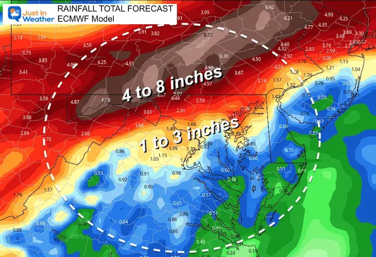
- The heaviest rain will be in northern Maryland to central Pennsylvania. Here it is possible to get 4 to 6 inches throughout the event.
- Central Maryland can easily get over 2 inches, much may occur in strong or severe storms during the evening and at night.
- Flood Warnings have been issued for local rivers already.
- Compare new rainfall maps below.
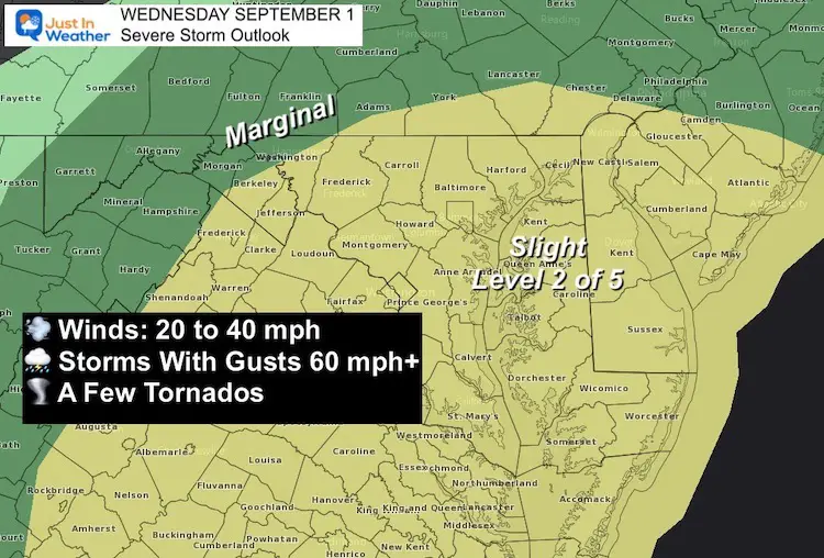
Severe Storms
- Individual cells within the main rain band could dump rates over 1 inch per hour.
- A ‘Watch’ may be issued for the region in the afternoon and at night.
- Severe T’storms = wind gusts could reach 60 mph +
- Tornado = tropical twisters will be possible. They are often short lived and rain wrapped. These ‘spin ups’ are usually EF-0 and EF-1 rated.
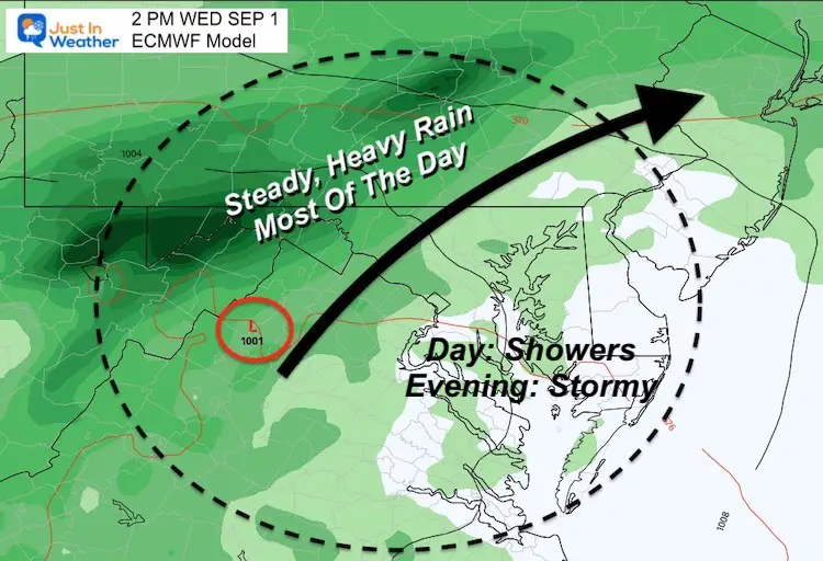
Plotting The Rain
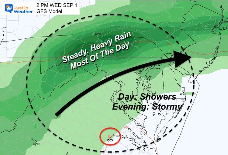
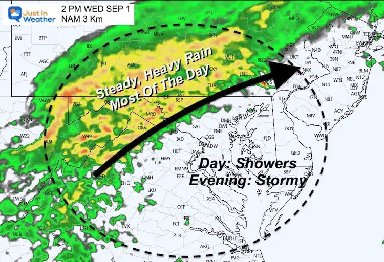
It is likely our region will be split with steady and heavy rain much of the day north and west all day.
But a sharp line may separate where just showers or many dry hours… That area will get the strong to severe storms late afternoon and evening.
ECMWF Model
The arrow shows the direction of the rain movement, not the track of the Low.
GFS Model
The arrow shows the direction of the rain movement, not the track of the Low.
NAM 3 Km
The arrow shows the direction of the rain movement, not the track of the Low.
Animation
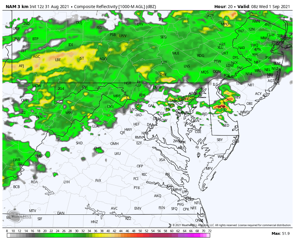
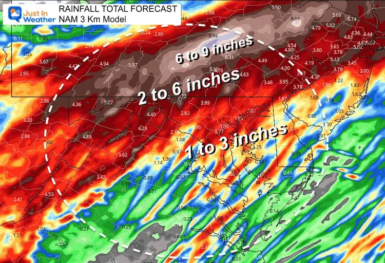
Here is the NAM 3 Km model. I still believe this product is not performing well, but this helps illustrate the sharp cut off of steady, heavy rain. The areas that miss the rain during the day, will get a surge of storms by evening.
I think the cut off will be south and east of what is shown here…
Rainfall:
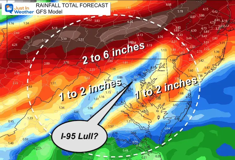
That is where it differs, but still all high enough for flooding.
The heaviest rain will be along and north of the track of the core Low.
ECMWF Model
GFS Model
For some reason here we see a lull in the I-95 corridor. This is not consistent with prior runs or compared to other models. I would still plan for a ‘minimum’ of 1 to 2 inches across the board.
NAM 3 Km
14 Local Maryland Pages (and York PA)
We have made a page for Maryland Weather which gives you the current conditions for 14 present area locations.
Maryland Trek Gear

Maryland Trek 8 Says THANK YOU!
Running Total Raised $116,438
During 329 Miles From Wisp To Ocean City
To Honor Kids In Cancer Treatment and Support FREE Programs At Just In Power Kids
![]()

Please share your thoughts, best weather pics/video, or just keep in touch via social media