Monday August 30 2021
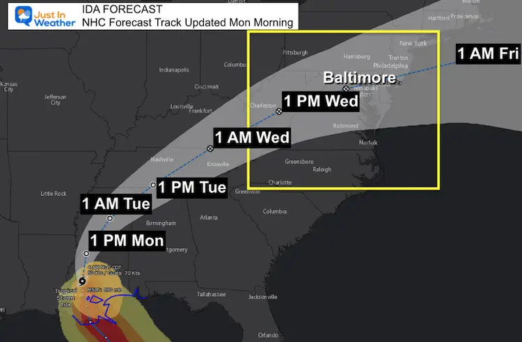
Ida has been downgraded to a Tropical Storm this morning. This remains on a path to weaken and curve our way Wednesday. This will bring the risk of heavy rain and severe storms.
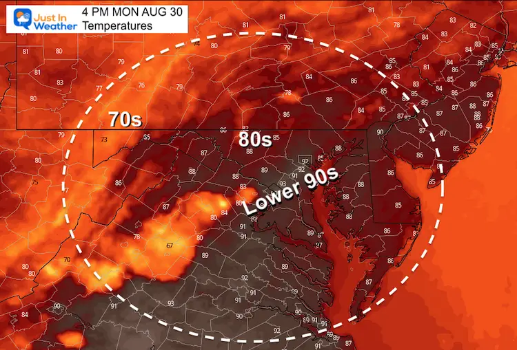
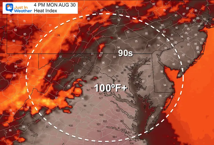
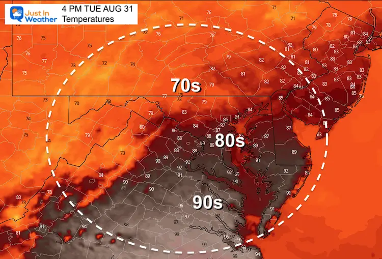
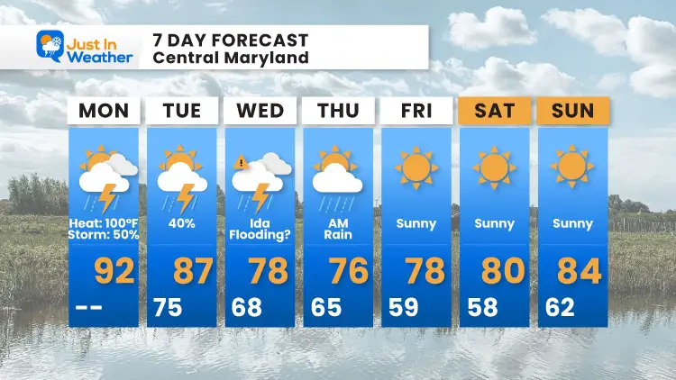
But first, we have one last HOT day with temps in the 90s and a Heat Index close to 100ºF, followed by late day pop up thunderstorms. After Ida, we will get a stretch of cooler and dry weather into the holiday weekend.
Note: More school busses are on the roads. Please be mindful of the Stop Sign Arm and kids crossing.
Morning Surface Weather
Tropical Storm Ida has winds down to 60 mph. This is moving to the North at 8 mph, and still expected to curve our way. Before that arrives, we have heat, humidity, and a separate round of storms to deal with.
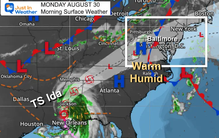
HEADLINES
- Today: Heat Index Near 100ºF
- Thunderstorms After 4 PM
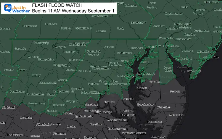
- Wednesday: Flash Flood Watch
- Potential for Severe Storms
- (Wind and Tornados)
*Ida Focus Below
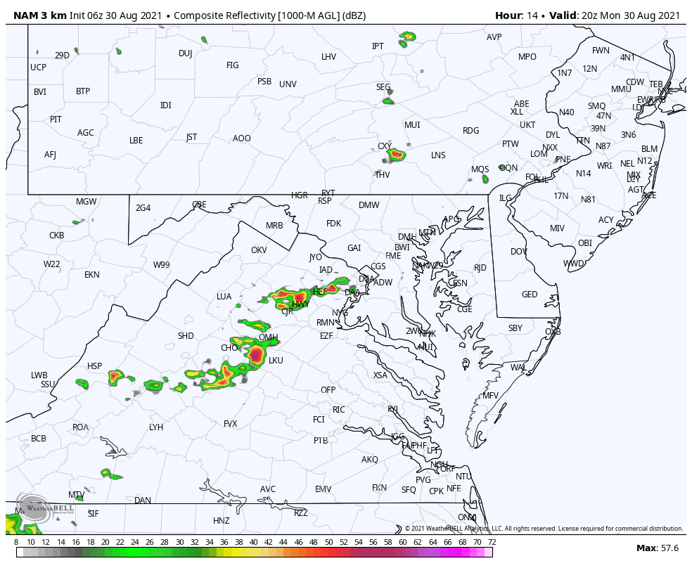
Radar Simulation
This NAM 3 Km model shows the potential of thunderstorms after 4 PM. This is not precise, but helps with the idea of timing and movement. We can expect a little more activity than shown here.
Afternoon Temperatures
Heat Index
Weather Almanac: Climate Data
TODAY August 30
Normal Low in Baltimore: 63ºF
Record 45ºF in 1986
Normal High in Baltimore: 83ºF
Record 101º F 1953
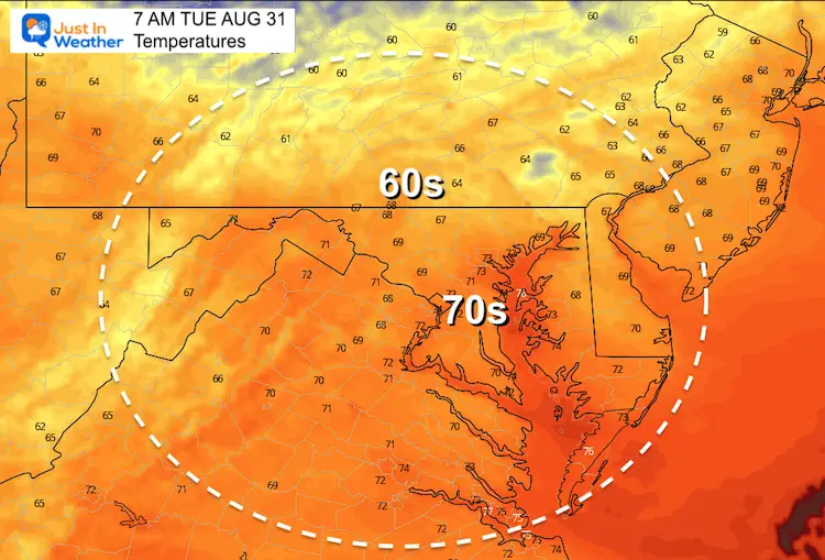
Tuesday Temperatures
Morning
Afternoon
Tropical Storm Ida
Forecast Track/Cone
Ida will weaken to a Tropical Depression, but remain a potent force for heavy rain and severe storms.
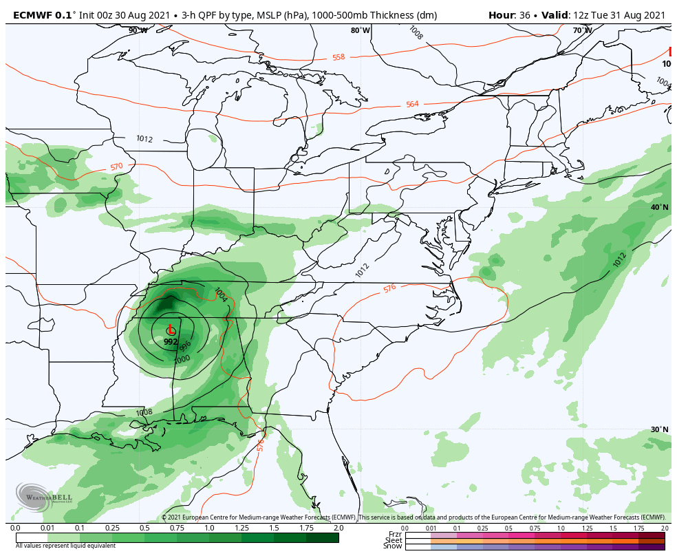
ECMWF Storm Animation:
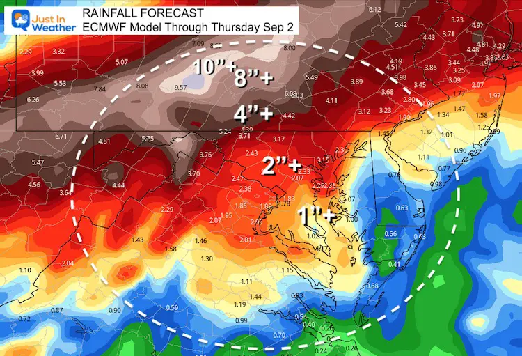
Here we see the rain from Ida arriving on Wednesday, well ahead of the center passing through Maryland Thursday morning.
The heaviest rain is forecast to reach into central PA, but I have verification of recent storms to the south. I think we still need to watch that core rain field.
Flash Flood Watch
Rainfall Forecast
7 Day Forecast
Interactive Widget
Check the wind field from the GFS Model on your own here.
Use the controls to pan and zoom the map view.
14 Local Maryland Pages (and York PA)
We have made a page for Maryland Weather which gives you the current conditions for 14 present area locations.
Maryland Trek Gear

Maryland Trek 8 Says THANK YOU!
Running Total Raised $116,438
During 329 Miles From Wisp To Ocean City
To Honor Kids In Cancer Treatment and Support FREE Programs At Just In Power Kids
![]()

Please share your thoughts, best weather pics/video, or just keep in touch via social media