Sunday August 29 Morning Update
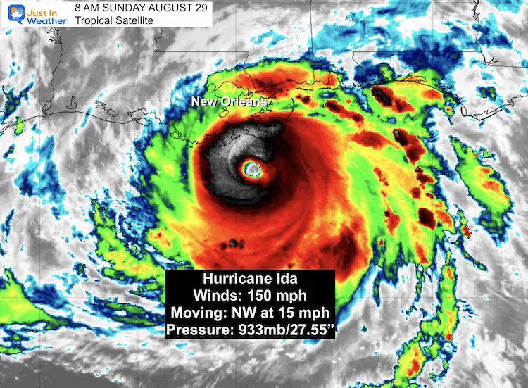
Hurricane Ida is doing what was expected, gaining strength and surpassing computer model guidance. This morning Hurricane Ida is a Category 4 storm with sustained winds of 150 mph. What makes this even more dangerous is that this storm is in a phase of intensification. The internal structure is amping up.
By contrast, Katrina peaked at a Category 5, but was weakening to a Cat 3 at landfall. By the way, today is the 16 anniversary of that storm.
Ida’s minimum pressure now is 933 mb, close to where Katrina was at her peak.
As of 8 AM EDT, it located 50 miles from the mouth of the Mississippi River.
Hurricane force winds reach 50 miles from the center.
Tropical Storm Force Winds reach 140 mile from the center.
Hurricane Ida Satellite
“Life Threatening Storm” National Hurricane Center
Wind Risk: In addition to the broad storm circulation, multiple spin up tornados are likely. This severe risk will continue well inland after the storm weakens.
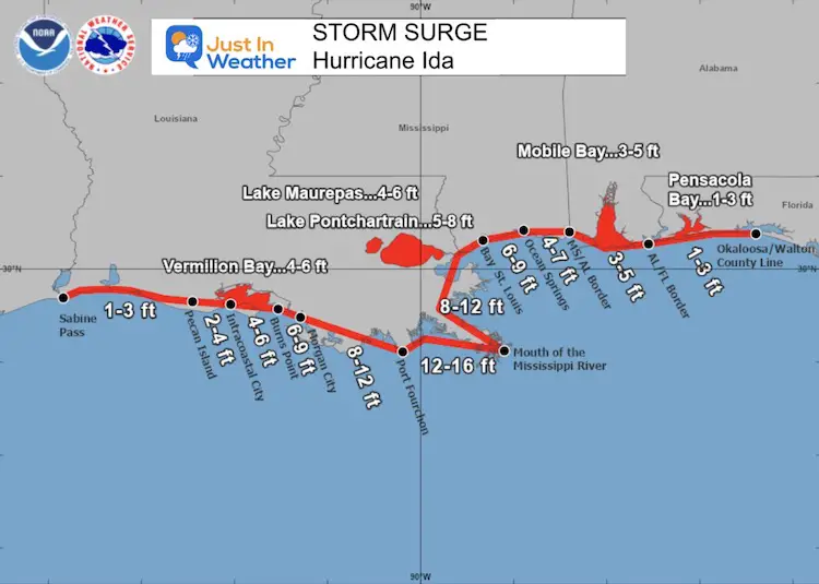
Flooding Risk: This will be the real test of the improved levee system. Rain could exceed 2 Feet, Storm Surge could push close to 20 Feet. The track just west of New Orleans will put that city on the strongest side of the storm!
National Hurricane Center Update:
8 AM EDT Sun Aug 29
LOCATION…28.5N 89.6W
ABOUT 50 MI…85 KM SW OF THE MOUTH OF THE MISSISSIPPI RIVER
ABOUT 100 MI…160 KM SE OF HOUMA LOUISIANA
MAXIMUM SUSTAINED WINDS…150 MPH…240 KM/H
PRESENT MOVEMENT...NW OR 320 DEGREES AT 15 MPH…24 KM/H
MINIMUM CENTRAL PRESSURE…933 MB…27.55 INCHES
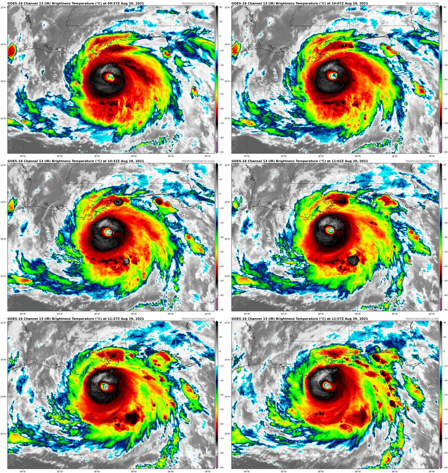
Satellite Loop
The eye at the center getting more clear and symmetrical. This is a signal of rapid pressure drop and even more strengthening. There is no way to overstate how devastating this will be for the coastline.
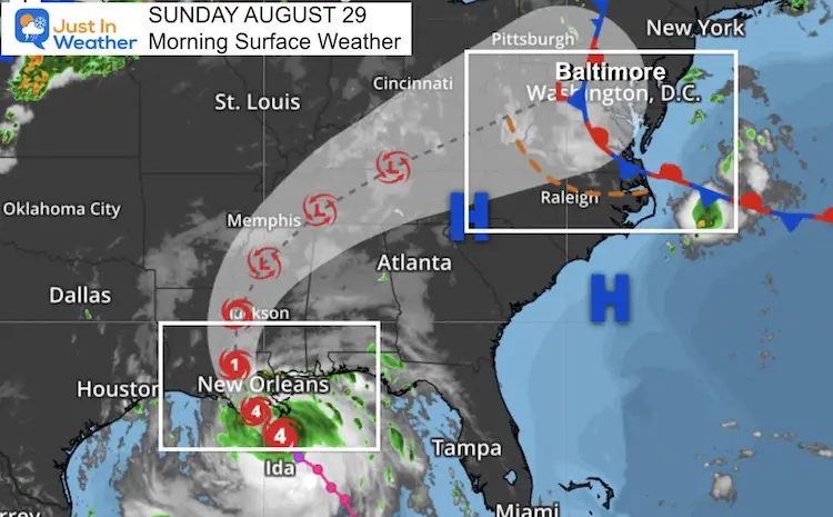
Forecast Landfall
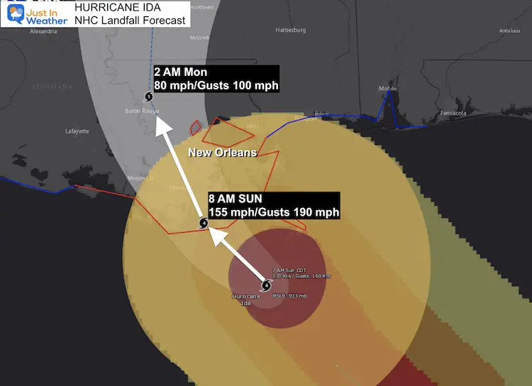
Storm Surge Forecast
WATCHES AND WARNINGS
A Storm Surge Warning is in effect for…
* East of Rockefeller Wildlife Refuge Louisiana to the
Alabama/Florida border
* Vermilion Bay, Lake Borgne, Lake Pontchartrain, Lake Maurepas,
and Mobile Bay
A Hurricane Warning is in effect for…
* Intracoastal City Louisiana to the Mouth of the Pearl River
* Lake Pontchartrain, Lake Maurepas, and Metropolitan New Orleans
A Tropical Storm Warning is in effect for…
* Cameron Louisiana to west of Intracoastal City Louisiana
* Mouth of the Pearl River to the Alabama/Florida border
Surface Weather Map
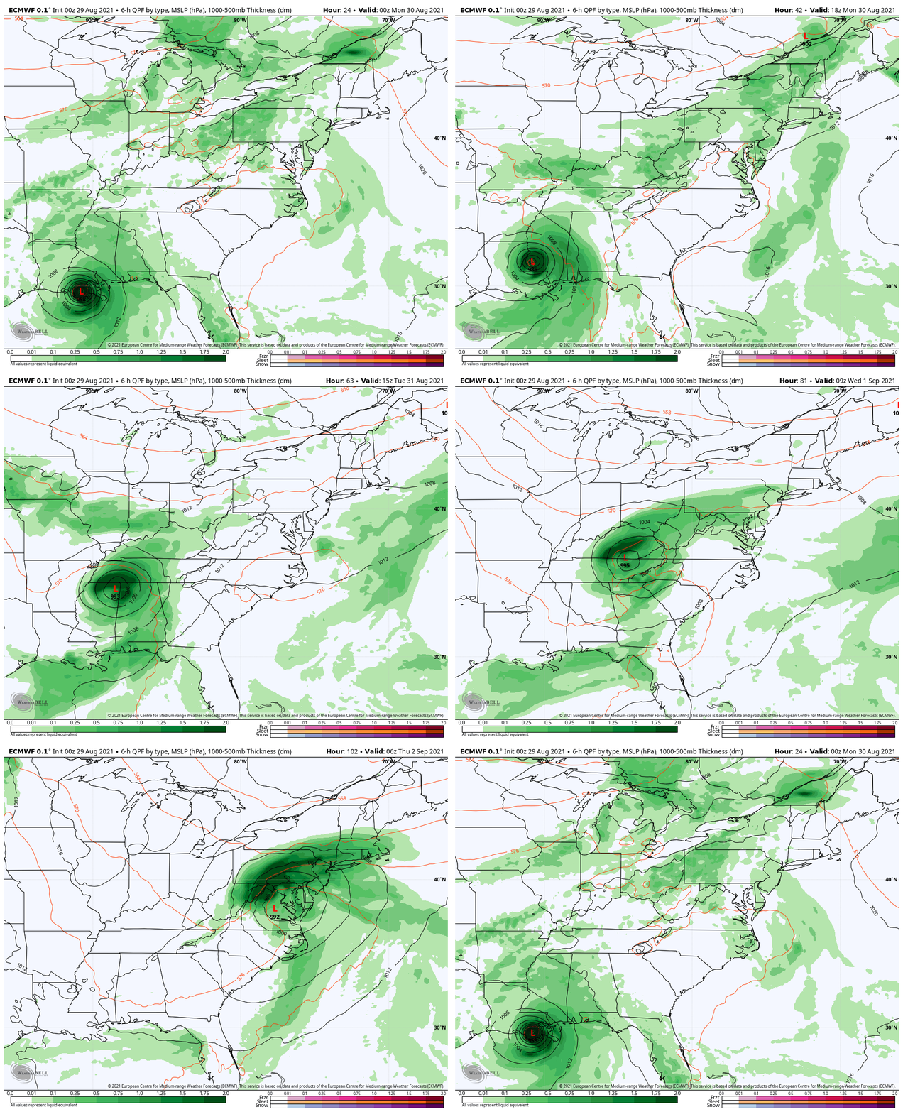
Hurricane Ida is entering the central Gulf of Mexico where even warmer water will feed into the rapid development. We still need to watch the inland path to reach us next week.
Impact on The Mid Atlantic…
Rain Simulation
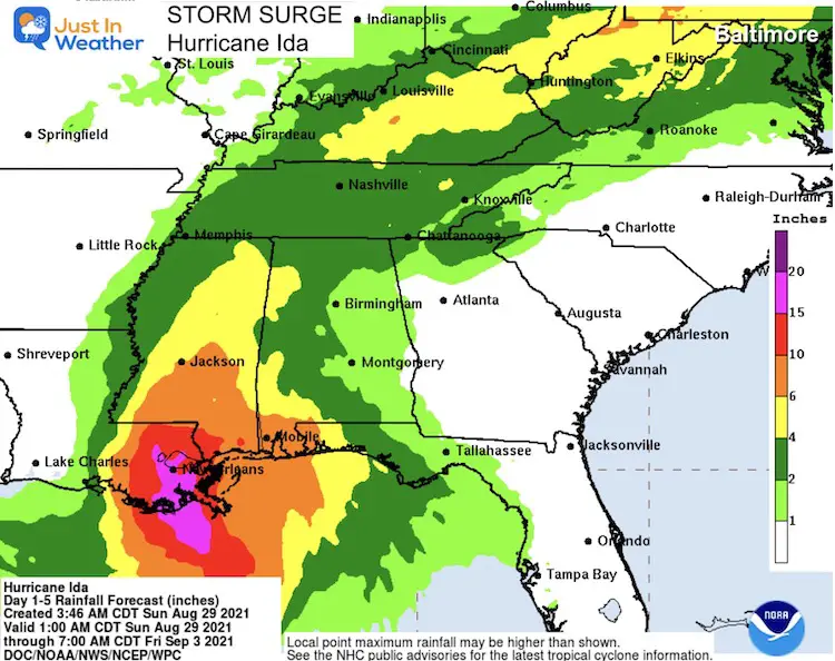
Rain Forecast
At the core of landfall, rain will be between 1 and 2 FEET!. Locally in the Mid Atlantic we may see between 2 and 4 inches, with severe storms on top.
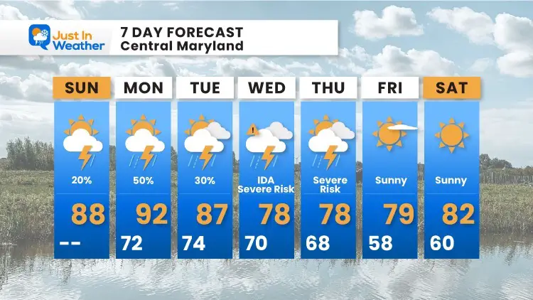
7 Day Forecast
Interactive Widget
Check the wind field from the GFS Model on your own here.
Use the controls to pan and zoom the map view.
14 Local Maryland Pages (and York PA)
We have made a page for Maryland Weather which gives you the current conditions for 14 present area locations.
Maryland Trek Gear
Maryland Trek 8 Says THANK YOU!
Running Total Raised $116,438
During 329 Miles From Wisp To Ocean City
To Honor Kids In Cancer Treatment and Support FREE Programs At Just In Power Kids
Please share your thoughts, best weather pics/video, or just keep in touch via social media
Facebook: Justin Berk, Meteorologist
Twitter: @JustinWeather
Instagram: justinweather

