Saturday August 28: Update at 2 PM
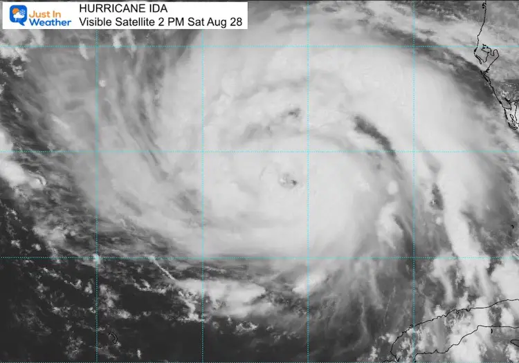
Hurricane Ida has sustained winds of 100 mph, making this a Category 2 storm. It is getting better organized and now displaying an eye on satellite. The significance of this represents the rapid drop of central air pressure. The structure will clear out the center of this heat engine and become more efficient with the spiral banding and symmetry.
This is one sign that confirms the expected rapid development. Ida could jump up to Cat 3 or Cat 4 within the next day.
Visible Satellite
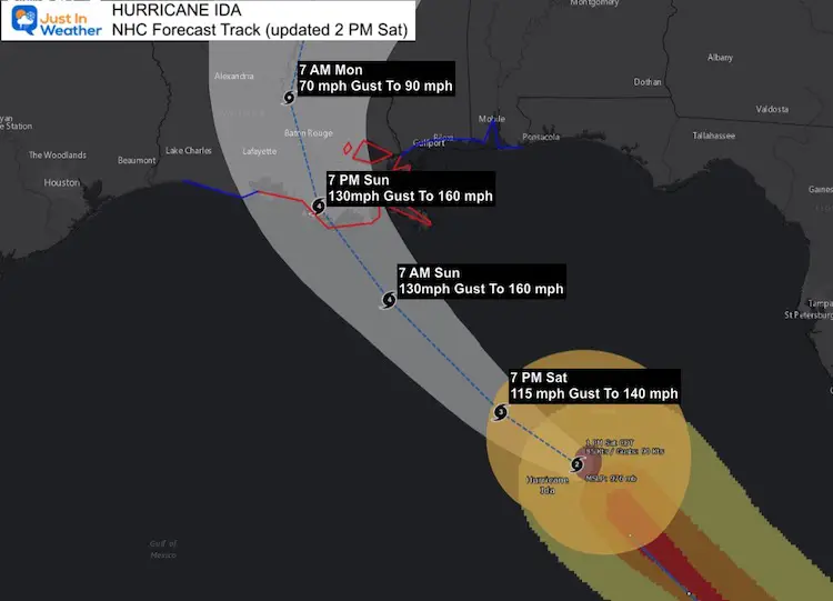
National Hurricane Center Update: 2 PM Sat Aug. 28
- LOCATION…25.5N 86.6W
- ABOUT 290 MI…470 KM SSE OF THE MOUTH OF THE MISSISSIPPI RIVER
- ABOUT 380 MI…610 KM SE OF HOUMA LOUISIANA
- MAXIMUM SUSTAINED WINDS…100 MPH…155 KM/H
- PRESENT MOVEMENT…NW OR 315 DEGREES AT 16 MPH…26 KM/H
- MINIMUM CENTRAL PRESSURE…976 MB…28.82 INCHES
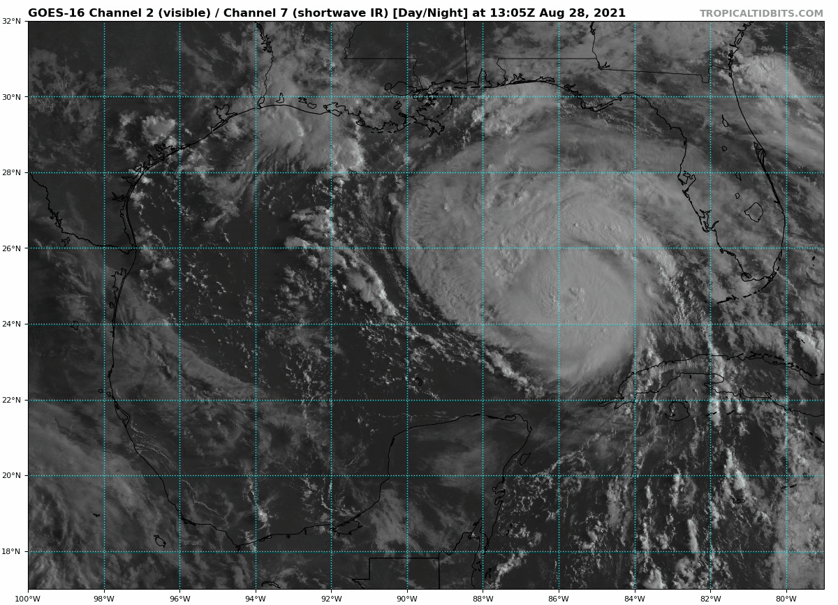
Satellite Loop
- Hurricane Force Winds (754 mph +) reach 30 miles from the center.
- Tropical Storm Force Winds (39 mph+) reach 125 miles from the center.
- Rapid strengthening is expected in the next 24 to 36 hours up to landfall.
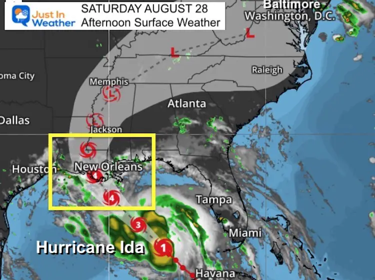
Surface Weather Map
Hurricane Ida is entering the central Gulf of Mexico where even warmer water will feed into the rapid development. We still need to watch the inland path to reach us next week.
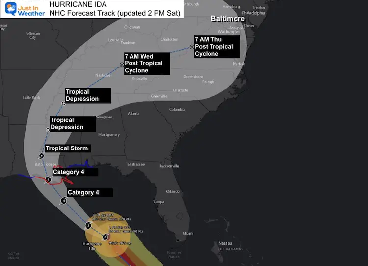
Forecast Landfall
WATCHES AND WARNINGS
A Storm Surge Warning is in effect for…
* East of Rockefeller Wildlife Refuge Louisiana to the
Mississippi/Alabama border
* Vermilion Bay, Lake Borgne, Lake Pontchartrain, and Lake Maurepas
A Hurricane Warning is in effect for…
* Intracoastal City Louisiana to the Mouth of the Pearl River
* Lake Pontchartrain, Lake Maurepas, and Metropolitan New Orleans
A Storm Surge Watch is in effect for…
* Mobile Bay
A Tropical Storm Warning is in effect for…
* Cameron Louisiana to west of Intracoastal City Louisiana
* Mouth of the Pearl River to the Alabama/Florida border
Compare Model Forecast
(spaghetti plots)
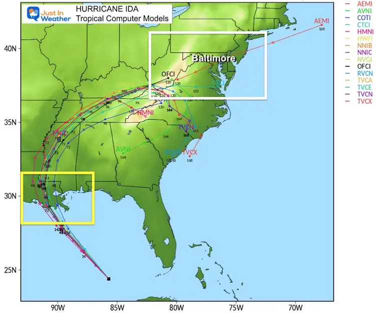
Track To The Mid Atlantic…
Ida will weaken rapidly inland and then curve to to the northeast. It is likely to diminish to a Tropical Depression, but still remain a potent force for heavy rain and severe storms. The risk for flooding, damaging winds, and even quick spin up tornados will still be possible in our region.
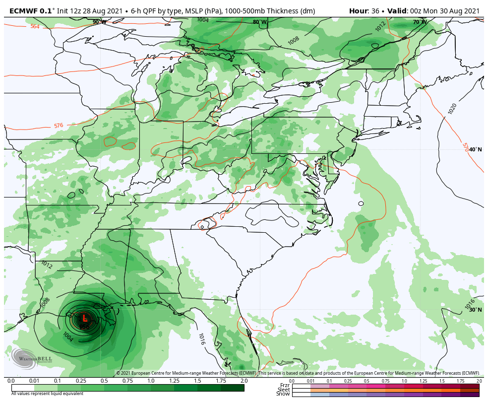
Rain Simulation: ECMWF Model
Landfall Sunday to Thursday Morning
Heavy rain building in Wednesday into Thursday
Interactive Widget
14 Local Maryland Pages (and York PA)
We have made a page for Maryland Weather which gives you the current conditions for 14 present area locations.
Maryland Trek Gear

Maryland Trek 8 Says THANK YOU!
Running Total Raised $116,438
During 329 Miles From Wisp To Ocean City
To Honor Kids In Cancer Treatment and Support FREE Programs At Just In Power Kids
![]()

Please share your thoughts, best weather pics/video, or just keep in touch via social media