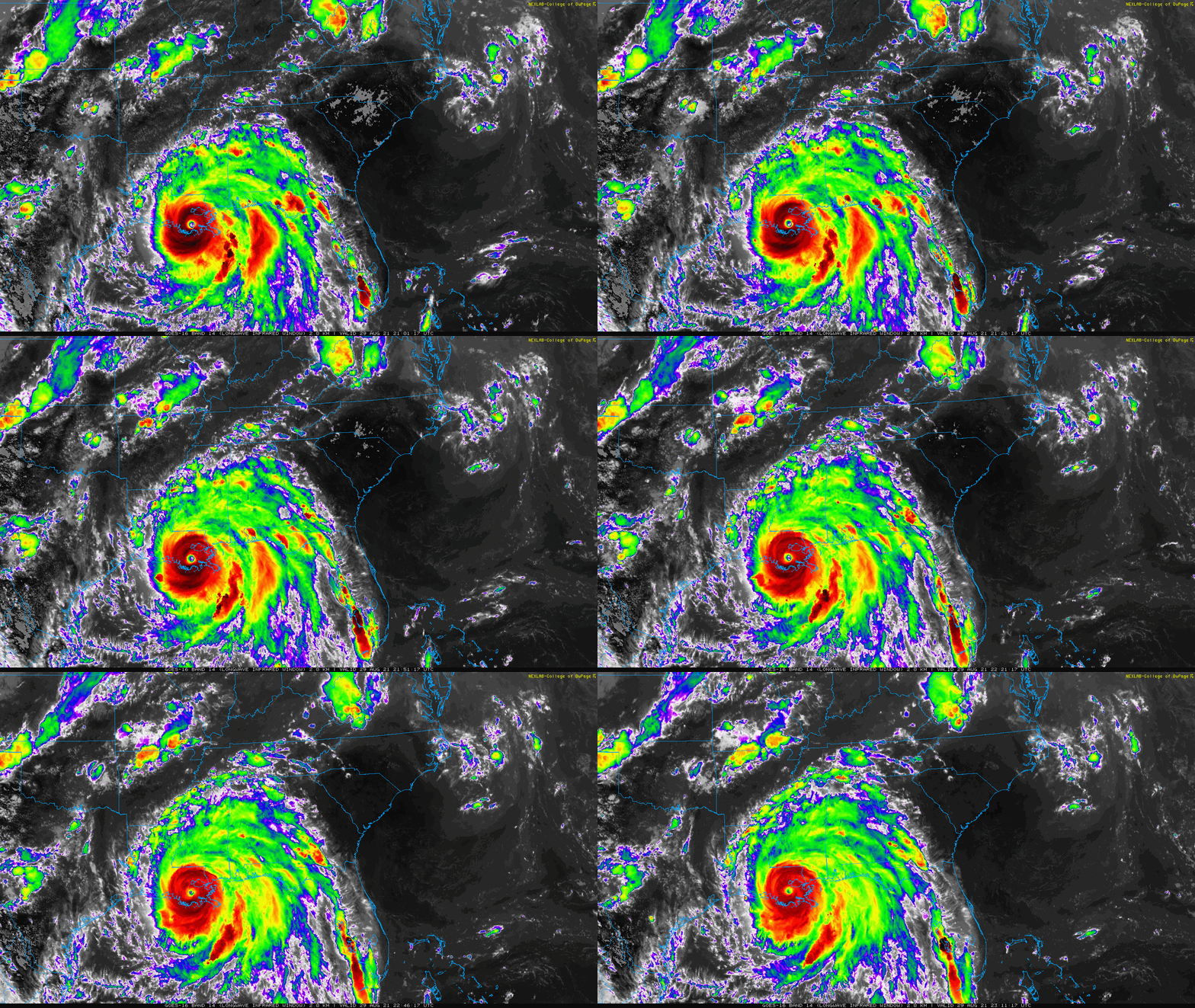
Sunday August 29 Evening Update
Hurricane Ida made landfall this morning near Port Fourchon in Louisiana at 12:55 PM EDT. Max winds were 145 mph at the time. The storm was in a strengthening phase, which allowed the internal structure to counter the weakening affects of being inland a little longer.
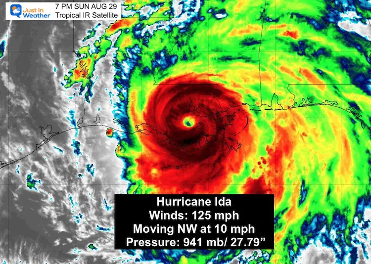
At the 7 PM update, winds were still 125 mph as the storm was 30 miles SW of New Orleans.
Hurricane Ida Snapshot
Storm Size
- Hurricane Force Winds reach 45 miles from the center
- Tropical Storm Force Winds reach 150 miles from the center
I can not overstate this: The devastation that will unfold across media outlets over the next day will be devastating. This is one of the strongest storms to hit the US.
While we take a look at the current set up, my focus in this post will shift the the impact this storm will have inland. The rainfall we could see as shown by multiple models, will be extensive.
Headlines:
- Ida is still a Category 3 Hurricane.
- Ida will weaken to a Tropical Depression By Tuesday Morning
- Remnants Cross Our Region Between Virginia and Maryland
- Wednesday: Flooding Rain and Severe Storms Possible
- Thursday: Rain should end in the morning.
*Compare Rainfall on four computer models below.
IR Loop: Regional View
Moisture is expected to expanded north and east while being enhanced by the mountains.
Surface Weather Map
While Hurricane Ida is slowly crawling inland. It is expected to increase forward speed as it weakens. The Remnant Low will cross between Virginia and Maryland Thursday Morning.
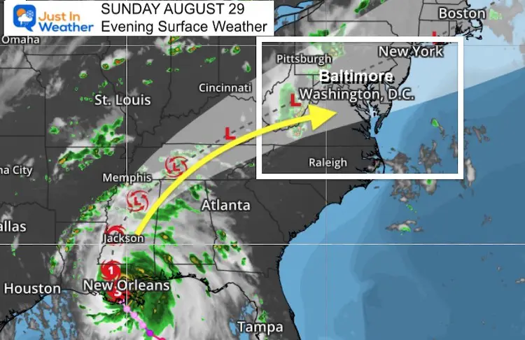
Impact on The Mid Atlantic…
While we may get some thunderstorms over the next few days, the impact from Ida will be on Wednesday into Thursday morning.
The heaviest rain will spread well ahead of the center.
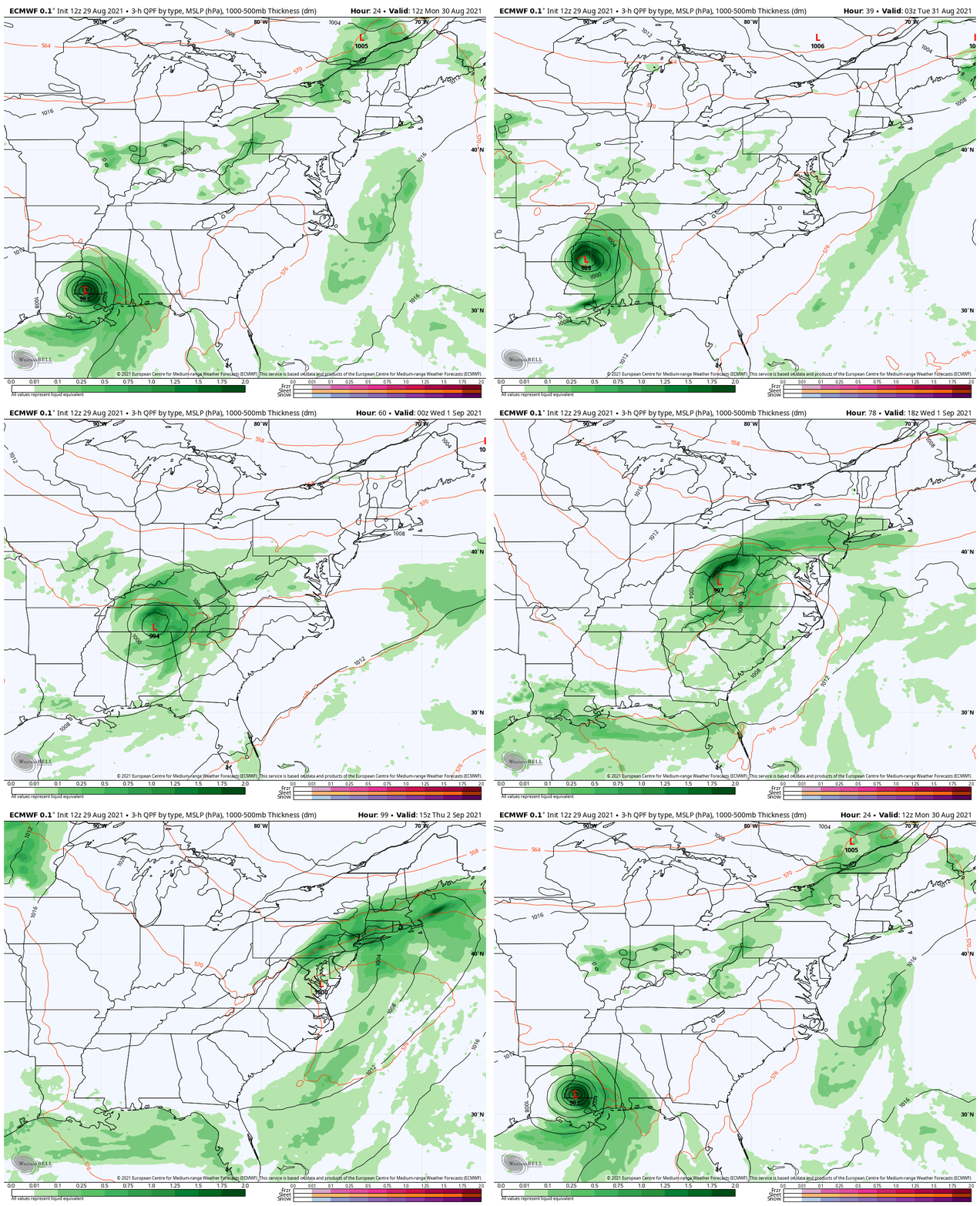
Storm Simulation: ECMWF Model
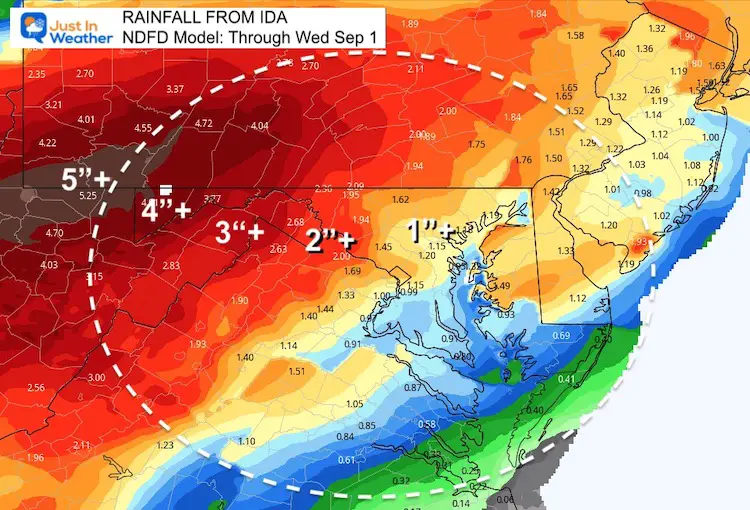
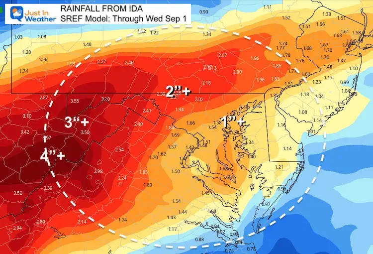
Rain Forecast
Short Range Forecasts Through Wednesday Evening
NDFS= National Digital Forecast Database
SREF = Short Range Ensemble Forecast
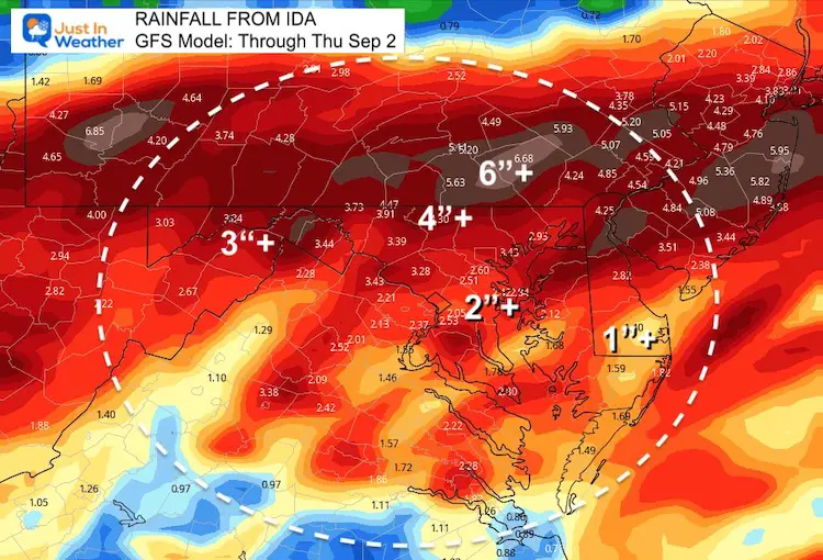
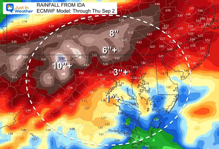
Longer Look Through Thursday Night
GFS Model
ECMWF Model
This is producing the heaviest rainfall. This model is known for the highest accuracy, but can overestimate precipitation.
Either way, we are looking at very heavy rain.
Notes:
We can expect heavy rain form Ida, and regional flooding. Most of this will be on Wednesday, but may last into Thursday morning.
As you have seen, the totals range from over 1 inch to over 6 inches in our region.
There will be enough wind sheer to also produce rotating storms with a few low end tornados (EF 0-EF 1).
The details will be refined over the next day for how much we can receive. Simply plan for the timing to limit outdoor plans and after school sports.
Interactive Widget
Check the wind field from the GFS Model on your own here.
Use the controls to pan and zoom the map view.
14 Local Maryland Pages (and York PA)
We have made a page for Maryland Weather which gives you the current conditions for 14 present area locations.
Maryland Trek Gear
Maryland Trek 8 Says THANK YOU!
Running Total Raised $116,438
During 329 Miles From Wisp To Ocean City
To Honor Kids In Cancer Treatment and Support FREE Programs At Just In Power Kids
Please share your thoughts, best weather pics/video, or just keep in touch via social media
Facebook: Justin Berk, Meteorologist
Twitter: @JustinWeather
Instagram: justinweather

