Saturday August 28 2021
There is one theme I have maintained all summer: Over achieving weather events! We have seen it time and time again!
Computer model guidance has often underplayed radar simulations, meaning we have ended up with more than suggested on most occasions. We saw that yesterday as well.
With that theme in mind, I have added that suggestion to today’s storms. This was also applied to Hurricane Ida. My early reports mentioned the warm water and likelihood this would be a major hurricane (Cat. 3 or higher) by landfall. Now the modeling is pushing a Cat 4 storm reaching Louisiana on Sunday, the anniversary of Katrina.
All of this will be addressed below.
Also see: Storm Reports Friday Aug 27
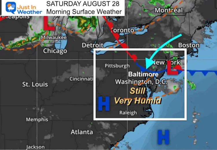
Morning Surface Weather
The circulation I tracked yesterday was responsible for our severe storms. It is now located off of the coast on a stalled front.
Light winds will be from the Northeast. This will bring afternoon temps about 10 degrees cooler, but still humid. It will also produce more showers and storms.
Storm Chances Today
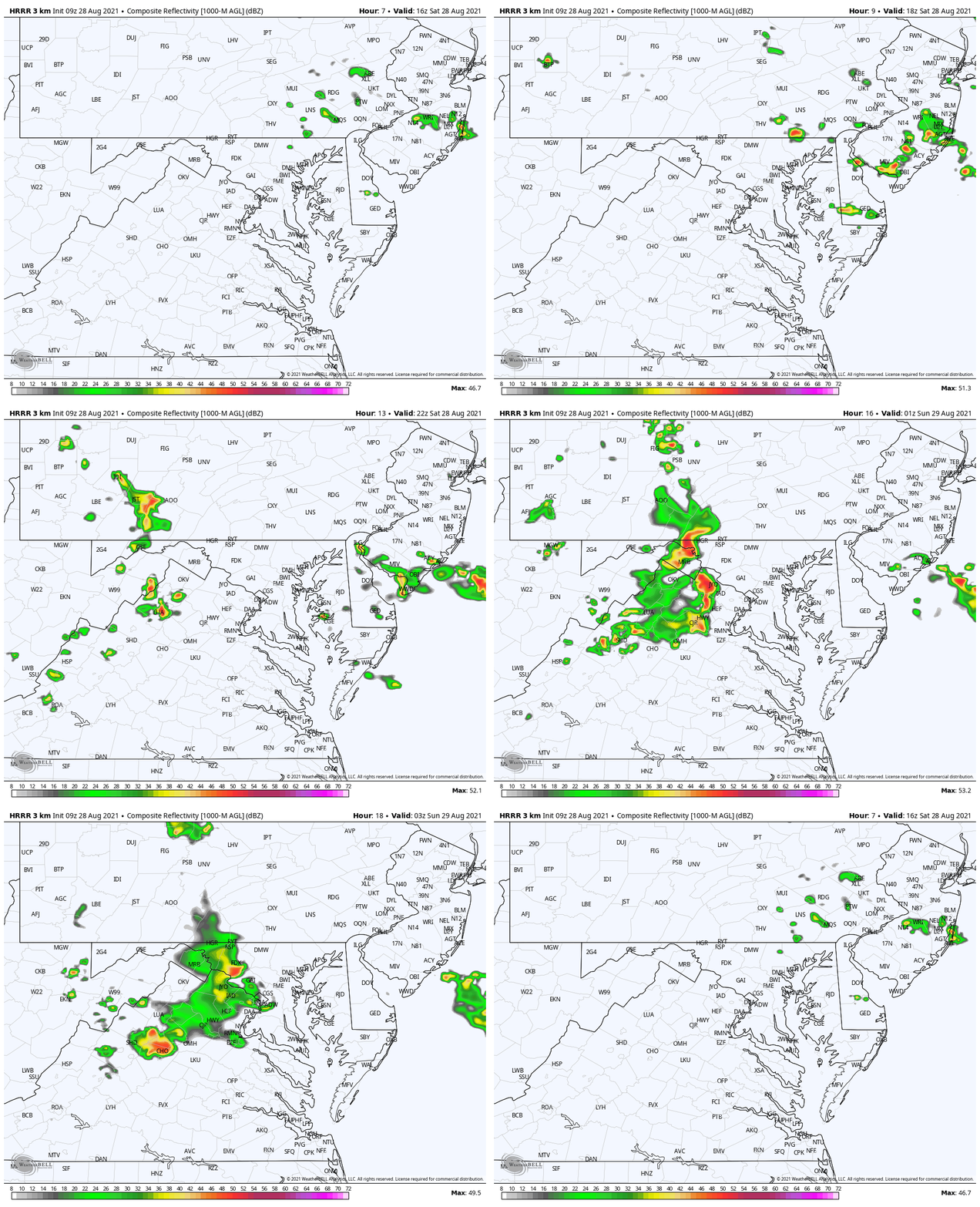
This Model below shows pop up development ‘near’ and mainly east of Baltimore this afternoon.
This is close enough to keep a 50% chance of storms, with higher odds for Harford, Cecil Counties and Delmarva to the beaches.
Another line of storms will form in the mountains and push in to our western suburbs by evening.
Radar Simulation
We need to anticipate that there will be more activity than shown here. Afternoon storms will develop near and east of Baltimore between noon and 4 PM.
A new line of strong and possibly severe storms will develop in the mountains after 4 PM, and could reach our western suburbs after 8 PM.
Afternoon Temperatures
Weather Almanac: Climate Data
TODAY August 26
Normal Low in Baltimore: 64ºF
Record 48ºF in 1885
Normal High in Baltimore: 84ºF
Record 101º F 1948
Hurricane Ida: National Hurricane Center Update
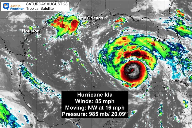
- LOCATION...24.4N 85.7W
- ABOUT 385 MI…620 KM SSE OF THE MOUTH OF THE MISSISSIPPI RIVER
- ABOUT 440 MI…710 KM SSE OF NEW ORLEANS LOUISIANA
- MAXIMUM SUSTAINED WINDS…85 MPH…140 KM/H
- PRESENT MOVEMENT…NW OR 315 DEGREES AT 16 MPH…26 KM/H
- MINIMUM CENTRAL PRESSURE…985 MB…29.09 INCHES
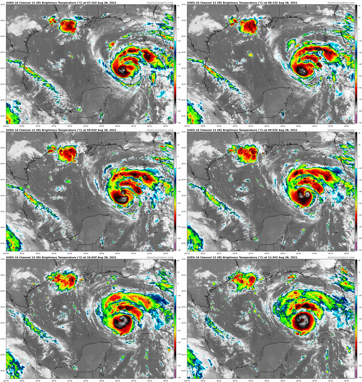
Satellite Loop
Headlines
- Hurricane Ida has already out performed modeling.
- It has passed north of Cuba and now in the open Gulf of Mexico with winds of 85 mph.
- Hurricane Warnings in place with evacuations from coastal Louisiana happening now.
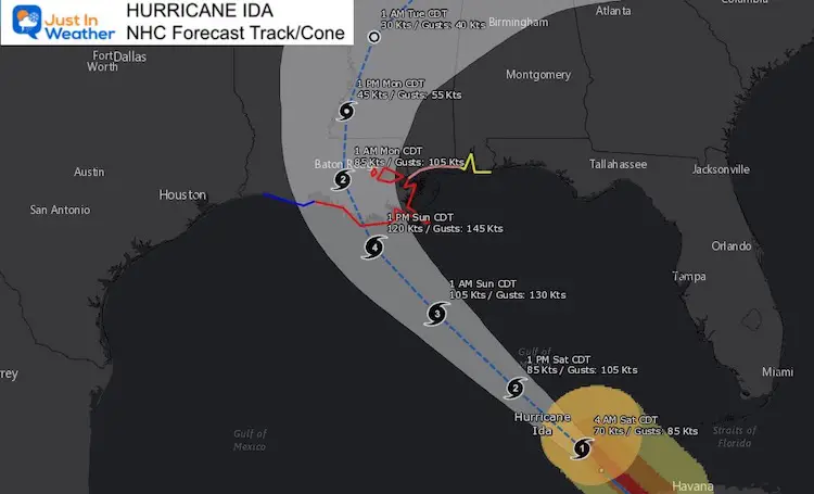
- Expected landfall on Sunday as a Category 4 with sustained winds of 140 mph and gusts to 170 mph.
Forecast Track/Cone
The National Hurricane Center Track shows the path of landfall on the coast of Louisiana as a Category 4 Major Hurricane. The timing shows Sunday, but there is still some wiggle room among models.
I will have a more detailed update on the storm specifics later this morning.
Warnings And Watches
A Storm Surge Warning is in effect for…
* East of Rockefeller Wildlife Refuge Louisiana to the
Mississippi/Alabama border
* Vermilion Bay, Lake Borgne, Lake Pontchartrain, and Lake Maurepas
A Hurricane Warning is in effect for…
* Intracoastal City Louisiana to the Mouth of the Pearl River
* Lake Pontchartrain, Lake Maurepas, and Metropolitan New Orleans
A Storm Surge Watch is in effect for…
* Sabine Pass to Rockefeller Wildlife Refuge Louisiana
* Mobile Bay
A Hurricane Watch is in effect for…
* Cameron Louisiana to west of Intracoastal City Louisiana
* Mouth of the Pearl River to the Mississippi/Alabama border
A Tropical Storm Warning is in effect for…
* Cameron Louisiana to west of Intracoastal City Louisiana
* Mouth of the Pearl River to the Mississippi/Alabama border
A Tropical Storm Watch is in effect for…
* Mississippi/Alabama border to the Alabama/Florida border
Impact for us:
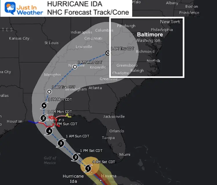
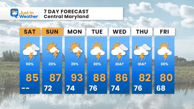
The modeling shows the expected weakening inland, then curving to the Northeast. We can expect impact of tropical rain and possible severe storms Wednesday and Thursday.
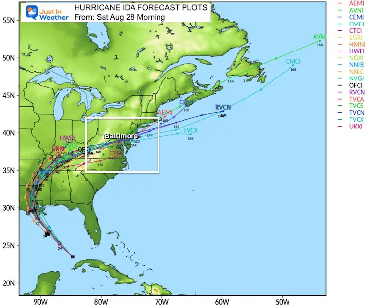
Computer Models Spaghetti Plots
This cluster shows agreement on the landfall and curving northeast. It also generally plots the remnant Low of Ida into central Maryland.
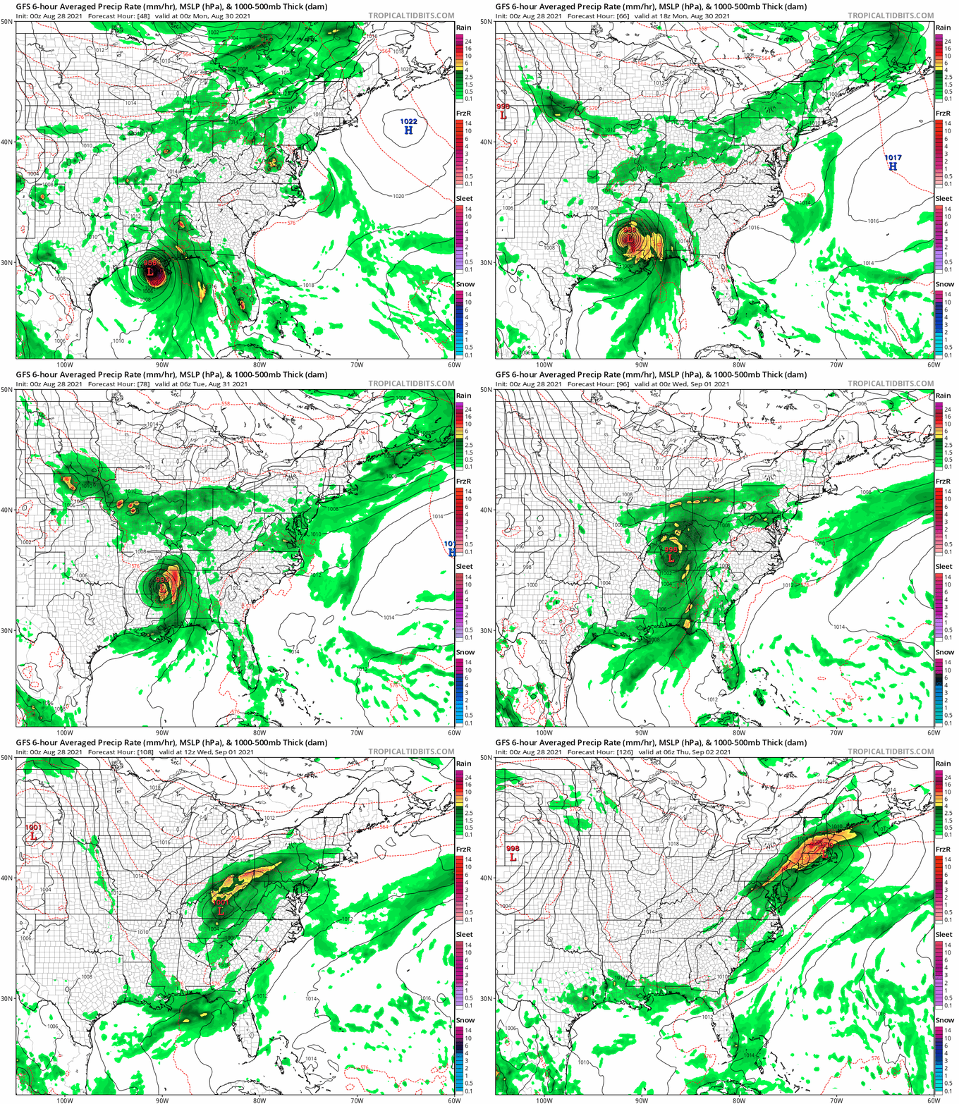
Storm Animation:
This GFS Model simulation shows the rain from Ida spreading our way by Wednesday, however this shows the remnant Low passing to our north. The actual track may determine the highest risk for severe storms… So we need to pay close attention.
7 Day Forecast
14 Local Maryland Pages (and York PA)
We have made a page for Maryland Weather which gives you the current conditions for 14 present area locations.
Maryland Trek Gear
Maryland Trek 8 Says THANK YOU!
Running Total Raised $116,438
During 329 Miles From Wisp To Ocean City
To Honor Kids In Cancer Treatment and Support FREE Programs At Just In Power Kids
Please share your thoughts, best weather pics/video, or just keep in touch via social media

