Sunday August 22 2021
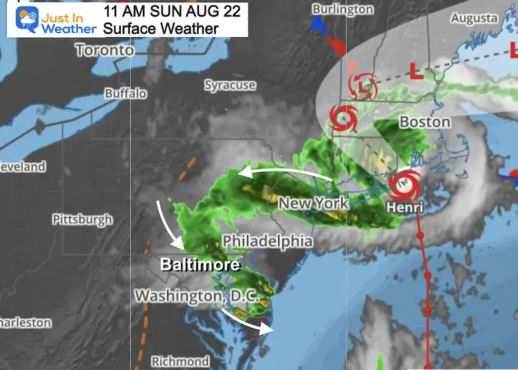
Tropical Storm Henri continue to weaken while throwing moisture well west of its path. Winds are down to 60 mph, but there is a lot of rain to spread around.
A weakening and landfalling tropical cyclone will almost always spread out the rain coverage. We get an added boost from upper level forcing to push that rain into our region today, even as the storm moves farther away.
My wife made plans to go for a walk with her friend. I tried to advise them of the rain, but they insist on making a game time decision.
I figured you may have plans as well, while either watching rain outside or waiting for it to reach you.
This post is focused mainly on the rain. You will find the morning radar loop, latest snapshot, model forecast simulation, and Live Radar widget below.
Surface Map
Flood Potential
There will be some areas that get persistent heavy rain. Flood Advisories will be issued. Already some are posted for Delmarva, already experiencing this.
National Hurricane Center Update
...CENTER OF HENRI PASSING CLOSE TO BLOCK ISLAND AS THE STORM HEADS
FOR SOUTHERN NEW ENGLAND...
...DANGEROUS STORM SURGE, STRONG GUSTY WINDS, AND FLOODING RAINFALL
ARE EXPECTED ACROSS PORTIONS OF THE NORTHEASTERN UNITED STATES...


SUMMARY OF 1100 AM EDT...1500 UTC...INFORMATION
-----------------------------------------------
LOCATION...41.1N 71.6W
ABOUT 15 MI...25 KM E OF MONTAUK POINT NEW YORK
ABOUT 50 MI...80 KM SSW OF PROVIDENCE RHODE ISLAND
MAXIMUM SUSTAINED WINDS...60 MPH...95 KM/H
PRESENT MOVEMENT...NNW OR 335 DEGREES AT 12 MPH...19 KM/H
MINIMUM CENTRAL PRESSURE...987 MB...29.15 INCHES
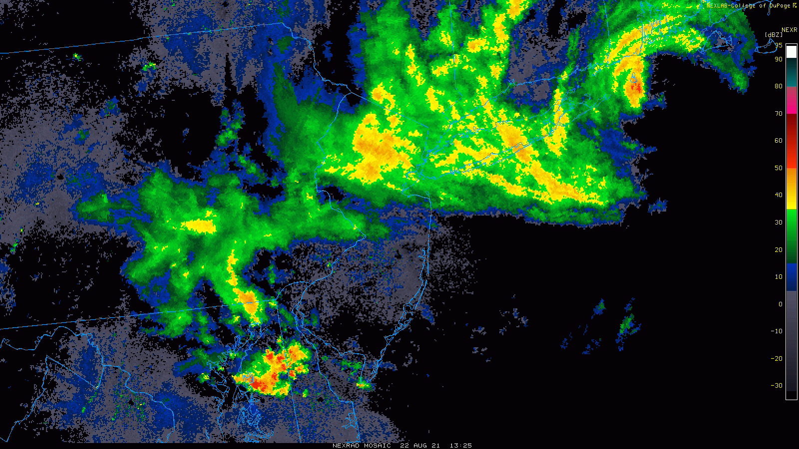
Regional Composite Radar Loop
The path of Henri is just east of Long Island NY into Rhode Island, but the heavy rain continues to be pulled west and southwest.
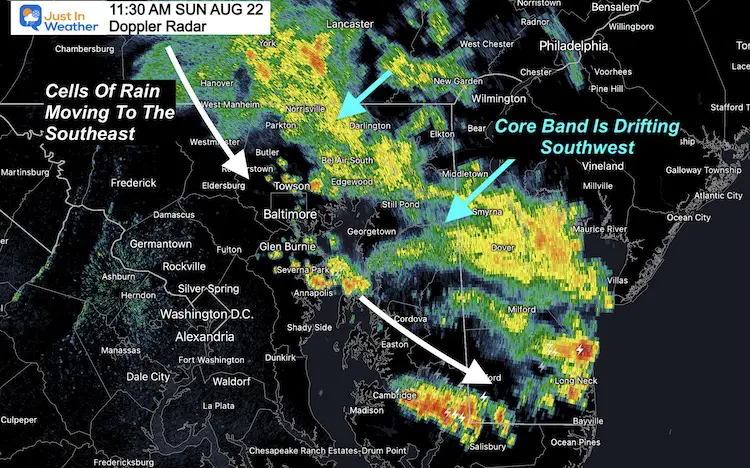
Doppler Radar Snapshot
Steady rain has been closer to the center. For us that is northeastern Maryland and Southeastern PA.
The entire shield of rain is drifting SOUTHWEST into central Maryland.
Cells and bands are moving from Northwest to Southeast.
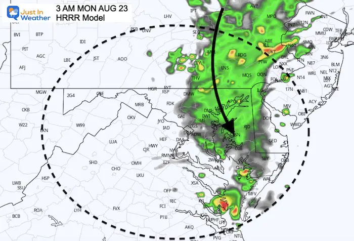
HRRR Model Simulation—-> slider
Compare to the Live Radar and Lightning Widget below
This has done a better job than the NAM 3 Km model I have shown in prior reports.
- There may still be more rain verified than shown in this simulation.
- Local tropical downpours can drop rates of 1”/Hr or higher rainfall.


Monday Morning
It looks like a resurgence of rain will fill in across central Maryland and Delmarva, much like a Nor’easter. This snapshot is pre-dawn, but likely to be with us through sunrise.
Live Radar and Lightning
14 Local Maryland Pages (and York PA)
We have made a page for Maryland Weather which gives you the current conditions for 14 present area locations.
Maryland Trek Gear

Maryland Trek 8 Says THANK YOU!
Running Total Raised $116,098
During 329 Miles From Wisp To Ocean City
To Honor Kids In Cancer Treatment and Support FREE Programs At Just In Power Kids
![]()

Please share your thoughts, best weather pics/video, or just keep in touch via social media