Sunday August 22 2021
Henri was a hurricane, but has downgraded back to a tropical storm with winds of 70 mph. It is moving over colder water, but the impacts will be the same as expected.
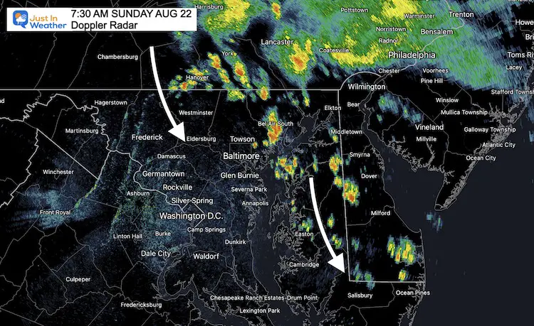
Heavy rain showers have already developed in central Maryland and Delmarva. The model guidance is underestimating this, which is shown below.
Henri is moving north towards the shores of southern New England and New York’s Long Island. Leading up to landfall, we expect the rain shield to spread out, and that is what we are seeing.
So far between 4 and 7 inches of rain has already fallen on New York City. Flooding in streets and tunnels, in addition with some storm surge will make for restricted travel today.
Heavy rain has spread through New Jersey and southern Pennsylvania. Now the outer edges are developing heavy rain in parts of Maryland and Delaware.
Morning Surface Weather
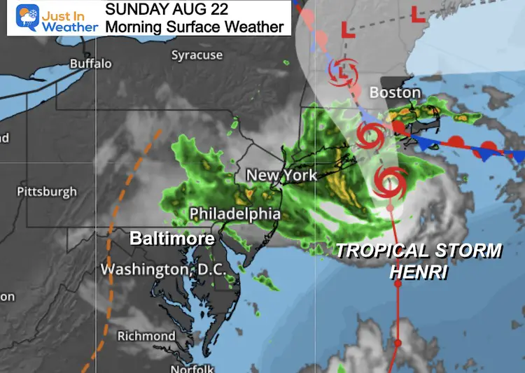
The shape of the structure shows forces pulling a lot of moisture well west. Impacts this morning extend to New Jersey and southern Pennsylvania. Outer edge storms are expected to form in Maryland and Delaware today.
This report will cover the latest on the storm and what we can expect in the Mid Atlantic on the edge. Tropical showers will develop and some of our region could get downpours with a quick 1 inch or more of rain.
Main Weather Risks:
- Flooding from storm surge and tropical downpours.
- Wind damage from the storm and spin up tornados.
- Power Outages expected to be widespread.
- The feeder bands extend far west into Southern Pennsylvania.
Conditions From The National Hurricane Center:
DOWNGRADED TO TROPICAL STORM
SUMMARY OF 700 AM EDT...1100 UTC...INFORMATION
----------------------------------------------
LOCATION...40.6N 71.2W
ABOUT 50 MI...80 KM SE OF MONTAUK POINT NEW YORK
ABOUT 85 MI...135 KM S OF PROVIDENCE RHODE ISLAND
MAXIMUM SUSTAINED WINDS...70 MPH...110 KM/H
PRESENT MOVEMENT...N OR 350 DEGREES AT 18 MPH...30 KM/H
MINIMUM CENTRAL PRESSURE...986 MB...29.12 INCHES
Tropical Satellite
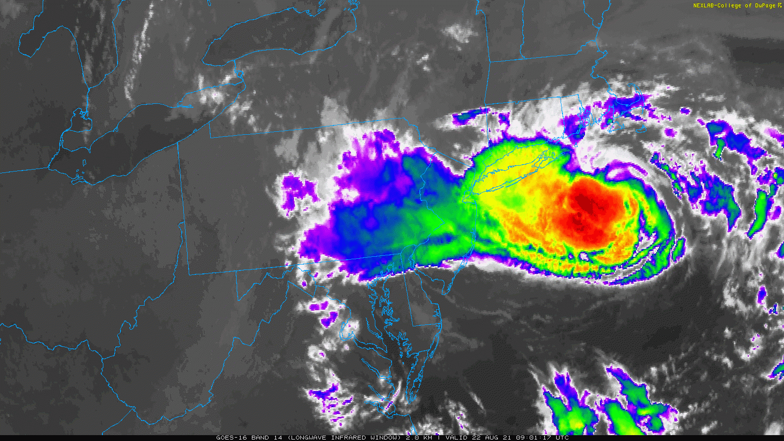
Notice the core of the storm with the red shading. He bulk of the activity icon the west side across southern New England, metro New York, and New Jersey.
Also: The pull of moisture well west, across the Maryland and Pennsylvania border. I will address this impact on our region below…
National Hurricane Center Track
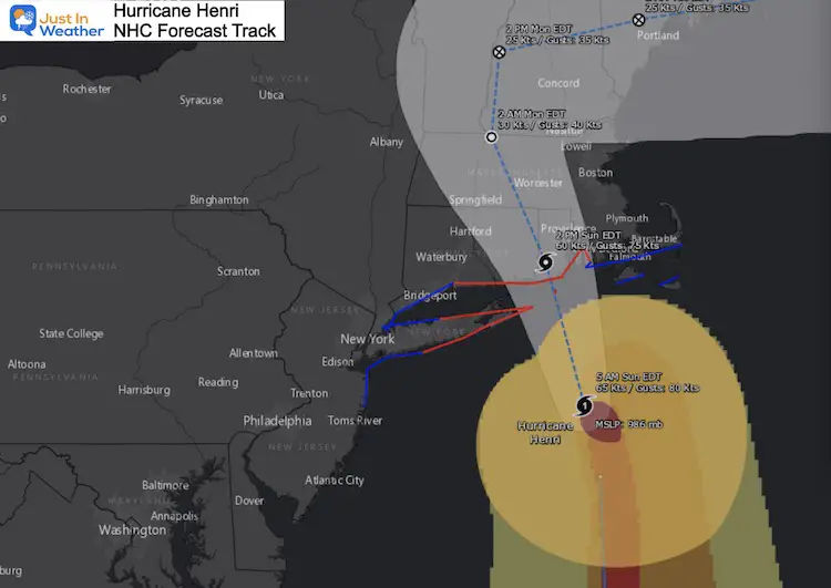
This is being compared to the last direct hurricane impacts on this region. Those were Irene in 2011 and Gloria in 1985. So, it’s not often a direct hit from a tropical system this storm happens here.
The track puts this into New England, and slows down, then turns to the east. This will be on land through late Monday, where wind, rapid spin up tornados, and heavy rain cover a large area.
Landfalling tropical systems spread out their coverage, and this will hit a large area.
Warnings
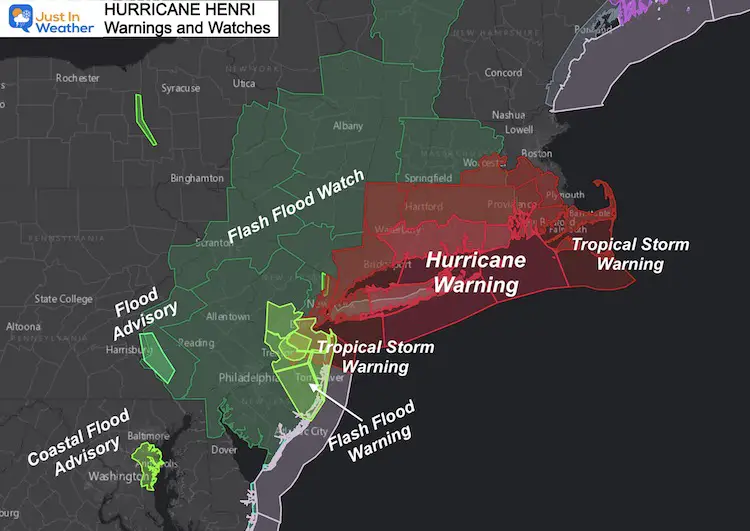
- Hurricane and Storm Surge Warning for Long Island and Connecticut
- Tropical Storm Warning: Northern New Jersey, New York City, Rhode Island.
- Flooding will be widespread from heavy rain, which has already been seen into southern PA this morning in Lancaster County.
- Coastal Flood Advisory for Anne Arundel County thanks to the winds sloshing on the Bay from the East in conjunction with the Full Moon high tides.
Local Rain
Radar Animation

Doppler Radar Snapshot:
This look at 7:30 AM already shows heavy rain across north central Maryland.
Movement is from the North, shifting to the South-Southeast.
Tropical downpours can quickly drop 1 inch or more of rain. Get under a few, and local flooding is possible in central Maryland and Delmarva.
Radar Simulation —> slider
Note: This product is a suggestion.
It is already missing the early rain in Maryland, and has often under estimated the rain coverage. Use this for potential movement, timing, and regional coverage of rain bands.


Weather Almanac: Climate Data
TODAY August 22
Normal Low in Baltimore: 65ºF
Record 52ºF in 1956
Normal High in Baltimore: 85ºF
Record 99º F 1983
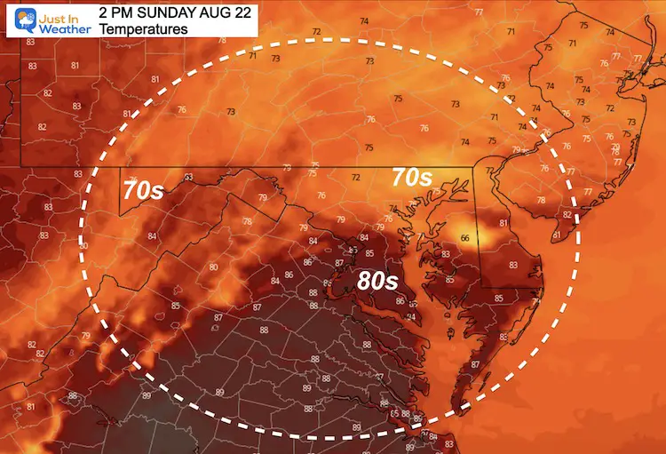
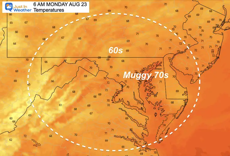
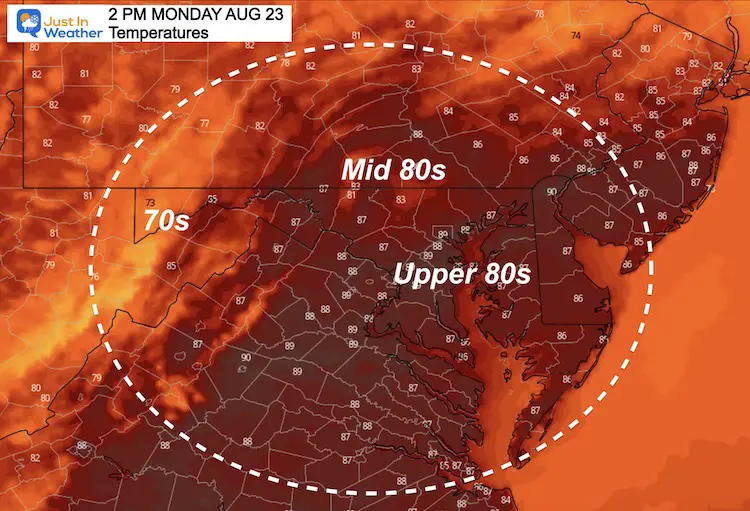
Temperatures
This Afternoon: Cooler with expected rainfall…
Saturday Morning
Saturday Afternoon
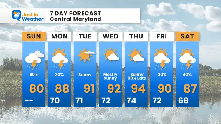
7 Day Forecast
Maryland Trek Gear

Maryland Trek 8 Says THANK YOU!
Running Total Raised $114,179
During 329 Miles From Wisp To Ocean City
To Honor Kids In Cancer Treatment and Support FREE Programs At Just In Power Kids
![]()
Sunshine State Of Mind
I am done with the cold and snow (for the season). I am embracing my wife’s mantra of Sunshine State of Mind.
This was designed by Shannon Berk and we will be wearing it through spring and to the beach.
Double Benefit: Proceeds will be split between our nonprofit Just In Power Kids and the development of my new weather website. That has been scheduled to be ready to launch in May.

14 Local Maryland Pages (and York PA)
We have made a page for Maryland Weather which gives you the current conditions for 14 present area locations.

Please share your thoughts, best weather pics/video, or just keep in touch via social media