Thursday August 19 2021
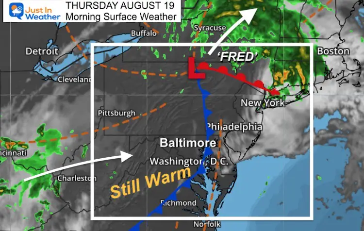
The remains of Tropical Storm Fred are in central New York State this morning. We still have warm temps left behind, yet not as humid as yesterday.
There is another disturbance that will bring in showers and storms for our southern areas tonight, and increase our rain chances for the next few days.
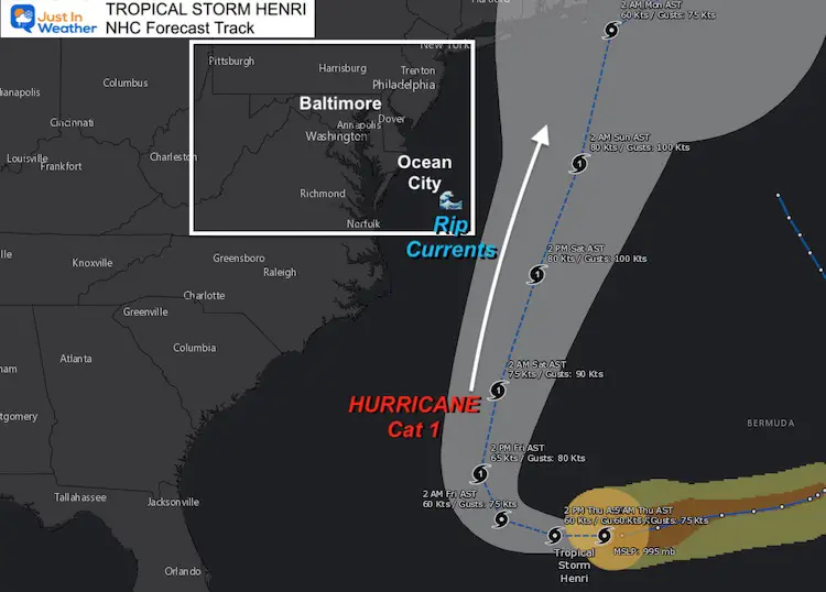
Henri is a Tropical Storm that may become a hurricane and pass well off the coast Saturday, but still increase our coverage of storms.
Morning Surface Weather
Remains of Henri are moving through central New York with heavy rain into New England. The next push of rain will try to move in around sunset near Washington.
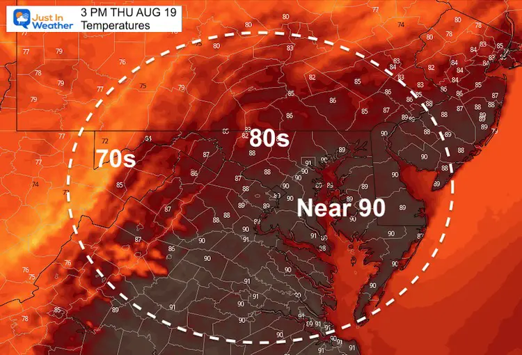
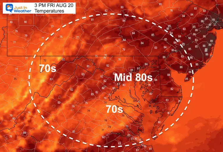
That cold front is deceiving. Temps aiming for mid 80s to near 90ºF, but it will be less humid.
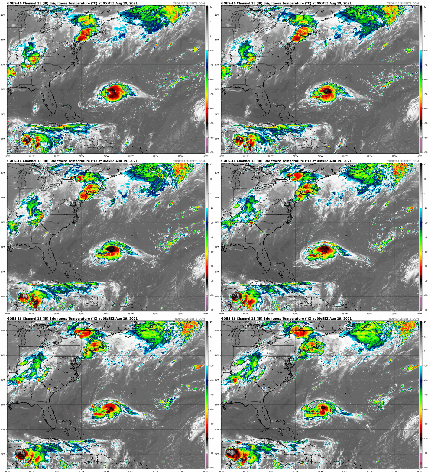
Tropical Satellite Loop
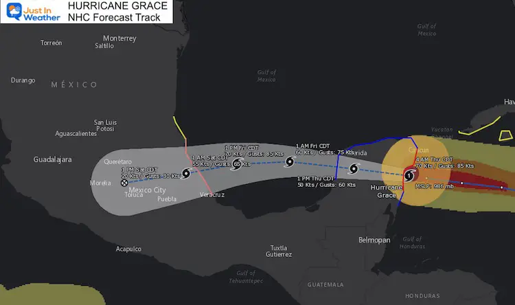
Hurricane Grace
SUMMARY OF 400 AM CDT...0900 UTC...INFORMATION
----------------------------------------------
LOCATION...20.0N 87.2W
ABOUT 25 MI...40 KM SE OF TULUM MEXICO
MAXIMUM SUSTAINED WINDS...80 MPH...130 KM/H
PRESENT MOVEMENT...W OR 280 DEGREES AT 17 MPH...28 KM/H
MINIMUM CENTRAL PRESSURE...986 MB...29.12 INCHES
Landfall occurred this morning south of Cancun. This will continue west and make a second landfall on mainland Mexico.
Tropical Storm Henri
SUMMARY OF 500 AM AST...0900 UTC...INFORMATION
----------------------------------------------
LOCATION...29.5N 69.5W
ABOUT 525 MI...845 KM SE OF CAPE HATTERAS NORTH CAROLINA
ABOUT 810 MI...1300 KM S OF NANTUCKET MASSACHUSETTS
MAXIMUM SUSTAINED WINDS...70 MPH...110 KM/H
PRESENT MOVEMENT...W OR 260 DEGREES AT 9 MPH...15 KM/H
MINIMUM CENTRAL PRESSURE...995 MB...29.39 INCHES
This looped around Bermuda, and is expected to turn north and parallel the US East Coast. This will miss our region, but provide Rip Currents and possibly enhance our showers and thunderstorms on Saturday.
A landfall near Cape Cod is still possible.
Radar Simulation
Friday 1 AM to Sunday 5 PM
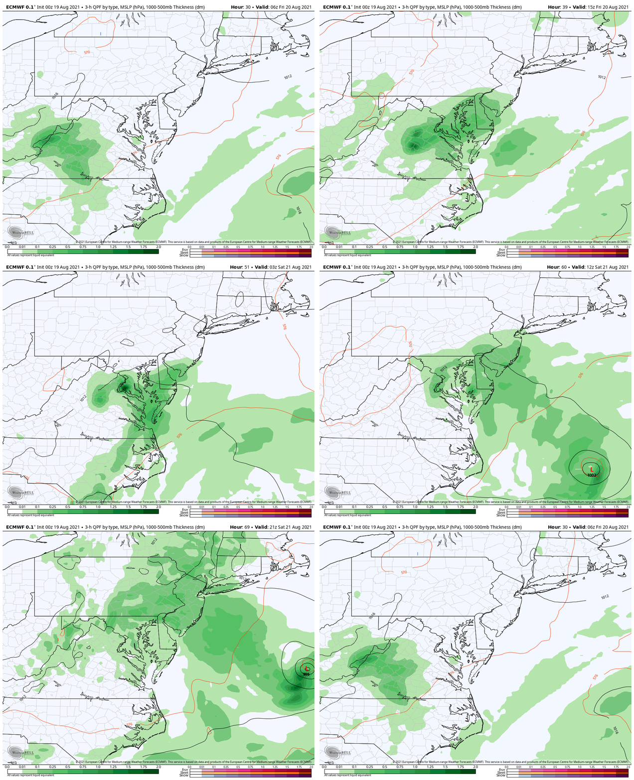
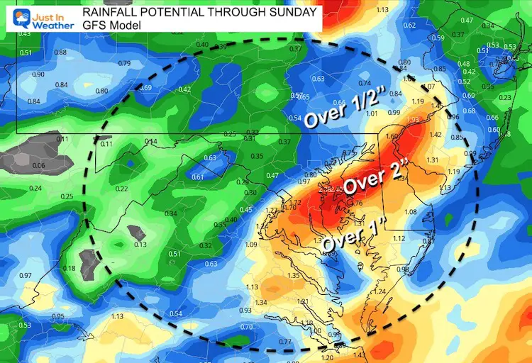
You can see Henri just off the edge of the screen on Saturday, but it will help enhance rain in our region. This will also increase Rip Currents along the beaches all weekend.
Rainfall Potential: GFS Model
Weather Almanac: Climate Data
TODAY August 19
Normal Low in Baltimore: 65ºF
Record 52ºF in 1958
Normal High in Baltimore: 85ºF
Record 99º F 2019
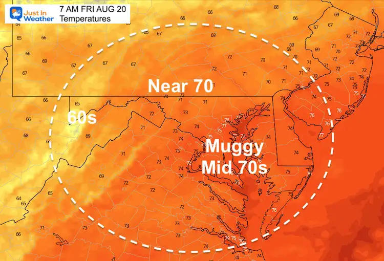
Temperatures
This Afternoon
Friday Morning
Friday Afternoon
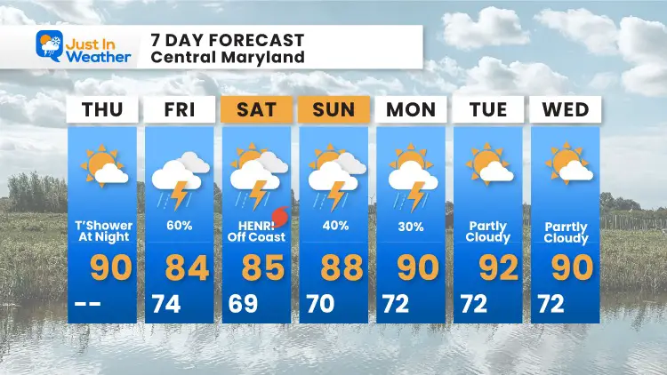
7 Day Forecast
The coverage of showers and storms looks widespread into the weekend. Not much break from the heat, as temps will remain near 90ºF into next week.
Maryland Trek Gear
Maryland Trek 8 Says THANK YOU!
So Far We Raised $111,901
During 329 Miles From Wisp To Ocean City
To Honor Kids In Cancer Treatment and Support FREE Programs At Just In Power Kids
Sunshine State Of Mind
I am done with the cold and snow (for the season). I am embracing my wife’s mantra of Sunshine State of Mind.
This was designed by Shannon Berk and we will be wearing it through spring and to the beach.
Double Benefit: Proceeds will be split between our nonprofit Just In Power Kids and the development of my new weather website. That has been scheduled to be ready to launch in May.
14 Local Maryland Pages (and York PA)
We have made a page for Maryland Weather which gives you the current conditions for 14 present area locations.
Please share your thoughts, best weather pics/video, or just keep in touch via social media
Facebook: Justin Berk, Meteorologist
Twitter: @JustinWeather
Instagram: justinweather

