Sunday August 1 2021
Mostly likely you will wake up with wet ground this morning. There is mixed news in this update, and it does depend on your perspective. So one size does not fit all. Please keep that in mind.
As of 7 AM: We had some rain already roll through. Steady rain is still falling south, pockets of heady rain along the Rt 50 corridor between Washington, Annapolis, and crossing the Bay. Meanwhile, the north end of Maryland it is already breaking up.
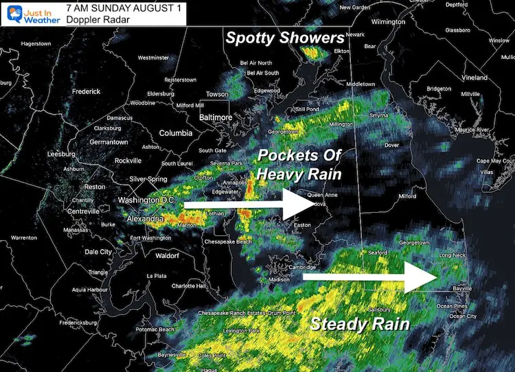
Once again the short range modeling did not perform well (and I led with it).
I know many welcome rain, while others have outdoor events. One mom wrote me yesterday asking about her son’s morning pool party. I had expected rain and upper 60s and didn’t think it would be optimal. Instead, that location will have spotty showers and closer to 70ºF.
We have an outdoor event for Just In Power Kids, and personally I have been hoping the rain would not verify. While it looks better at our location, we still need to plan for more rain, and you may want to as well.
The expectation: Today will bring more rain and some thunderstorms, but plotting them will be tough.
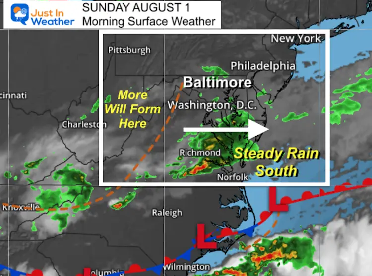
Morning Surface Weather
The cluster of rain we expected kept speeding up, and tracked a little south. It has still mainly hit southern Maryland, but did allow the north part of rain to erode away to showers in metro areas.
While it looks dry to our west, more showers and storms will develop and track our way this afternoon.
Weather Tracking Page
Click to see: Temperatures, Radar, and Satellite
Most Likely Weather:
North in PA:
More sun will get through, then afternoon storms. But it will be warmer.
Southern Maryland:
More rain is likely.
In Between (Central MD/Metro Areas):
Where the bulk of the population is, the set up will be a little bit of everything. Spotty showers, breaks of sun, and late day storms. There is still a chance to get 1 inch of rain, depending on where the showers set up.
Sunday Rain Simulation —-> slider
I switched to a different computer model for guidance today.
PLEASE NOTE: This HRRR is also NOT PERFECT! But this does show the development of more showers and storms. I annotated the direction I expect them to move.
Weather Almanac: Climate Data
TODAY August 1
Normal Low in Baltimore: 67ºF
Record 57ºF in 1895
Normal High in Baltimore: 87ºF
Record 100º F 2006
Temperature Forecast
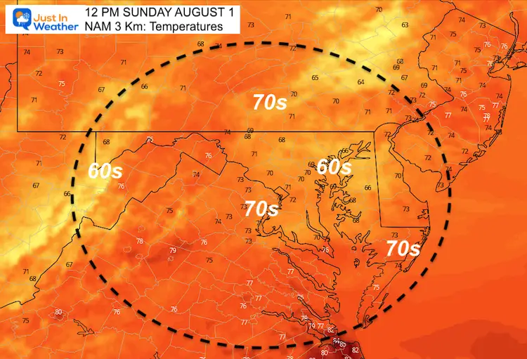
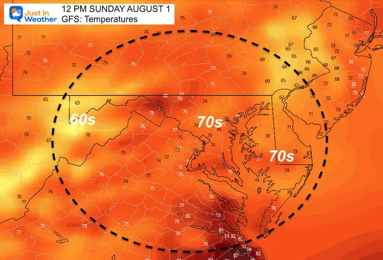
Comparing Noon Between NAM and GFS Models
The NAM Model is the one I showed yesterday with more rain. It has our temps remaining a little cooler.
I am opting for the milder GFS view, which is still much cooler than an average start to August.
NAM 3 KM
GFS
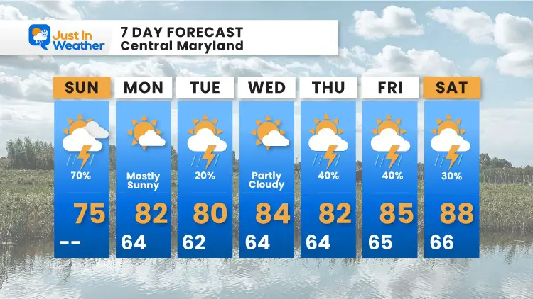
7 Day Forecast
Maryland Trek 8 Begins on August 8
329 Miles From Wisp To Ocean City
To Honor Kids In Cancer Treatment and Support FREE Programs At Just In Power Kids
Sunshine State Of Mind
I am done with the cold and snow (for the season). I am embracing my wife’s mantra of Sunshine State of Mind.
This was designed by Shannon Berk and we will be wearing it through spring and to the beach.
Double Benefit: Proceeds will be split between our nonprofit Just In Power Kids and the development of my new weather website. That has been scheduled to be ready to launch in May.
14 Local Maryland Pages (and York PA)
We have made a page for Maryland Weather which gives you the current conditions for 14 present area locations.
Please share your thoughts, best weather pics/video, or just keep in touch via social media

