Sunday July 25 2021
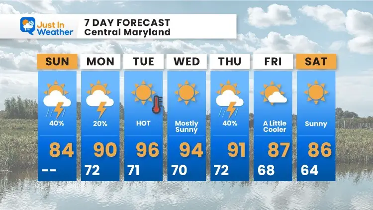
You will notice more clouds today. This is part of a weather system that will bring back another extended period of heat most of next week. This will increase the humidity and chance of showers later today as well.
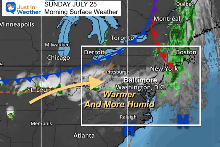
Surface Weather
We are in this wedge between frontal systems today. The results has pumped in a conveyor belt of clouds. Eventually bring some showers and late day storms.
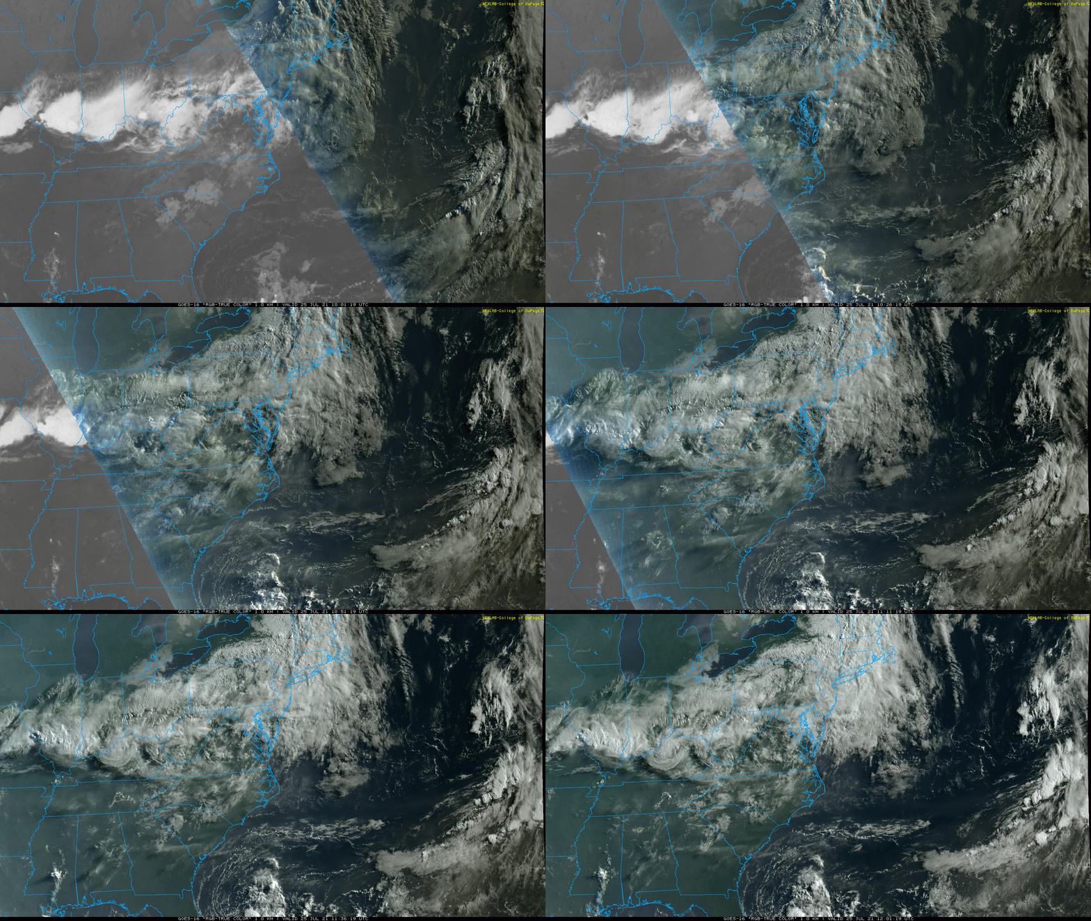
Satellite Loop
The line of clouds from west to east seems to be locked in for the day. We will get some sunny breaks in between at times.
Severe Storm Outlook
We have a ‘Marginal’ Risk of Storms north and west of Annapolis. The timing of this systems should limit the chance of showers in southern Maryland to the beaches until much later into the evening or tonight.

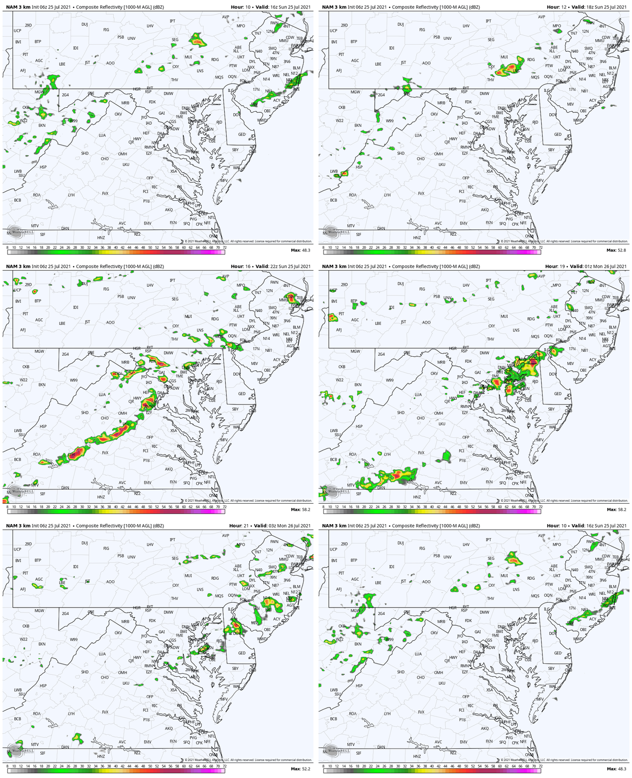
Radar Simulation
Noon to 11 PM (More likely after 4 PM)
Weather Almanac: Climate Data
TODAY July 25
Normal Low in Baltimore: 67ºF
Record 57ºF in 2014
Normal High in Baltimore: 87ºF
Record 100º F 2016
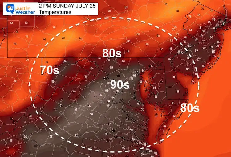
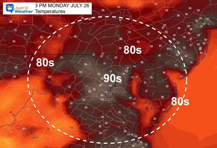
Afternoon Temperature Forecast
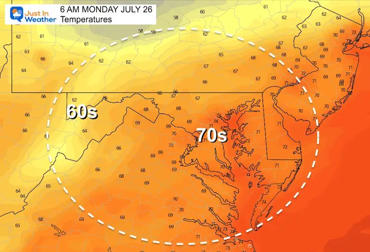
Monday Temperatures
Morning
Afternoon
7 Day Forecast
Maryland Trek 8 Begins on August 8
329 Miles From Wisp To Ocean City
To Honor Kids In Cancer Treatment and Support FREE Programs At Just In Power Kids
Still Time To Sponsor Our Team
Keep our expenses low.
Click Here to Help with Lodging, Meals, and Fuel

Sunshine State Of Mind
I am done with the cold and snow (for the season). I am embracing my wife’s mantra of Sunshine State of Mind.
This was designed by Shannon Berk and we will be wearing it through spring and to the beach.
Double Benefit: Proceeds will be split between our nonprofit Just In Power Kids and the development of my new weather website. That has been scheduled to be ready to launch in May.
14 Local Maryland Pages (and York PA)
We have made a page for Maryland Weather which gives you the current conditions for 14 present area locations.
Please share your thoughts, best weather pics/video, or just keep in touch via social media
Facebook: Justin Berk, Meteorologist
Twitter: @JustinWeather
Instagram: justinweather

